New Strawn, Kansas
New Strawn is a city in Coffey County, Kansas, United States. As of the 2010 census, the city population was 394.[6]
New Strawn, Kansas | |
|---|---|
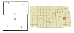 Location within Coffey County and Kansas | |
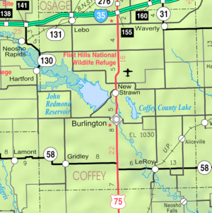 KDOT map of Coffey County (legend) | |
| Coordinates: 38°16′N 95°44′W | |
| Country | United States |
| State | Kansas |
| County | Coffey |
| Incorporated | 1970 |
| Area | |
| • Total | 0.83 sq mi (2.15 km2) |
| • Land | 0.79 sq mi (2.05 km2) |
| • Water | 0.04 sq mi (0.10 km2) |
| Elevation | 1,102 ft (336 m) |
| Population | |
| • Total | 394 |
| • Estimate (2019)[3] | 380 |
| • Density | 479.19/sq mi (185.08/km2) |
| Time zone | UTC-6 (CST) |
| • Summer (DST) | UTC-5 (CDT) |
| ZIP code | 66839 |
| Area code | 620 |
| FIPS code | 20-50450 [4] |
| GNIS ID | 0477464 [5] |
| Website | newstrawn.org |
History
The city of New Strawn came about when John Redmond Reservoir was built in the early 1960s, causing the original town of Strawn to be claimed by the Army Corps of Engineers for flood area.[7] The old city of Strawn is usually available for exploration, but will be underwater if the lake is up. Very little is left of "old" Strawn today, although the Main Street can still be traveled when dry. The school at the old site of Strawn was a two-room school with first through fourth grades in one room and fifth through eighth grade in the second room. The Strawn Methodist Church was just to the south. A small parking area is at the approximate site of the school and church.[8]
Geography
New Strawn is located at 38°16′N 95°44′W (38.2628, -95.7411).[9] According to the United States Census Bureau, the city has a total area of 0.82 square miles (2.12 km2), of which, 0.78 square miles (2.02 km2) is land and 0.04 square miles (0.10 km2) is water.[10]
Climate
The climate in this area is characterized by hot, humid summers and generally mild to cool winters. According to the Köppen Climate Classification system, New Strawn has a humid subtropical climate, abbreviated "Cfa" on climate maps.[11]
Demographics
| Historical population | |||
|---|---|---|---|
| Census | Pop. | %± | |
| 1980 | 457 | — | |
| 1990 | 428 | −6.3% | |
| 2000 | 425 | −0.7% | |
| 2010 | 394 | −7.3% | |
| Est. 2019 | 380 | [3] | −3.6% |
| U.S. Decennial Census | |||
2010 census
As of the census[2] of 2010, there were 394 people, 163 households, and 126 families residing in the city. The population density was 505.1 inhabitants per square mile (195.0/km2). There were 173 housing units at an average density of 221.8 per square mile (85.6/km2). The racial makeup of the city was 95.9% White, 0.5% African American, 1.5% Native American, and 2.0% from two or more races. Hispanic or Latino of any race were 1.8% of the population.
There were 163 households of which 30.1% had children under the age of 18 living with them, 63.2% were married couples living together, 9.2% had a female householder with no husband present, 4.9% had a male householder with no wife present, and 22.7% were non-families. 19.6% of all households were made up of individuals and 3.1% had someone living alone who was 65 years of age or older. The average household size was 2.42 and the average family size was 2.72.
The median age in the city was 42 years. 22.1% of residents were under the age of 18; 3.8% were between the ages of 18 and 24; 28% were from 25 to 44; 36.8% were from 45 to 64; and 9.4% were 65 years of age or older. The gender makeup of the city was 49.7% male and 50.3% female.
2000 census
As of the census[4] of 2000, there were 425 people, 150 households, and 120 families residing in the city. The population density was 496.9 people per square mile (190.8/km2). There were 164 housing units at an average density of 191.8 per square mile (73.6/km2). The racial makeup of the city was 95.53% White, 1.65% Native American, 0.94% Asian, 0.71% from other races, and 1.18% from two or more races. Hispanic or Latino of any race were 1.88% of the population.
There were 150 households out of which 44.0% had children under the age of 18 living with them, 71.3% were married couples living together, 6.7% had a female householder with no husband present, and 20.0% were non-families. 17.3% of all households were made up of individuals and 7.3% had someone living alone who was 65 years of age or older. The average household size was 2.83 and the average family size was 3.21.
In the city, the population was spread out with 32.7% under the age of 18, 4.9% from 18 to 24, 27.8% from 25 to 44, 27.3% from 45 to 64, and 7.3% who were 65 years of age or older. The median age was 37 years. For every 100 females, there were 95.9 males. For every 100 females age 18 and over, there were 97.2 males.
The median income for a household in the city was $64,125, and the median income for a family was $70,250. Males had a median income of $48,750 versus $26,944 for females. The per capita income for the city was $22,288. None of the families and 2.4% of the population were living below the poverty line, including no under eighteens and 15.6% of those over 64.
References
- "2019 U.S. Gazetteer Files". United States Census Bureau. Retrieved July 24, 2020.
- "U.S. Census website". United States Census Bureau. Retrieved 2012-07-06.
- "Population and Housing Unit Estimates". United States Census Bureau. May 24, 2020. Retrieved May 27, 2020.
- "U.S. Census website". United States Census Bureau. Retrieved 2008-01-31.
- "US Board on Geographic Names". United States Geological Survey. 2007-10-25. Retrieved 2008-01-31.
- "2010 City Population and Housing Occupancy Status". U.S. Census Bureau. Retrieved February 3, 2012.
- "History of John Redmond Reservoir". U.S. Army Corps of Engineers. Archived from the original on August 17, 2019.
- "US Gazetteer files: 2010, 2000, and 1990". United States Census Bureau. 2011-02-12. Retrieved 2011-04-23.
- "US Gazetteer files 2010". United States Census Bureau. Archived from the original on 2012-01-25. Retrieved 2012-07-06.
- Climate Summary for New Strawn, Kansas
Further reading
An history of "Old Strawn", which was relocated to the site of New Strawn, was written by Mary Lou DeLong Atherly; it is titled "Yesterday's Tomorrow: A History of Strawn, Kansas & Surrounding Territory",[1] and is available through the Coffey County Museum in Burlington.
External links
- City
- Schools
- USD 244, local school district
- Maps
- New Strawn City Map, KDOT
Municipalities and communities of Coffey County, Kansas, United States | ||
|---|---|---|
| Cities | 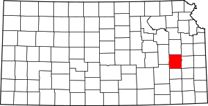 Map of Kansas highlighting Coffey County | |
| Unincorporated communities |
| |
| Townships | ||
- Atherly, Mary Lou De Long. Yesterday's Tomorrow: A History of Strawn, Kansas, & Surrounding Territory. N.p.: Author, 1982. (K978.1/-C65/St82)