Nandewar County

Nandewar County is one of the 141 Cadastral divisions of New South Wales. It is located to the east of the Namoi River, with Narrabri at the north-west edge, and Gunnedah at the southern edge.

Nandewar
New South Wales
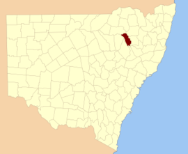
Location in New South Wales
Lands administrative divisions around Nandewar:
Jamison Courallie Murchison
White Nandewar Darling
Pottinger Buckland Parry

Nandewar County is named after the range of mountains called Nandewar by the local Aboriginals.[1]

Parishes

A full list of parishes found within this county; their current LGA and mapping coordinates to the approximate centre of each location is as follows:

ParishLGACoordinates
BerrioyeNarrabri Shire30°30′54″S 150°14′04″E
BillyenaNarrabri Shire30°28′54″S 150°08′04″E
BoggabriNarrabri Shire30°39′49″S 150°07′06″E
BollolNarrabri Shire30°35′54″S 150°17′04″E
BoorobilGunnedah Shire30°56′54″S 150°24′04″E
BrentryGunnedah Shire30°46′54″S 150°12′04″E
BullawaNarrabri Shire30°17′54″S 149°59′04″E
BurburgateGunnedah Shire30°54′24″S 150°14′04″E
ByarNarrabri Shire30°25′54″S 150°14′04″E
ConnorNarrabri Shire30°30′54″S 150°20′04″E
CoryahNarrabri Shire30°11′54″S 150°04′04″E
DeriahNarrabri Shire30°21′54″S 150°04′04″E
DurrisdeerNarrabri Shire30°29′54″S 150°00′04″E
EulahNarrabri Shire30°21′54″S 150°00′04″E
GunnenbemeGunnedah Shire30°52′54″S 150°25′04″E
KillarneyNarrabri Shire30°14′54″S 149°59′04″E
LeardNarrabri Shire30°34′54″S 150°08′04″E
LindesayGwydir Shire30°29′54″S 150°18′04″E
MihiNarrabri Shire30°35′54″S 150°22′04″E
MoonbillNarrabri Shire30°12′54″S 149°56′04″E
NarrabriNarrabri Shire30°14′54″S 149°49′04″E
NingadhunNarrabri Shire30°14′54″S 150°07′04″E
RangiraGunnedah Shire30°36′54″S 150°25′04″E
RusdenNarrabri Shire30°20′54″S 150°11′04″E
TherribriNarrabri Shire30°32′54″S 150°04′04″E
TippereenaNarrabri Shire30°20′54″S 149°53′04″E
TulcumbaGunnedah Shire30°44′54″S 150°20′04″E
VickeryNarrabri Shire30°43′54″S 150°14′04″E
WallahNarrabri Shire30°26′54″S 149°58′04″E
WeanNarrabri Shire30°39′54″S 150°14′04″E
WeetalibaGunnedah Shire30°54′54″S 150°18′04″E
WilluriGunnedah Shire30°42′54″S 150°23′04″E
YarrariGunnedah Shire30°49′54″S 150°22′04″E
gollark: GTech™ nanofabricators.
gollark: NIR only right now though.
gollark: Our tape is so red it's infrared.
gollark: Sadly, bee-feet and seconds aren't dimensionally compatible.
gollark: Boot into a live USB and fix the kernel, or at least keep your home folder.

References

  1. "Nandewar County". Geographical Names Register (GNR) of NSW. Geographical Names Board of New South Wales.
This article is issued from Wikipedia. The text is licensed under Creative Commons - Attribution - Sharealike. Additional terms may apply for the media files.