Courallie County

Courallie County is one of the 141 Cadastral divisions of New South Wales.

Courallie
New South Wales
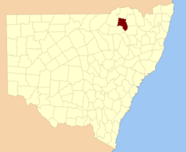
Location in New South Wales
Lands administrative divisions around Courallie:
Benarba Stapylton Burnett
Benarba Courallie Burnett
Jamison Jamison Murchison

Courallie is believed to be derived from a local Aboriginal word.[1]

Parishes

A full list of parishes found within this county; their current LGA and mapping coordinates to the approximate centre of each location is as follows:

ParishLGACoordinates
ArdgowanMoree Plains Shire29°24′54″S 150°04′04″E
BartonMoree Plains Shire29°47′54″S 150°00′04″E
BerrygillMoree Plains Shire29°59′54″S 150°10′04″E
BiniguyMoree Plains Shire29°29′54″S 150°08′04″E
BogreeMoree Plains Shire29°19′54″S 149°48′04″E
BombellNarrabri Shire29°59′54″S 150°04′04″E
Boo BooMoree Plains Shire29°54′54″S 149°56′04″E
BooloorooMoree Plains Shire29°20′54″S 149°56′04″E
BooramineMoree Plains Shire29°46′02″S 149°28′04″E
BowmanMoree Plains Shire29°47′54″S 150°14′04″E
BulleranaMoree Plains Shire29°25′54″S 149°34′04″E
BumbleMoree Plains Shire29°44′54″S 149°39′04″E
BundoowithidieMoree Plains Shire29°26′54″S 150°02′04″E
BurranbahMoree Plains Shire29°44′54″S 149°41′04″E
CampbellMoree Plains Shire29°51′54″S 150°11′04″E
CaroreMoree Plains Shire29°22′54″S 149°46′04″E
CombadeloMoree Plains Shire29°35′54″S 149°40′04″E
DownsMoree Plains Shire29°51′54″S 150°06′04″E
DuckholeMoree Plains Shire29°55′54″S 150°14′04″E
EllisMoree Plains Shire29°39′54″S 150°12′04″E
FletcherMoree Plains Shire29°42′54″S 150°12′04″E
GordonMoree Plains Shire29°45′54″S 149°35′04″E
GreenbahMoree Plains Shire29°27′54″S 149°40′04″E
GurleyMoree Plains Shire29°47′54″S 149°57′04″E
GurrygedahMoree Plains Shire29°44′54″S 150°00′04″E
GyanMoree Plains Shire29°42′54″S 150°05′04″E
HarveyMoree Plains Shire29°20′54″S 150°07′04″E
KingMoree Plains Shire29°20′54″S 150°00′04″E
MedgunMoree Plains Shire29°17′54″S 149°43′04″E
MenadoolMoree Plains Shire29°35′54″S 149°56′04″E
Mia MiaMoree Plains Shire29°26′54″S 150°00′04″E
MinnaminaneMoree Plains Shire29°41′54″S 149°31′04″E
MooeeMoree Plains Shire29°26′54″S 149°47′04″E
MoreeMoree Plains Shire29°27′54″S 149°50′04″E
Mungie BundieMoree Plains Shire29°29′54″S 150°00′04″E
NepickallinaMoree Plains Shire29°36′54″S 149°34′04″E
NoonaMoree Plains Shire29°22′54″S 149°41′04″E
ParamellowaMoree Plains Shire29°26′54″S 150°09′04″E
PeacumboulMoree Plains Shire29°38′54″S 149°45′04″E
PringleMoree Plains Shire29°56′54″S 150°06′04″E
SmartMoree Plains Shire29°35′54″S 149°31′04″E
TalmoiMoree Plains Shire29°18′54″S 149°33′04″E
TerrergeeMoree Plains Shire30°02′54″S 150°08′04″E
Terry Hie HieMoree Plains Shire29°47′54″S 150°06′04″E
TycannahMoree Plains Shire29°33′54″S 149°52′04″E
WallanollMoree Plains Shire29°28′54″S 149°44′04″E
WathagarMoree Plains Shire29°28′54″S 149°33′04″E
Weah WaaMoree Plains Shire29°37′54″S 150°06′04″E
Wee Bulla BullaMoree Plains Shire29°28′54″S 149°56′04″E
WhittakerMoree Plains Shire29°28′54″S 149°39′04″E
WindoondillaMoree Plains Shire29°45′54″S 149°51′04″E
WirrigurldongaMoree Plains Shire29°40′54″S 149°54′04″E
YarramanMoree Plains Shire29°14′54″S 149°33′04″E
YattaMoree Plains Shire29°55′54″S 149°59′04″E
gollark: Wrong.
gollark: Done.
gollark: Great, instantaneously materializing metatemporal spheres...
gollark: Presumably. You can also just express an interest in the product and we will automatically exchange capital.
gollark: The GTech™ website. We will ship by railgun or any other approved method once purchase is confirmed.

References

  1. "Courallie County". Geographical Names Register (GNR) of NSW. Geographical Names Board of New South Wales.
This article is issued from Wikipedia. The text is licensed under Creative Commons - Attribution - Sharealike. Additional terms may apply for the media files.