Murchison County

Murchison County is one of the 141 Cadastral divisions of New South Wales, Australia.

Murchison
New South Wales
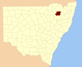
Location in New South Wales
Lands administrative divisions around Murchison:
Courallie Burnett Arrawatta
Jamison Murchison Hardinge
Nandewar Darling Hardinge

Murchison County is named in honour of Sir Roderick Impey Murchison (1792–1871) First Baronet and geologist.[1]

Parishes

A full list of parishes found within this county; their current LGA and mapping coordinates to the approximate centre of each location is as follows:

ParishLGACoordinates
AndersonGwydir Shire30°07′54″S 150°33′04″E
AustenGwydir Shire29°59′54″S 150°21′04″E
BangheetGwydir Shire29°48′54″S 150°30′04″E
BingaraGwydir Shire29°51′54″S 150°32′04″E
BoomiMoree Plains Shire30°12′54″S 150°18′04″E
CapelGwydir Shire30°08′54″S 150°40′04″E
CarodaMoree Plains Shire29°59′54″S 150°15′04″E
CobbadahGwydir Shire30°14′54″S 150°34′04″E
CrawleyGwydir Shire30°14′54″S 150°28′04″E
CurrangandiGwydir Shire30°09′54″S 150°20′04″E
DelingeraGwydir Shire29°43′54″S 150°39′04″E
DelungraInverell Shire29°36′54″S 150°45′04″E
Derra DerraGwydir Shire29°52′24″S 150°30′04″E
DingoGwydir Shire29°52′54″S 150°50′04″E
DinogaGwydir Shire30°00′54″S 150°34′04″E
DrummondGwydir Shire30°06′54″S 150°45′04″E
DumboyGwydir Shire29°39′54″S 150°41′04″E
DunneeGwydir Shire30°10′54″S 150°30′04″E
DurhamGwydir Shire29°48′54″S 150°44′04″E
EulowrieGwydir Shire30°03′54″S 150°07′04″E
EvansGwydir Shire29°52′24″S 150°42′04″E
FurberGwydir Shire29°56′54″S 150°51′04″E
GlassGwydir Shire29°43′54″S 150°20′04″E
GouronGwydir Shire29°59′54″S 150°40′04″E
Gum FlatInverell Shire29°43′54″S 150°59′04″E
GundamuldaGwydir Shire30°14′54″S 150°45′04″E
HallGwydir Shire30°04′54″S 150°34′04″E
HortonGwydir Shire30°11′54″S 150°24′04″E
KeeraGwydir Shire30°01′54″S 150°45′04″E
KingGwydir Shire30°04′54″S 150°28′04″E
LindesayGwydir Shire30°18′54″S 150°21′04″E
Little PlainInverell Shire29°48′54″S 150°54′04″E
MacintyreGwydir Shire30°04′54″S 150°41′04″E
McKinnonGwydir Shire30°06′54″S 150°50′04″E
MehiGwydir Shire29°59′54″S 150°57′04″E
MilroyGwydir Shire29°49′54″S 150°34′04″E
MunroGwydir Shire30°01′54″S 150°50′04″E
MyallGwydir Shire29°49′54″S 150°39′04″E
PalerooGwydir Shire30°06′54″S 150°08′04″E
PallalGwydir Shire29°59′54″S 150°26′04″E
PiedmontGwydir Shire30°14′54″S 150°40′04″E
PringleGwydir Shire30°04′54″S 150°16′04″E
RiderGwydir Shire29°51′54″S 150°19′04″E
RusdenGwydir Shire30°13′54″S 150°13′04″E
StagInverell Shire29°47′54″S 150°50′04″E
TangeGwydir Shire29°56′54″S 150°30′04″E
TurrawarraInverell Shire29°41′54″S 150°40′04″E
WyndhamGwydir Shire29°43′54″S 150°33′04″E
gollark: So you neutralized the dendrohazard?
gollark: That's a tree. And a wall.
gollark: The wall demon was SCP-████, SCP-████ and an unknown number of apiopyrohazards.
gollark: ++list_deleted Wall Demon
gollark: Or bfλ for short.

References

  1. "Murchison County". Geographical Names Register (GNR) of NSW. Geographical Names Board of New South Wales.
This article is issued from Wikipedia. The text is licensed under Creative Commons - Attribution - Sharealike. Additional terms may apply for the media files.