Buckland County
Buckland County is one of the 141 Cadastral divisions of New South Wales. It is situated between a small part of the Namoi River in the north to the Liverpool Range in the south. The Mooki River is the boundary to the west. It includes Quirindi.
| Buckland New South Wales | |||||||||||||||
|---|---|---|---|---|---|---|---|---|---|---|---|---|---|---|---|
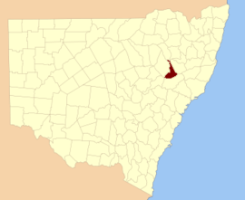 Location in New South Wales | |||||||||||||||
| |||||||||||||||
Buckland County was proclaimed as a county on December 30, 1848 as one of 15 counties then proclaimed Description:-'County of Buckland, containing about 1,484 square miles (3,840 km2). Whilst no official record of naming of the county has been found and there can be no certainty as to the person after whom it was named it is considered possible that the county was named in honour of the Reverend Dr. Buckland.[1]
Parishes within this county
A full list of parishes found within this county; their current LGA and mapping coordinates to the approximate centre of each location is as follows:
| Parish | LGA | Coordinates |
|---|---|---|
| Babbinboon | Gunnedah Shire Council | 31°02′54″S 150°33′04″E |
| Borambil | Liverpool Plains Shire Council | 31°18′54″S 150°36′04″E |
| Carroll | Gunnedah Shire Council | 30°59′54″S 150°29′04″E |
| Clift | Tamworth Regional Council | 31°17′54″S 150°37′04″E |
| Coeypolly | Liverpool Plains Shire Council | 31°25′54″S 150°46′04″E |
| Cooridoon | Gunnedah Shire Council | 30°59′54″S 150°20′04″E |
| Currabubula | Liverpool Plains Shire Council | 31°16′54″S 150°43′04″E |
| Denver | Gunnedah Shire Council | 31°10′54″S 150°30′04″E |
| Dight | Gunnedah Shire Council | 31°03′54″S 150°27′04″E |
| Evan | Liverpool Plains Shire Council | 31°21′54″S 150°48′04″E |
| Ferrier | Gunnedah Shire Council | 31°18′54″S 150°31′04″E |
| Gregson | Liverpool Plains Shire Council | 31°43′54″S 150°37′04″E |
| Grenfell | Tamworth Regional Council | 31°23′54″S 150°36′04″E |
| Gunnadilly | Liverpool Plains Shire Council | 31°27′54″S 150°31′04″E |
| Hudson | Liverpool Plains Shire Council | 31°41′54″S 150°20′04″E |
| Loder | Liverpool Plains Shire Council | 31°36′54″S 150°52′04″E |
| Moan | Liverpool Plains Shire Council | 31°42′54″S 150°12′04″E |
| Mooki | Gunnedah Shire Council | 31°12′54″S 150°29′04″E |
| Parnell | Liverpool Plains Shire Council | 31°29′54″S 150°54′04″E |
| Parsons Hill | Liverpool Plains Shire Council | 31°36′54″S 150°30′04″E |
| Piallaway | Tamworth Regional Council | 31°09′54″S 150°38′04″E |
| Quirindi | Liverpool Plains Shire Council | 31°29′54″S 150°43′04″E |
| Telford | Liverpool Plains Shire Council | 31°32′54″S 150°25′04″E |
| Temi | Liverpool Plains Shire Council | 31°41′54″S 150°49′04″E |
| Texas | Gunnedah Shire Council | 31°08′54″S 150°28′04″E |
| Towarri | Liverpool Plains Shire Council | 31°49′54″S 150°37′04″E |
| Wallabadah | Liverpool Plains Shire Council | 31°28′54″S 150°48′04″E |
| Wallala | Gunnedah Shire Council | 31°22′54″S 150°29′04″E |
| Warrah | Liverpool Plains Shire Council | 31°33′54″S 150°37′04″E |
| Werrie | Tamworth Regional Council | 31°19′54″S 150°42′04″E |
| Willow Tree | Liverpool Plains Shire Council | 31°39′54″S 150°44′04″E |
| Windy | Liverpool Plains Shire Council | 31°35′54″S 150°21′04″E |
| Yarrimanbah | Liverpool Plains Shire Council | 31°47′54″S 150°26′04″E |
References
- "Buckland County". Geographical Names Register (GNR) of NSW. Geographical Names Board of New South Wales.
