White County, New South Wales
White County is one of the 141 Cadastral divisions of New South Wales. It is located to the south of the Namoi River along both sides of Bohena Creek, with Narrabri at the northern end. It includes most of the Pilliga Nature Reserve.
| White New South Wales | |||||||||||||||
|---|---|---|---|---|---|---|---|---|---|---|---|---|---|---|---|
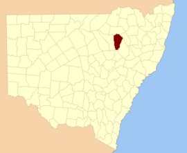 Location in New South Wales | |||||||||||||||
| |||||||||||||||
White County was named in honour of the surveyor and diarist George Boyle White (1802-1876).[1]
Parishes within this county
A full list of parishes found within this county; their current LGA and mapping coordinates to the approximate centre of each location is as follows:
gollark: Also actually supported.
gollark: It's very well-tested, fast, and supports nice SQL querying.
gollark: I... probably won't use it, I like SQLite, but interesting.
gollark: What language?
gollark: <@623743560650588202> Wait, your database?
References
- "White". Geographical Names Register (GNR) of NSW. Geographical Names Board of New South Wales. Retrieved 11 August 2013.

This article is issued from Wikipedia. The text is licensed under Creative Commons - Attribution - Sharealike. Additional terms may apply for the media files.