Mogocha
Mogocha (Russian: Могоча, IPA: [mɐˈgotɕə]) is a town and the administrative center of Mogochinsky District in Zabaykalsky Krai, Russia, located at the confluence of the Mogocha and Amazar Rivers, 709 kilometers (441 mi) northeast of Chita, the administrative center of the krai. Population: 13,258 (2010 Census);[2] 13,282 (2002 Census);[9] 17,847 (1989 Census).[10]
Mogocha Могоча | |
|---|---|
Town[1] | |
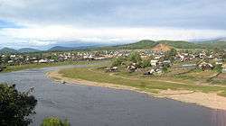
 View of Mogocha | |
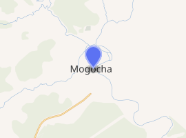
Location of Mogocha 
| |
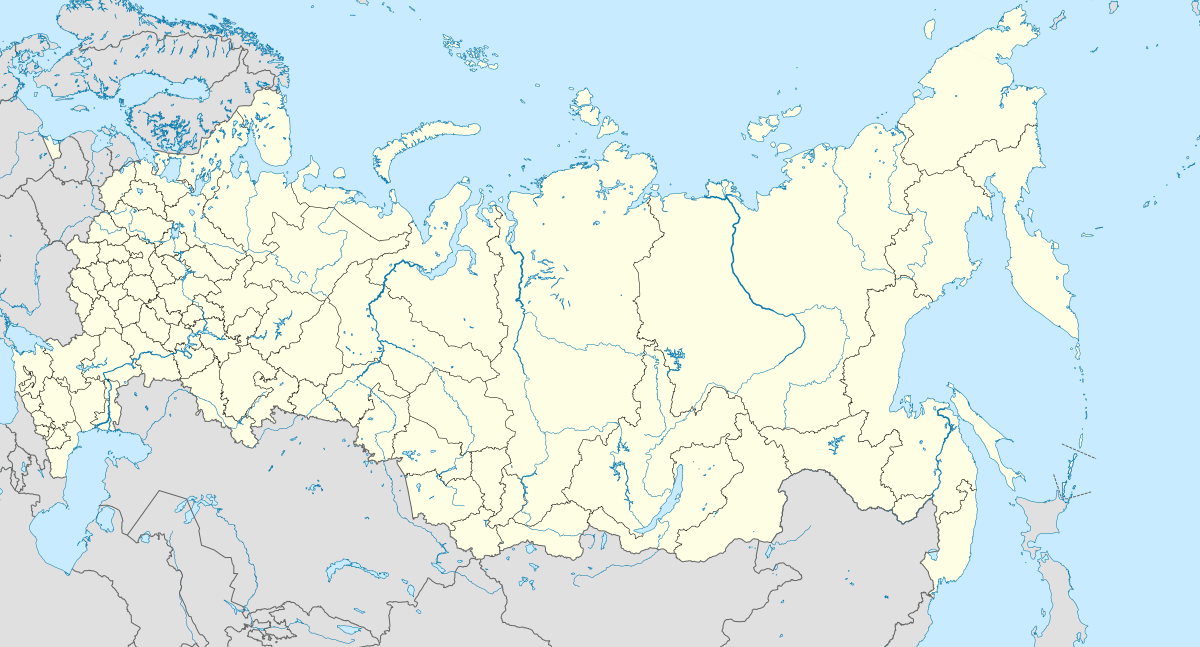
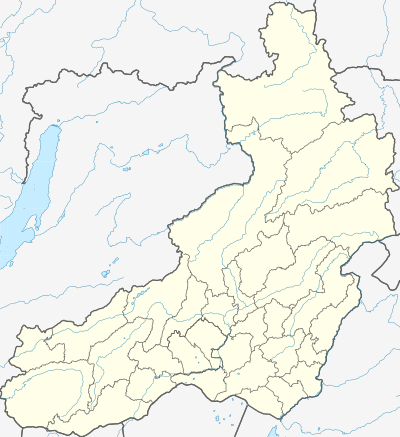
 Mogocha Location of Mogocha  Mogocha Mogocha (Zabaykalsky Krai) | |
| Coordinates: 53°44′N 119°46′E | |
| Country | Russia |
| Federal subject | Zabaykalsky Krai[1] |
| Administrative district | Mogochinsky District[1] |
| Founded | 1910 |
| Town status since | 1950 |
| Elevation | 620 m (2,030 ft) |
| Population | |
| • Total | 13,258 |
| • Estimate (2018)[3] | 13,285 (+0.2%) |
| • Capital of | Mogochinsky District[1] |
| • Municipal district | Mogochinsky Municipal District[4] |
| • Urban settlement | Mogochinskoye Urban Settlement[4] |
| • Capital of | Mogochinsky Municipal District[5], Mogochinskoye Urban Settlement[6] |
| Time zone | UTC+9 (MSK+6 |
| Postal code(s)[8] | 673730–673732, 673779 |
| Dialing code(s) | +7 30241 |
| OKTMO ID | 76626101001 |
Etymology
The name "Mogocha" is derived from the river on which it stands, whose name comes from the Evenki word mongochi. This meaning of this word is ambiguous; it can be translated as golden valley, but also as belonging to the Mongo tribe.
History
It was founded in 1910, with the construction of the local section of the Trans-Siberian Railway. Rail traffic began in 1914. In addition to its status as a supply point for the railway, from the 1920s and 1930s it became the base for gold mining in the surrounding area. Town status was granted to it in 1950.
From 1947 until 1953, Mogocha was site for the Klyuchevlag prison labor camp of the gulag system. The camp held up to 3,000 prisoners at any one time, mainly used as forced labor for molybdenum and gold mining in the villages to the southwest of the town.
During the deterioration of Sino-Soviet relations in the 1950s, a large airbase was created near Mogocha, which hosted several helicopter regiments until the 1990s. The remoteness of Mogocha combined with the harsh climatic conditions, gave rise to the Soviet military slang expression God created Sochi, and Satan Mogocha.
After the dissolution of the Soviet Union and subsequent economic crisis, Mogocha lost around one third of its population, a common occurrence for cities in the Russian Far East. At the same time, a significant number of Chinese citizens and companies have moved to the region.
Administrative and municipal status
Within the framework of administrative divisions, Mogocha serves as the administrative center of Mogochinsky District, to which it is directly subordinated.[1] As a municipal division, the town of Mogocha, together with four rural localities, is incorporated within Mogochinsky Municipal District as Mogochinskoye Urban Settlement.[4]
Economy
Other than railway-related industries, there is logging and timber milling conducted in the surrounding area.
Transportation
Mogocha has a station on the Trans-Siberian Railway. The town's small airport, which had opened in 1937, was closed during the 1990s.
Climate
Mogocha has a subarctic climate (Köppen climate classification Dwc) with bitterly cold, dry winters and mild, rainy summers.
| Climate data for Mogocha | |||||||||||||
|---|---|---|---|---|---|---|---|---|---|---|---|---|---|
| Month | Jan | Feb | Mar | Apr | May | Jun | Jul | Aug | Sep | Oct | Nov | Dec | Year |
| Record high °C (°F) | −3.2 (26.2) |
6.3 (43.3) |
14.3 (57.7) |
23.1 (73.6) |
31.9 (89.4) |
35.4 (95.7) |
37.6 (99.7) |
33.8 (92.8) |
29.6 (85.3) |
21.5 (70.7) |
9.5 (49.1) |
2.0 (35.6) |
37.6 (99.7) |
| Average high °C (°F) | −20.5 (−4.9) |
−12.9 (8.8) |
−4.2 (24.4) |
5.6 (42.1) |
14.9 (58.8) |
22.1 (71.8) |
24.4 (75.9) |
21.6 (70.9) |
14.6 (58.3) |
4.4 (39.9) |
−10.5 (13.1) |
−20.7 (−5.3) |
3.2 (37.8) |
| Daily mean °C (°F) | −27.9 (−18.2) |
−22.7 (−8.9) |
−13.8 (7.2) |
−1.9 (28.6) |
7.0 (44.6) |
14.0 (57.2) |
17.1 (62.8) |
14.5 (58.1) |
7.3 (45.1) |
−3.0 (26.6) |
−17.8 (0.0) |
−27.1 (−16.8) |
−4.5 (23.9) |
| Average low °C (°F) | −35.4 (−31.7) |
−32.6 (−26.7) |
−23.5 (−10.3) |
−9.4 (15.1) |
−1 (30) |
5.8 (42.4) |
9.8 (49.6) |
7.3 (45.1) |
−0.1 (31.8) |
−10.4 (13.3) |
−25.2 (−13.4) |
−33.5 (−28.3) |
−12.3 (9.9) |
| Record low °C (°F) | −48.8 (−55.8) |
−51.5 (−60.7) |
−44.2 (−47.6) |
−29.3 (−20.7) |
−16.7 (1.9) |
−6.7 (19.9) |
−3.1 (26.4) |
−5.1 (22.8) |
−12.8 (9.0) |
−32 (−26) |
−43.6 (−46.5) |
−51.7 (−61.1) |
−51.7 (−61.1) |
| Average precipitation mm (inches) | 3.3 (0.13) |
3.6 (0.14) |
5.5 (0.22) |
16.9 (0.67) |
34.4 (1.35) |
75.0 (2.95) |
114.9 (4.52) |
105.0 (4.13) |
49.9 (1.96) |
14.3 (0.56) |
10.2 (0.40) |
5.7 (0.22) |
438.7 (17.25) |
| Average precipitation days | 4.5 | 4.2 | 4.5 | 5.9 | 8.7 | 14.1 | 15.4 | 14.9 | 10.6 | 5.8 | 6.9 | 6.4 | 101.9 |
| Mean monthly sunshine hours | 124 | 172 | 232 | 224 | 247 | 242 | 234 | 202 | 173 | 175 | 134 | 103 | 2,262 |
| Source: climatebase.ru (1910-2012)[11] | |||||||||||||
References
Notes
- Registry of the Administrative-Territorial Units and the Inhabited Localities of Zabaykalsky Krai
- Russian Federal State Statistics Service (2011). "Всероссийская перепись населения 2010 года. Том 1" [2010 All-Russian Population Census, vol. 1]. Всероссийская перепись населения 2010 года [2010 All-Russia Population Census] (in Russian). Federal State Statistics Service.
- "26. Численность постоянного населения Российской Федерации по муниципальным образованиям на 1 января 2018 года". Federal State Statistics Service. Retrieved January 23, 2019.
- Law #317-ZZK
- Law #316-ZZK
- Федеральная служба государственной статистики. Федеральное агентство по технологическому регулированию и метрологии. №ОК 033-2013 1 января 2014 г. «Общероссийский классификатор территорий муниципальных образований. Код 76 626 101». (Federal State Statistics Service. Federal Agency on Technological Regulation and Metrology. #OK 033-2013 January 1, 2014 Russian Classification of Territories of Municipal Formations. Code 76 626 101. ).
- "Об исчислении времени". Официальный интернет-портал правовой информации (in Russian). June 3, 2011. Retrieved January 19, 2019.
- Почта России. Информационно-вычислительный центр ОАСУ РПО. (Russian Post). Поиск объектов почтовой связи (Postal Objects Search) (in Russian)
- Russian Federal State Statistics Service (May 21, 2004). "Численность населения России, субъектов Российской Федерации в составе федеральных округов, районов, городских поселений, сельских населённых пунктов – районных центров и сельских населённых пунктов с населением 3 тысячи и более человек" [Population of Russia, Its Federal Districts, Federal Subjects, Districts, Urban Localities, Rural Localities—Administrative Centers, and Rural Localities with Population of Over 3,000] (XLS). Всероссийская перепись населения 2002 года [All-Russia Population Census of 2002] (in Russian).
- "Всесоюзная перепись населения 1989 г. Численность наличного населения союзных и автономных республик, автономных областей и округов, краёв, областей, районов, городских поселений и сёл-райцентров" [All Union Population Census of 1989: Present Population of Union and Autonomous Republics, Autonomous Oblasts and Okrugs, Krais, Oblasts, Districts, Urban Settlements, and Villages Serving as District Administrative Centers]. Всесоюзная перепись населения 1989 года [All-Union Population Census of 1989] (in Russian). Институт демографии Национального исследовательского университета: Высшая школа экономики [Institute of Demography at the National Research University: Higher School of Economics]. 1989 – via Demoscope Weekly.
- "Mogocha, Russia". Climatebase.ru. Retrieved January 24, 2013.
Sources
- Министерство территориального развития Забайкальского края. 1 января 2014 г. «Реестр административно-территориальных единиц и населённых пунктов Забайкальского края», в ред. Распоряжения №209-р от 10 июня 2014 г.. (Ministry of the Territorial Development of Zabaykalsky Krai. January 1, 2014 Registry of the Administrative-Territorial Units and the Inhabited Localities of Zabaykalsky Krai, as amended by the Directive #209-r of June 10, 2014. ).
- Законодательное Собрание Забайкальского края. Закон №317-ЗЗК от 18 декабря 2009 г. «О границах сельских и городских поселений Забайкальского края», в ред. Закона №1070-ЗЗК от 31 октября 2014 г. «О внесении изменений в Закон Забайкальского края "О границах сельских и городских поселений Забайкальского края"». Вступил в силу через десять дней после дня официального опубликования. Опубликован: "Забайкальский рабочий", №239–242, 21 декабря 2009 г. (Legislative Assembly of Zabaykalsky Krai. Law #317-ZZK of December 18, 2009 On the Borders of the Rural and Urban Settlements of Zabaykalsky Krai, as amended by the Law #1070-ZZK of October 31, 2014 On Amending the Law of Zabaykalsky Krai "On the Borders of the Rural and Urban Settlements of Zabaykalsky Krai". Effective as of the day which is ten days after the day of the official publication.).
- Законодательное Собрание Забайкальского края. Закон №316-ЗЗК от 18 декабря 2009 г. «О границах муниципальных районов и городских округов Забайкальского края», в ред. Закона №770-ЗЗК от 26 декабря 2012 г. «О внесении изменений в Закон Забайкальского края "О границах муниципальных районов и городских округов Забайкальского края"». Вступил в силу через десять дней после дня официального опубликования. Опубликован: "Забайкальский рабочий", №239–242, 21 декабря 2009 г. (Legislative Assembly of Zabaykalsky Krai. Law #316-ZZK of December 18, 2009 On the Borders of the Municipal Districts and Urban Okrugs of Zabaykalsky Krai, as amended by the Law #770-ZZK of December 26, 2012 On Amending the Law of Zabaykalsky Krai "On the Borders of the Municipal Districts and Urban Okrugs of Zabaykalsky Krai". Effective as of the day which is ten days after the day of the official publication.).