Atamanovka, Zabaykalsky Krai
Atamanovka (Russian: Атама́новка) is an urban locality (an urban-type settlement) and a railway station in the central part of Chitinsky District of Zabaykalsky Krai, Russia, located on the left bank of the Ingoda River, 18 kilometers (11 mi) southeast of Chita. Population: 10,381 (2010 Census);[1] 9,463 (2002 Census);[5] 10,269 (1989 Census);[6] 190 (1917).
Atamanovka Атамановка | |
|---|---|
Urban-type settlement | |
Location of Atamanovka 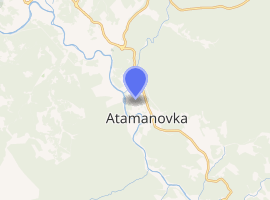
| |
 Atamanovka Location of Atamanovka 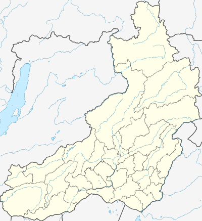 Atamanovka Atamanovka (Zabaykalsky Krai) | |
| Coordinates: 51°56′N 113°38′E | |
| Country | Russia |
| Federal subject | Zabaykalsky Krai |
| Administrative district | Chitinsky District |
| Founded | 1852 |
| Elevation | 652 m (2,139 ft) |
| Population | |
| • Total | 10,381 |
| • Estimate (2018)[2] | 10,209 (-1.7%) |
| Time zone | UTC+9 (MSK+6 |
| Postal code(s)[4] | 672530 |
| OKTMO ID | 76650154051 |
History
It was founded in 1852 and initially named Atamanka (Атама́нка). Until the 1930s, Atamanovka's inhabitants lived on raising their livestock. Urban-type settlement status was granted to it in 1958.
Economy
A large broadcasting facility (Kruchina transmitter) for LW, MW, and SW is situated at Atamanovka.
Culture
There is a memorial honoring the explorers of space in Atamanovka.
gollark: #1 then.
gollark: Well, I guess we carefully attain another GM
gollark: We have 4 rocks, right?
gollark: I take the rock, we share the money again, and I add the corpse to our corpse pile for sale.
gollark: Well, we swordify the GM#1 then.
References
- Russian Federal State Statistics Service (2011). "Всероссийская перепись населения 2010 года. Том 1" [2010 All-Russian Population Census, vol. 1]. Всероссийская перепись населения 2010 года [2010 All-Russia Population Census] (in Russian). Federal State Statistics Service.
- "26. Численность постоянного населения Российской Федерации по муниципальным образованиям на 1 января 2018 года". Federal State Statistics Service. Retrieved January 23, 2019.
- "Об исчислении времени". Официальный интернет-портал правовой информации (in Russian). June 3, 2011. Retrieved January 19, 2019.
- Почта России. Информационно-вычислительный центр ОАСУ РПО. (Russian Post). Поиск объектов почтовой связи (Postal Objects Search) (in Russian)
- Russian Federal State Statistics Service (May 21, 2004). "Численность населения России, субъектов Российской Федерации в составе федеральных округов, районов, городских поселений, сельских населённых пунктов – районных центров и сельских населённых пунктов с населением 3 тысячи и более человек" [Population of Russia, Its Federal Districts, Federal Subjects, Districts, Urban Localities, Rural Localities—Administrative Centers, and Rural Localities with Population of Over 3,000] (XLS). Всероссийская перепись населения 2002 года [All-Russia Population Census of 2002] (in Russian).
- "Всесоюзная перепись населения 1989 г. Численность наличного населения союзных и автономных республик, автономных областей и округов, краёв, областей, районов, городских поселений и сёл-райцентров" [All Union Population Census of 1989: Present Population of Union and Autonomous Republics, Autonomous Oblasts and Okrugs, Krais, Oblasts, Districts, Urban Settlements, and Villages Serving as District Administrative Centers]. Всесоюзная перепись населения 1989 года [All-Union Population Census of 1989] (in Russian). Институт демографии Национального исследовательского университета: Высшая школа экономики [Institute of Demography at the National Research University: Higher School of Economics]. 1989 – via Demoscope Weekly.
External links
- The Encyclopedia of Trans-Baikal. Entry on Atamanovka (in Russian)
This article is issued from Wikipedia. The text is licensed under Creative Commons - Attribution - Sharealike. Additional terms may apply for the media files.