Missouri's 6th congressional district
Missouri's 6th congressional district takes in a large swath of land in northern Missouri, stretching across nearly the entire width of the state from Kansas to Illinois. Its largest voting population is centered in the northern portion of the Kansas City metropolitan area and the town of St. Joseph. The district includes nearly all of Kansas City north of the Missouri River (including Kansas City International Airport).
| Missouri's 6th congressional district | |||
|---|---|---|---|
.tif.png) Missouri's 6th congressional district - since January 3, 2013. | |||
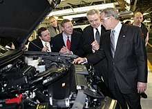
| Representative |
| ||
| Median income | $58,778[1] | ||
| Cook PVI | R+16[2] | ||
The district takes in all or parts of the following counties: Adair, Andrew, Atchison, Buchanan, Caldwell, Carroll, Chariton, Clark, Clay, Clinton, Daviess, De Kalb, Gentry, Grundy, Harrison, Holt, Jackson, Knox, Lewis, Linn, Livingston, Macon, Marion, Mercer, Monroe, Nodaway, Pike, Platte, Putnam, Ralls, Schuyler, Scotland, Shelby, Sullivan, Worth.
Notable representatives from the district include governors John Smith Phelps and Austin A. King as well as Kansas City Mayor Robert T. Van Horn. In 1976, Jerry Litton was killed on election night as he flew to a victory party after winning the Democratic nomination for United States Senate. The visitors center at Smithville Lake is named in Litton's memory. Democrat Pat Danner, a former aid to Jerry Litton, won the seat in 1992 becoming the first woman to be elected in the district defeating a 16-year Republican incumbent.
George W. Bush beat John Kerry in this district 57%-43% in 2004. The district is represented by Republican Sam Graves, who has held the seat since 2001. Graves easily held on to his seat what was expected to be a tough 2008 election, defeating former Kansas City mayor Kay Waldo Barnes by 22 percentage points.
Historically, the 6th was not safe for either party. However, in recent years, it has trended Republican, mirroring the increasingly conservative bent of the more rural areas of Missouri that historically voted for Yellow Dog Democrats. But recent trends in the suburbs of Kansas City could make the district more competitive.
Redistricting following 2010 Census
After Missouri lost a Congressional seat following the 2010 Census (in part because of losses in population in several rural northern Missouri counties), the 6th was expanded to include most of Missouri north of the Missouri River, stretching from border to border from Kansas to Illinois. The biggest geographic addition was in northeast Missouri (including Kirksville, Missouri and Hannibal, Missouri), which used to be the northern half of the old 9th district.[3]
The 6th lost Cooper and Howard counties to the 4th district, and Gladstone in southwestern Clay County to the 5th district.
List of members representing the district
| Member | Party | Years | Cong ress |
Electoral history |
|---|---|---|---|---|
| District created March 4, 1853 | ||||
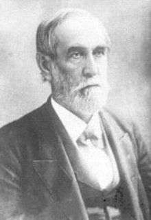 John S. Phelps |
Democratic | March 4, 1853 – March 3, 1863 |
33rd 34th 35th 36th 37th |
Redistricted from the 5th district. [data unknown/missing] |
 Austin A. King |
Unionist | March 4, 1863 – March 3, 1865 |
38th | [data unknown/missing] |
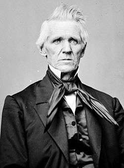
 Robert T. Van Horn |
Republican | March 4, 1865 – March 3, 1871 |
39th 40th 41st |
[data unknown/missing] |
 Abram Comingo |
Democratic | March 4, 1871 – March 3, 1873 |
42nd | [data unknown/missing] Redistricted to the 8th district. |
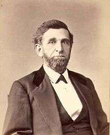
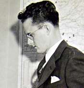
.jpg) Harrison E. Havens |
Republican | March 4, 1873 – March 3, 1875 |
43rd | Redistricted from the 4th district. [data unknown/missing] |
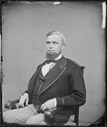
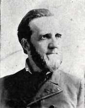
.jpg) Charles H. Morgan |
Democratic | March 4, 1875 – March 3, 1879 |
44th 45th |
[data unknown/missing] |
.jpg) James R. Waddill |
Democratic | March 4, 1879 – March 3, 1881 |
46th | [data unknown/missing] |
 Ira S. Hazeltine |
Greenback | March 4, 1881 – March 3, 1883 |
47th | [data unknown/missing] |
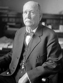
.jpg) John Cosgrove |
Democratic | March 4, 1883 – March 3, 1885 |
48th | [data unknown/missing] |
 John T. Heard |
Democratic | March 4, 1885 – March 3, 1893 |
49th 50th 51st 52nd |
[data unknown/missing] Redistricted to the 7th district. |
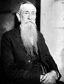
.jpg) David A. De Armond |
Democratic | March 4, 1893 – November 23, 1909 |
53rd 54th 55th 56th 57th 58th 59th 60th 61st |
Redistricted from the 12th district. Died. |
| Vacant | November 23, 1909 – February 1, 1910 |
61st | ||
 Clement C. Dickinson |
Democratic | February 1, 1910 – March 3, 1921 |
61st 62nd 63rd 64th 65th 66th |
Elected to finish De Armond's term. [data unknown/missing] |
 William O. Atkeson |
Republican | March 4, 1921 – March 3, 1923 |
67th | [data unknown/missing] |
Clement C. Dickinson |
Democratic | March 4, 1923 – March 3, 1929 |
68th 69th 70th |
[data unknown/missing] |
.jpg) Thomas J. Halsey |
Republican | March 4, 1929 – March 3, 1931 |
71st | [data unknown/missing] |
Clement C. Dickinson |
Democratic | March 4, 1931 – March 3, 1933 |
72nd | [data unknown/missing] Redistricted to the At-large district |
| None | March 4, 1933 – January 3, 1935 |
73rd | District inactive, all representatives elected At-large on a general ticket | |
.jpg) Reuben T. Wood |
Democratic | January 3, 1935 – January 3, 1941 |
74th 75th 76th |
Redistricted from the At-large district |
.jpg) Philip A. Bennett |
Republican | January 3, 1941 – December 7, 1942 |
77th | Elected in 1940. Re-elected in 1942. Died. |
| Vacant | December 7, 1942 – January 12, 1943 |
77th 78th | ||
 Marion T. Bennett |
Republican | January 12, 1943 – January 3, 1949 |
78th 79th 80th |
Elected to finish his father's term. [data unknown/missing] |
.jpg) George H. Christopher |
Democratic | January 3, 1949 – January 3, 1951 |
81st | [data unknown/missing] |
.jpg) Orland K. Armstrong |
Republican | January 3, 1951 – January 3, 1953 |
82nd | [data unknown/missing] |
.jpg) William C. Cole |
Republican | January 3, 1953 – January 3, 1955 |
83rd | [data unknown/missing] |
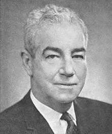 William Raleigh Hull Jr. |
Democratic | January 3, 1955 – January 3, 1973 |
84th 85th 86th 87th 88th 89th 90th 91st 92nd |
[data unknown/missing] |
 Jerry Litton |
Democratic | January 3, 1973 – August 3, 1976 |
93rd 94th |
[data unknown/missing] Retired to run for U.S. senator. Died. |
| Vacant | August 3, 1976 – November 2, 1976 |
94th | ||
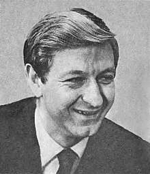
 Tom Coleman |
Republican | November 2, 1976 – January 3, 1993 |
94th 95th 96th 97th 98th 99th 100th 101st 102nd |
Elected to finish Litton's term. Lost re-election. |
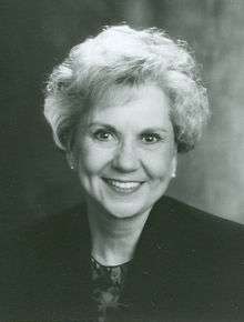 Pat Danner |
Democratic | January 3, 1993 – January 3, 2001 |
103rd 104th 105th 106th |
[data unknown/missing] Retired. |
 Sam Graves |
Republican | January 3, 2001 – present |
107th 108th 109th 110th 111th 112th 113th 114th 115th 116th |
Elected in 2000. |
Election results from presidential races
| Year | Office | Results | Political parties that won the district |
|---|---|---|---|
| 2000 | President | George W. Bush 53 - Al Gore 44% | Republican Party (United States) |
| 2004 | President | George W. Bush 57 - John Kerry 42% | Republican Party (United States) |
| 2008 | President | John McCain 54 - Barack Obama 45% | Republican Party (United States) |
| 2012 | President | Mitt Romney 60 - Barack Obama 38% | Republican Party (United States) |
| 2016 | President | Donald Trump 63 - Hillary Clinton 32% | Republican Party (United States) |
Election results
1996
| Party | Candidate | Votes | % | ± | |
|---|---|---|---|---|---|
| Democratic | Pat Danner | 169,006 | 68.6% | ||
| Republican | Jeff Bailey | 72,064 | 29.3% | ||
| Libertarian | Karl H. Wetzel | 5,212 | 2.1% | ||
| Total votes | 246,282 | 100% | |||
| Majority | |||||
| Turnout | |||||
| Democratic hold | Swing | ||||
1998
| Party | Candidate | Votes | % | ± | |
|---|---|---|---|---|---|
| Democratic | Pat Danner (Incumbent) | 136,774 | 70.9% | ||
| Republican | Jeff Bailey | 51,679 | 26.8% | ||
| Libertarian | Karl H. Wetzel | 4,324 | 2.2% | ||
| Total votes | 129,777 | 100% | |||
| Majority | |||||
| Turnout | |||||
| Democratic hold | Swing | ||||
2000
| Party | Candidate | Votes | % | ± | |
|---|---|---|---|---|---|
| Republican | Samuel B. Graves, Jr. | 138,925 | 50.9% | ||
| Democratic | Steve Danner | 127,792 | 46.8% | ||
| Libertarian | Jimmy Dykes | 3,696 | 1.4% | ||
| Independent | Marie Richey | 2,788 | 1.0% | ||
| Total votes | 273,201 | 100% | |||
| Majority | |||||
| Turnout | |||||
| Republican gain from Democratic | Swing | ||||
2002
| Party | Candidate | Votes | % | ± | |
|---|---|---|---|---|---|
| Republican | Samuel B. Graves, Jr. (Incumbent) | 131,151 | 63.0% | ||
| Democratic | Cathy Rinehart | 73,202 | 35.2% | ||
| Libertarian | Erik Buck | 3,735 | 1.8% | ||
| Total votes | 208,088 | 100% | |||
| Majority | |||||
| Turnout | |||||
| Republican hold | Swing | ||||
2004
| Party | Candidate | Votes | % | ± | |
|---|---|---|---|---|---|
| Republican | Samuel B. Graves, Jr. (Incumbent) | 196,516 | 63.83% | ||
| Democratic | Charles S. Broomfield | 106,987 | 34.75% | ||
| Libertarian | Erik Buck | 4,352 | 1.41% | ||
| Total votes | 307,885 | 100% | |||
| Majority | |||||
| Turnout | |||||
| Republican hold | Swing | ||||
2006
| Party | Candidate | Votes | % | ± | |
|---|---|---|---|---|---|
| Republican | Samuel B. Graves, Jr. (Incumbent) | 150,882 | 61.64% | ||
| Democratic | Sara Jo Shettles | 87,477 | 35.73% | ||
| Libertarian | Erik Buck | 4,757 | 1.94% | ||
| Progressive | Shirley A. Yurkonis | 1,679 | 0.69% | ||
| Total votes | 244,795 | 100% | |||
| Majority | |||||
| Turnout | |||||
| Republican hold | Swing | ||||
2008
| Party | Candidate | Votes | % | ± | |
|---|---|---|---|---|---|
| Republican | Samuel B. Graves, Jr. (Incumbent) | 196,526 | 59.4% | ||
| Democratic | Kay Barnes | 121,894 | 36.9% | ||
| Libertarian | Dave Browning | 12,279 | 3.7% | ||
| Total votes | 330,699 | 100% | |||
| Majority | 62,353 | 18.8% | |||
| Turnout | |||||
| Republican hold | Swing | ||||
Historical district boundaries

References
- https://www.census.gov/mycd/?st=29&cd=06
- "Partisan Voting Index – Districts of the 115th Congress" (PDF). The Cook Political Report. April 7, 2017. Retrieved April 7, 2017.
- "Archived copy". Archived from the original on 2011-05-11. Retrieved 2011-03-31.CS1 maint: archived copy as title (link)
- 1996 Election Results
- 1998 Election Results
- 2000 Election Results
- 2002 Election Results
- Official Manual of the State of Missouri, 2005-2006, page 637
- Official Manual of the State of Missouri, 2007-2008, page 649
- 2008 Election Results
- Martis, Kenneth C. (1989). The Historical Atlas of Political Parties in the United States Congress. New York: Macmillan Publishing Company.
- Martis, Kenneth C. (1982). The Historical Atlas of United States Congressional Districts. New York: Macmillan Publishing Company.
- Congressional Biographical Directory of the United States 1774–present
- https://web.archive.org/web/20131013222920/http://2010.census.gov/2010census/popmap/