Mid Suffolk
Mid Suffolk is a local government district in Suffolk, England. Its council was based in Needham Market until late 2017, and are currently sharing offices with the Suffolk County Council at their headquarters in Ipswich.[1][2] The largest town of Mid Suffolk is Stowmarket. The population of the District taken at the 2011 Census was 96,731.[3]
Mid Suffolk District | |
|---|---|
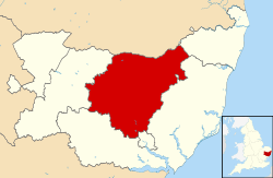 Mid Suffolk shown within Suffolk and England | |
| Sovereign state | United Kingdom |
| Constituent country | England |
| Region | East of England |
| Non-metropolitan county | Suffolk |
| Status | Non-metropolitan district |
| Admin HQ | Ipswich |
| Incorporated | 1 April 1974 |
| Government | |
| • Type | Non-metropolitan district council |
| • Body | Mid Suffolk District Council |
| • Leadership | Leader & Cabinet (Conservative) |
| • MPs | Dan Poulter Jo Churchill |
| Area | |
| • Total | 336.3 sq mi (871.1 km2) |
| Area rank | 42nd (of 317) |
| Population (mid-2019 est.) | |
| • Total | 103,895 |
| • Rank | 230th (of 317) |
| • Density | 310/sq mi (120/km2) |
| • Ethnicity | 99.0% White |
| Time zone | UTC0 (GMT) |
| • Summer (DST) | UTC+1 (BST) |
| ONS code | 42UE (ONS) E07000203 (GSS) |
| OS grid reference | TM0853555286 |
| Website | www.MidSuffolk.gov.uk |
The district was formed on 1 April 1974 by the merger of the Borough of Eye, Stowmarket urban district, Gipping Rural District, Hartismere Rural District and Thedwastre Rural District.
Communities
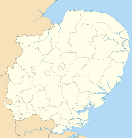
The district has the largest number of parishes for a district Council in Suffolk, with a total of 123 (parishes and towns).
- Akenham
- Ashbocking
- Ashfield cum Thorpe
- Aspall
- Athelington
- Bacton
- Badley
- Badwell Ash
- Barham
- Barking
- Battisford
- Baylham
- Bedfield
- Bedingfield
- Beyton
- Botesdale
- Braiseworth
- Bramford
- Brome and Oakley
- Brundish
- Burgate
- Buxhall
- Claydon
- Coddenham
- Combs
- Cotton
- Creeting St Mary
- Creeting St Peter
- Crowfield
- Darmsden
- Debenham
- Denham
- Drinkstone
- Earl Stonham
- Elmswell
- Eye
- Felsham
- Finningham
- Flowton
- Framsden
- Fressingfield
- Gedding
- Gipping
- Gislingham
- Gosbeck
- Great Ashfield
- Great Blakenham
- Great Bricett
- Great Finborough
- Harleston
- Haughley
- Helmingham
- Hemingstone
- Henley
- Hessett
- Hinderclay
- Horham
- Hoxne
- Hunston
- Kenton
- Langham
- Laxfield
- Little Blakenham
- Little Finborough
- Mellis
- Mendham
- Mendlesham
- Metfield
- Mickfield
- Monk Soham
- Needham Market
- Nettlestead
- Norton
- Occold
- Offton
- Old Newton with Dagworth
- Onehouse
- Palgrave
- Pettaugh
- Rattlesden
- Redgrave
- Redlingfield
- Rickinghall Inferior
- Rickinghall Superior
- Ringshall
- Rishangles
- Shelland
- Somersham
- Southolt
- Stoke Ash
- Stonham Aspal
- Stonham Parva
- Stowlangtoft
- Stowmarket
- Stowupland
- Stradbroke
- Stuston
- Syleham
- Tannington
- Thorndon
- Thornham Magna
- Thornham Parva
- Thrandeston
- Thurston
- Thwaite
- Tostock
- Walsham-le-Willows
- Wattisfield
- Westhorpe
- Wetherden
- Wetheringsett-cum-Brockford
- Weybread
- Whitton
- Wickham Skeith
- Wilby
- Willisham
- Wingfield
- Winston
- Woolpit
- Worlingworth
- Wortham
- Wyverstone
- Yaxley
gollark: How are you planning to upload 30GB of random content to Discord? How is anyone meant to LOOK THROUGH that?
gollark: Thus, no.
gollark: That's Wikipedia with images, even; a raw dump with just text is 15GB.
gollark: Correction: my copy of Wikipedia (compressed ZIM file, including FTS index, including images too, dated 2020-08) is 92GB.
gollark: * accidentally adding a zero
References
- "Contact Us » Babergh Mid Suffolk". www.midsuffolk.gov.uk.
- Geater, Paul. "Babergh and Mid Suffolk councils set to move to Ipswich in September". Ipswich Star.
- "District population 2011". Neighbourhood Statistics. Office for National Statistics. Archived from the original on 12 October 2016. Retrieved 15 August 2016.
External links
- Mid Suffolk District Council
- Table of wards that comprise Mid Suffolk and the parishes that this 2001 law defines as constituting each of those wards
| Boroughs or districts |
|
|---|---|
| Major settlements |
|
| Topics | |
This article is issued from Wikipedia. The text is licensed under Creative Commons - Attribution - Sharealike. Additional terms may apply for the media files.