Athelington
Athelington is a small village and civil parish in the Mid Suffolk district of Suffolk, England, about 12 miles (19 km) south-east from Diss. The name is derived from the Old English word Aetheling. The population of the village was less than 50 at the 2011 Census and is included in the civil parish of Redlingfield, in 2005 the population was estimated as 30.
| Athelington | |
|---|---|
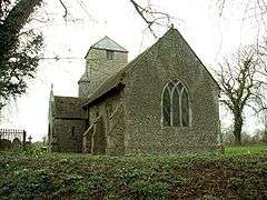
 St. Peter's church, Athelington | |
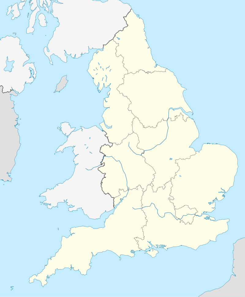
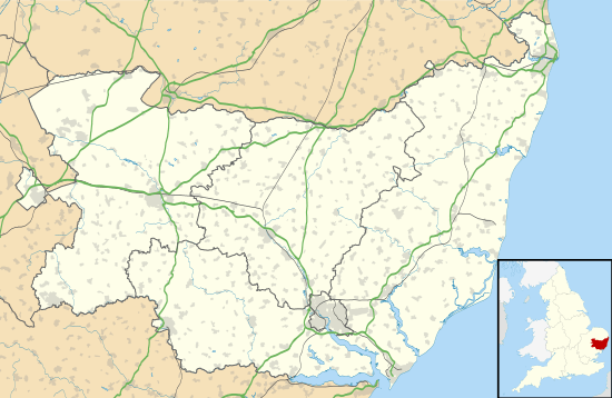
 Athelington  Athelington Location within Suffolk | |
| Area | 2.00 km2 (0.77 sq mi) |
| Population | 30 (2005 Est.)[1] |
| • Density | 15/km2 (39/sq mi) |
| OS grid reference | TL210710 |
| District | |
| Shire county | |
| Region | |
| Country | England |
| Sovereign state | United Kingdom |
| Post town | Eye |
| Postcode district | IP21 |
| Dialling code | 01728 |
| Police | Suffolk |
| Fire | Suffolk |
| Ambulance | East of England |
| UK Parliament | |
The village is first recorded as Elyngtone in 942 in the will of Bishop Theodred granting lands to a community dedicated to St Æthelberht in Hoxne.[2] It was not recorded in the Domesday book.
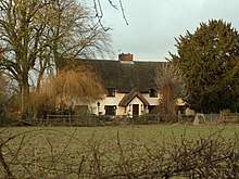
There are six listed buildings in the parish[3] with the church of St Peter being II* listed[4] and the remaining five being grade II listed including the 17th Century Athelington Hall.[5]

Church of St Peter
The church of St Peter is medieval in origin and was majorly restored both internally and externally in 1873-1874. The early 14th century nave and chancel are made of flint rubble with stone dressings with the 15th century tower being constructed of knapped flint with an admixture of red brick. There's a bare-faced flint porch which was added in 1873 with a memorial inscription.[6][7] Three bells hang in the tower all cast in 1450 by John Magges of Norwich and are currently unringable, the largest weigh approximately 4.5cwt and has a diameter of 28 inches. [8]
Governance
The parish is part of the historic Hoxne Hundred. Between 1894 and 1934 it was in Hoxne Rural District before transferring to Hartismere Rural District which in turn was abolished in 1974 by the Local Government Act 1972. Today Athelington lies in the Mid Suffolk District of the shire county of Suffolk. The four tiers of government & their respective representatives are:[9]
- Central Suffolk and North Ipswich UK Parliament constituency, Dan Poulter
- Suffolk County Council Hoxne & Eye division, Guy McGregor[10]
- Mid Suffolk District Council Hoxne and Worlingworth ward, Matthew Hicks[11]
- Horham and Athelington Parish Council with 7 elected parish councilors.
Historical writings
In 1870–72, John Marius Wilson's Imperial Gazetteer of England and Wales described the village as:[12]
ATHELINGTON, or Allington, a parish in Hoxne district, Suffolk; 5 miles SE by E of Eye, and 8 NW of Framlingham r. station. Post Town, Horham under Wickham-Market. Acres, 487. Real property, £926. Pop., 115. Houses, 24. The property is not much divided. The living is a rectory in the diocese of Norwich. Value, £155. Patron, the Lord Chancellor. The church is good.
In 1887, John Bartholomew also wrote an entry on Athelington in the Gazetteer of the British Isles with a much shorter description:[13]
Athelington, parish, East Suffolk, 5 miles SE. of Eye and 7 m. NW. of Framlingham railway. station., 487 acres., population. 118.
Population change
| Athelington from 1801 to 1961 | ||||||||||||||||
|---|---|---|---|---|---|---|---|---|---|---|---|---|---|---|---|---|
| Year | 1801 | 1811 | 1821 | 1831 | 1841 | 1851 | 1881 | 1891 | 1901 | 1911 | 1921 | 1931 | 1951 | 1961 | ||
| Population | 70 | 83 | 100 | 129 | 111 | 117 | 118 | 106 | 87 | 77 | 54 | 71 | 38 | 47 | ||
| Number of Houses | - | - | - | 14 | 26 | 26 | 27 | 23 | 20 | - | 14 | 14 | 12 | 15 | ||
| Source: A Vision of Britain Through Time[14] | ||||||||||||||||
External links

- Horham and Athelington Parish Council
References
- "SCC 2005 Population Est" (PDF). 19 December 2008. Archived from the original (PDF) on 19 December 2008. Retrieved 30 May 2020.
- "Electronic Sawyer S1526". esawyer.lib.cam.ac.uk. Retrieved 30 May 2020.
- "Listed Buildings in Athelington, Mid Suffolk, Suffolk". britishlistedbuildings.co.uk. Retrieved 30 May 2020.
- Stuff, Good. "Church of St Peter, Athelington, Suffolk". britishlistedbuildings.co.uk. Retrieved 30 May 2020.
- Stuff, Good. "Athelington Hall, Athelington, Suffolk". britishlistedbuildings.co.uk. Retrieved 30 May 2020.
- "CHURCH OF ST PETER, Athelington - 1032562 | Historic England". historicengland.org.uk. Retrieved 30 May 2020.
- "Suffolk Churches". www.suffolkchurches.co.uk. Retrieved 30 May 2020.
- "The Suffolk Guild of Ringers, Athelington Bells". www.suffolkbells.org.uk. Retrieved 30 May 2020.
- "Representatives of Athelington". Retrieved 30 May 2020.
- "Guy McGregor | Suffolk County Council". www.suffolk.gov.uk. Retrieved 30 May 2020.
- "Councillor details - Matthew Hicks". baberghmidsuffolk.moderngov.co.uk. 30 May 2020. Retrieved 30 May 2020.
- "ATHELINGTON, or Allington | As described in John Marius Wilson's Imperial Gazetteer of England and Wales (1870-72)". www.visionofbritain.org.uk. Retrieved 30 May 2020.
- "Athelington | As described in John Bartholomew's Gazetteer of the British Isles (1887)". www.visionofbritain.org.uk. Retrieved 30 May 2020.
- "Athelington CP/AP through time | Census tables with data for the Parish-level Unit". www.visionofbritain.org.uk. Retrieved 30 May 2020.