McDonald Township, Hardin County, Ohio
McDonald Township is one of the fifteen townships of Hardin County, Ohio, United States. As of the 2010 census the population was 862.[3]
McDonald Township, Hardin County, Ohio | |
|---|---|
 Countryside in western McDonald Township | |
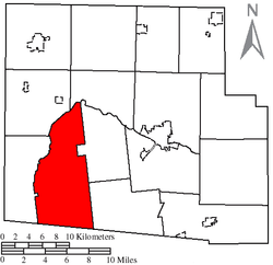 Location of McDonald Township, Hardin County, Ohio | |
| Coordinates: 40°35′13″N 83°46′7″W | |
| Country | United States |
| State | Ohio |
| County | Hardin |
| Area | |
| • Total | 42.9 sq mi (111.1 km2) |
| • Land | 42.9 sq mi (111.1 km2) |
| • Water | 0.0 sq mi (0.0 km2) |
| Elevation | 1,050 ft (320 m) |
| Population (2010) | |
| • Total | 862 |
| • Density | 20/sq mi (7.8/km2) |
| Time zone | UTC-5 (Eastern (EST)) |
| • Summer (DST) | UTC-4 (EDT) |
| FIPS code | 39-45920[2] |
| GNIS feature ID | 1086265[1] |
Geography
Located in the southwestern part of the county, it borders the following townships:
- Cessna Township - north
- Lynn Township - northeast
- Taylor Creek Township - southeast
- Richland Township, Logan County - south
- Roundhead Township - west
- Marion Township - northwest
No municipalities are located in McDonald Township.
Name and history
McDonald Township was established in the 1830s.[4] This township was named for William McDonald, an early settler.[5] It is the only McDonald Township statewide.[6]
McDonald Township is the location of the Zimmerman Kame, a burial site used by the ancient Glacial Kame Culture of Native Americans.[7]
Government
The township is governed by a three-member board of trustees, who are elected in November of odd-numbered years to a four-year term beginning on the following January 1. Two are elected in the year after the presidential election and one is elected in the year before it. There is also an elected township fiscal officer,[8] who serves a four-year term beginning on April 1 of the year after the election, which is held in November of the year before the presidential election. Vacancies in the fiscal officership or on the board of trustees are filled by the remaining trustees.
References
- "US Board on Geographic Names". United States Geological Survey. 2007-10-25. Retrieved 2008-01-31.
- "U.S. Census website". United States Census Bureau. Retrieved 2008-01-31.
- "Geographic Identifiers: 2010 Census Summary File 1 (G001): McDonald township, Hardin County, Ohio". American Factfinder. U.S. Census Bureau. Archived from the original on February 13, 2020. Retrieved December 28, 2017.
- The History of Hardin County, Ohio. Warner Beers & Company. 1883. p. 697.
- Kohler, Minnie Ichler (1910). A Twentieth Century History of Hardin County, Ohio: A Narrative Account of Its Historical Progress, Its People and Principal Interests,. Lewis Publishing Company. p. 37.
- "Detailed map of Ohio" (PDF). United States Census Bureau. 2000. Retrieved 2007-02-16.
- Drennen, Bert C., III. National Register of Historic Places Inventory/Nomination: Zimmerman Kame. National Park Service, 1974-01-22.
- §503.24, §505.01, and §507.01 of the Ohio Revised Code. Accessed 4/30/2009.
External links
Municipalities and communities of Hardin County, Ohio, United States | ||
|---|---|---|
| City | 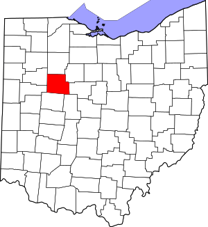 Map of Ohio highlighting Hardin County | |
| Villages | ||
| Townships | ||
| CDP | ||
| Unincorporated communities | ||
| Footnotes | ‡This populated place also has portions in an adjacent county or counties | |
| Authority control |
|
|---|