Lopburi
Lopburi (Thai: ลพบุรี, RTGS: Lop Buri, pronounced [lóp bū.rīː]) is the capital city of Lopburi Province in Thailand. It is about 150 kilometres (93 mi) northeast of Bangkok. As of 2014 it had a population of 758,406. The town (thesaban mueang) covers the whole tambon Tha Hin and parts of Thale Chup Son of Mueang Lopburi District, a total area of 6.85 km².
Lopburi ลพบุรี Lavo | |
|---|---|
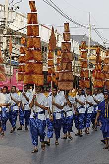
Downtown Lopburi | |
| Nickname(s): Monkey City | |
 Lopburi Location in Thailand | |
| Coordinates: 14°48′0″N 100°37′37″E | |
| Country | Thailand |
| Province | Lopburi Province |
| Amphoe | Amphoe Mueang Lopburi |
| Named for | Lava |
| Elevation | 19 m (62 ft) |
| Population (2006) | |
| • Total | 26,500 |
| Time zone | UTC+7 (ICT) |
Etymology
It was originally known as Lavo or Lavapura, meaning "city of Lava" in reference to the ancient South Asian city of Lavapuri (present-day Lahore, Pakistan).[1]
History
The city has a history dating back to the Dvaravati period more than 1,000 years ago.[2]:302,308 According to the Northern Chronicles, it was founded by King Kalavarnadish (Thai, "Phraya Kalavarnadit"), who came from Taxila (Takkasila) in north-west India (now Pakistan) in 648 CE.[3] Lopburi, or Lavapura as it then was, was under the rule of the rising Angkor regime and became one of the most important centers in the Chao Phraya Basin from then on.[4] Epigraphic evidence indicates that the dominant population of the city was Mon.[5]
The earliest confirmed occurrence of the name Lavapura is on silver coins inscribed "lava" on the obverse and "pura" on the reverse in a Pallava-derived script of the seventh or eighth century; several such coins were recovered in 1966 from a hoard found in an ancient jar in U Thong.[6][7]
Inscriptions say that Lopburi was incorporated into the administration structure of the Khmer Empire during the reign of Suryavarman I. [8] Control of Lopburi gave the Khmer Empire access to trade going through the Kra Isthmus. There is some evidence the Khmer Empire, under Suryavarman II, fought against the Mons in the 12th century over suzerainty. Lopburi sent embassies to China in 1115 and 1155.[9]:161
Lopburi (Lavo) is described in Book III of Marco Polo's Travels, where it is called Locach. This came from the Chinese (Cantonese) pronunciation of Lavo, "Lo-huk".[10] The city is referred to as "Lo-ho" in chapter 20 of the History of Yuan (元史 : Yuán Shǐ), the official history of the Mongol, or Yuan Dynasty of China. Due to a scribal error in Book III of Marco Polo's travels treating of the route southward from Champa, where the name Java was substituted for Champa as the point of departure, Java Minor was 1,300 miles to the south of Java Major, instead of from Champa, on or near an extension of the Terra Australis.[11] As explained by Sir Henry Yule, the editor of an English edition of Marco Polo's Travels: "Some geographers of the 16th century, following the old editions which carried the travellers south-east of Java to the land of Boeach (or Locac), introduced in their maps a continent in that situation".[12]
After the foundation of the Ayutthaya Kingdom in the 14th century, Lopburi was a stronghold of Ayutthaya's rulers. It became the capital of the kingdom during the reign of King Narai the Great in the mid-17th century and the king resided there about eight months a year.
 Water buffalo, Lopburi, 2300 BCE
 Ceramic, Lopburi, 2300 BCE
Archeological finds
- several flaked stone tools were discovered in Ban Mi district dated back to the Paleolithic Age in 1931.[13]
- a number of tools, human burial sites and bronze accessories belong to Iron Age were found in Lop Buri river Basin in 1964.[13]
- Bracelets and beads dated back 2700-3500 years were revealed at Ban Khok Charoen in 1966-1970.[13]
- Prehistoric human skeletons and clay jugs were found in Ban Tha Kae in 1979.[13]
- A Copper source was discovered in Khao Wong Phrachan in 1986-1994.[13]
Geography
Lopburi lies on the Lopburi River at an elevation of 20 metres (66 ft) mostly surrounded by alluvial plains, although some hills rise to between 300 metres (980 ft) and 600 metres (2,000 ft) to the north-east.
Climate
Lopburi has a tropical savanna climate (Köppen climate classification Aw). Winters are dry and very warm. Temperatures rise until April, which is very hot with the average daily maximum at 36.8 °C (98.2 °F). The monsoon season runs from late April through October, with heavy rain and somewhat cooler temperatures during the day, although nights remain warm.
| Climate data for Lop Buri (1981–2010) | |||||||||||||
|---|---|---|---|---|---|---|---|---|---|---|---|---|---|
| Month | Jan | Feb | Mar | Apr | May | Jun | Jul | Aug | Sep | Oct | Nov | Dec | Year |
| Record high °C (°F) | 38.4 (101.1) |
38.6 (101.5) |
39.4 (102.9) |
41.4 (106.5) |
40.8 (105.4) |
39.5 (103.1) |
38.3 (100.9) |
37.7 (99.9) |
36.2 (97.2) |
35.6 (96.1) |
35.8 (96.4) |
36.2 (97.2) |
41.4 (106.5) |
| Average high °C (°F) | 32.9 (91.2) |
34.6 (94.3) |
36.0 (96.8) |
36.8 (98.2) |
35.3 (95.5) |
34.3 (93.7) |
33.7 (92.7) |
33.3 (91.9) |
32.8 (91.0) |
32.5 (90.5) |
32.2 (90.0) |
31.7 (89.1) |
33.8 (92.8) |
| Daily mean °C (°F) | 26.4 (79.5) |
28.1 (82.6) |
29.5 (85.1) |
30.4 (86.7) |
29.5 (85.1) |
29.0 (84.2) |
28.6 (83.5) |
28.3 (82.9) |
28.0 (82.4) |
27.8 (82.0) |
27.1 (80.8) |
25.8 (78.4) |
28.2 (82.8) |
| Average low °C (°F) | 21.1 (70.0) |
23.2 (73.8) |
24.8 (76.6) |
25.8 (78.4) |
25.6 (78.1) |
25.2 (77.4) |
24.9 (76.8) |
24.9 (76.8) |
24.7 (76.5) |
24.3 (75.7) |
22.8 (73.0) |
20.6 (69.1) |
24.0 (75.2) |
| Record low °C (°F) | 12.0 (53.6) |
14.5 (58.1) |
16.4 (61.5) |
19.7 (67.5) |
17.9 (64.2) |
22.2 (72.0) |
21.5 (70.7) |
21.5 (70.7) |
20.5 (68.9) |
17.0 (62.6) |
13.8 (56.8) |
10.2 (50.4) |
10.2 (50.4) |
| Average rainfall mm (inches) | 5.7 (0.22) |
6.9 (0.27) |
32.1 (1.26) |
81.5 (3.21) |
147.1 (5.79) |
124.0 (4.88) |
120.1 (4.73) |
150.9 (5.94) |
265.5 (10.45) |
153.7 (6.05) |
33.1 (1.30) |
4.5 (0.18) |
1,125.1 (44.30) |
| Average rainy days | 1.1 | 1.3 | 2.7 | 6.1 | 12.9 | 12.7 | 14.2 | 16.5 | 17.6 | 13.2 | 3.4 | 0.8 | 102.5 |
| Average relative humidity (%) | 63 | 65 | 66 | 69 | 75 | 76 | 77 | 78 | 81 | 77 | 66 | 60 | 71 |
| Mean monthly sunshine hours | 263.5 | 245.8 | 238.7 | 240.0 | 155.0 | 114.0 | 117.8 | 117.8 | 108.0 | 182.9 | 219.0 | 260.4 | 2,262.9 |
| Mean daily sunshine hours | 8.5 | 8.7 | 7.7 | 8.0 | 5.0 | 3.8 | 3.8 | 3.8 | 3.6 | 5.9 | 7.3 | 8.4 | 6.2 |
| Source 1: Thai Meteorological Department[14] | |||||||||||||
| Source 2: Office of Water Management and Hydrology, Royal Irrigation Department (sun and humidity)[15] | |||||||||||||
Transportation
The main road through Lobpuri is Route 1 (Phahonyothin Road), which starts in Bangkok, and continues through Lopburi, Chai Nat, Nakhon Sawan, Kamphaeng Phet, Tak, Lampang, Chiang Rai, and the border with Burma at Mae Sai. Route 311 leads west to Sing Buri, and Route 3196 leads south-west to Ang Thong.
Lopburi is a station of the State Railway of Thailand's Northern Line, forming the end of Bangkok's suburban service. Train service from Bangkok railway station (Hua Lamphong) in Bangkok usually takes about 2 hours. The third class train costs less than $1 and is a great way to experience the local culture and the "Real Thailand".
Lopburi is served by the Khok Kathiam airport, 9 kilometres (5.6 mi) north of the town.
Culture
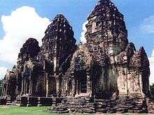
Today the city is best known for the thousands of crab-eating macaques (Macaca fascicularis) that live in the middle of the city, especially around the Khmer temple, Prang Sam Yot and a Khmer shrine, Sarn Phra Karn. It is suspected that urban expansion caused the monkeys to adapt to city life. They are fed by the local people, especially during the Monkey Festival. This festival usually occurs on the last Sunday of November. The monkeys can be aggressive, are not afraid of humans, and often steal whatever items or food they can find from unwary visitors. Most of the hotels and guesthouses in Lopburi are "monkey-proofed", using screen wire, or by screwing the windows shut.
In the city signs are posted reading:
To prevent monkeys attacking people, the officer will feed monkeys in 3 designated areas outside San Phrakan twice a day, at 10am and 4pm. Those who want to feed monkeys other than these times, please contact the officer or caretaker
During the 2020 COVID-19 pandemic, lack of tourists prompted hungry monkeys to harass local residents.[16]
Religion
Prang Sam Yot, originally a Hindu shrine, has three prangs (Pagoda: The Cambodian art in Cambodia has directly influenced the construction of the pagoda in Ayutthaya art.) that represent Brahma, Vishnu, and Shiva (the Hindu trinity). It was later converted to a Buddhist shrine.
References
- Phanindra Nath Bose, The Indian colony of Siam, Lahore, The Punjab Sanskrit Book Depot, 1927, p.v.
- Higham, C., 2014, Early Mainland south-east Asia, Bangkok: River Books Co., Ltd., ISBN 9786167339443
- Adhir Chakravarti, “International Trade and Towns of Ancient Siam”, Our Heritage: Bulletin of the Department of Post-graduate Training and Research, Sanskrit College, Calcutta, vol.XXIX, part I, January–June 1981, pp1-23, nb p.15; also in The South East Asian Review (Gaya, India), vol. 20, nos.1 & 2, 1995. Hiram W. Woodward, "Thailand and Cambodia: The Thirteenth and Fourteenth Centuries", in Khaisri Sri-Aroon, M.C. Subhadradis Diskul, Studies & Reflections on Asian Art History and Archaeology: Essays in Honour of H.S.H Professor Subhadradis Diskul, Bangkok, Silpakorn University, 1996, pp.335-350.
- Dhida Saraya, "Lavo — A Coastal State of the 11th Century", Muang Boran, vol.11, no.2, 1985, pp.35-51.
- Peter Skilling, "Dvaravati: Recent Revelations and Research", in Dedications to Her Royal Highness Princes Galyani Vadhana Krom Luang Naradhiwas Rajanagarindra on her 80th birthday, Bangkok, The Siam Society, 2003, pages 87–112, p.105; Pan Hla Nai, The Significant Role of the Mon Language and Culture in south-east Asia, Tokyo, Institute for the Study of Languages and Cultures of Asia and Africa, 1992; Pierre Dupont, The Archaeology of the Mons of Dvāravatī, translated by Joyanto K.Sen, Bangkok, White Lotus Press, 2006, pp.1, 3, 10.
- Boeles, J.J. "A Note on the Ancient City Called Lavapura" (PDF). Siamese Heritage. Siamese Heritage Trust. Retrieved 2014-11-19.
- Robert S. Wicks, Money, Markets, and Trade in Early south-east Asia: The Development of Indigenous Monetary Systems to AD 1400, SEAP Publications, 1992, pp.165-166.7-8th century Lavapura coin
- Hall, Kenneth R. “Khmer Commercial Development and Foreign Contacts under Sūryavarman I.” Journal of the Economic and Social History of the Orient, vol. 18, no. 3, 1975, pp. 318–336. JSTOR, www.jstor.org/stable/3632140. Accessed 3 June 2020.
- Coedès, George (1968). Walter F. Vella (ed.). The Indianized States of south-east Asia. trans.Susan Brown Cowing. University of Hawaii Press. ISBN 978-0-8248-0368-1.
- Paul Pelliot, Notes on Marco Polo, Paris, Imprimerie Nationale, 1963, Vol.II, pp.768-9, note 2.
- Paul Pelliot, Notes on Marco Polo, Paris, Imprimerie Nationale, 1963, Vol.II, p.769; James R. McClymont, "The Theory of an Antipodal Southern Continent during the Sixteenth Century", Report of the Fourth Meeting of the Australasian Association for the Advancement of Science, Hobart, January 1892, Hobart, the Association, 1893, pp.442-462.
- Yule, Sir Henry, ed. (1921). The Book of Ser Marco Polo. London: Murray. pp. 276–280.
- "Past lives". https://www.bangkokpost.com. Bangkok Post. External link in
|website=(help) - "Climatological Data for the Period 1981–2010". Thai Meteorological Department. p. 15. Retrieved 4 August 2016.
- "ปริมาณการใช้น้ำของพืชอ้างอิงโดยวิธีของ Penman Monteith (Reference Crop Evapotranspiration by Penman Monteith)" (PDF) (in Thai). Office of Water Management and Hydrology, Royal Irrigation Department. p. 75. Retrieved 4 August 2016.
- "Macaque attack: humans try to take back Thai city from monkeys". France 24. June 24, 2020.
