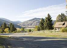
Loomis, Washington
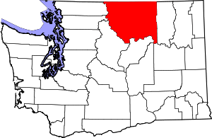
Loomis is a census-designated place (CDP) in Okanogan County, Washington, United States.[1] The population was 159 at the 2010 Census. Its area is 0.85 square miles (2.2 km2), which is all land and no water area.[2]

History
A post office called Loomis has been in operation since 1889.[3] The community was named after J. A. Loomis, a local storekeeper.[4]
On November 3, 1901, J.M. Haggerty was tarred and feathered in Loomis. He made comments to The Spokesman-Review about the lack of success of the Palmer Mountain Tunnel Company. The comments were resented and a mob was waiting for him when he stepped off the stage. During an impromptu mass meeting, "Suddenly a dozen men grabbed Haggerty, and before half the crowd knew what was happening a bucket of tar and pillows were produced." After half an hour of being paraded through the street covered in tar and feathers, he was released.[5]
Climate
North Star Ranch
According to the Köppen climate classification system, North Star Ranch has a Cold semi-arid climate (BSk) with warm summers and cold winters. Dew points (how humid it feels) are typically very dry even during the summer months. Because of this, summer heat index values are often a few degrees lower than the ambient air temperature. Since 1981, the highest air temperature was 99.6 °F (37.6 °C) on 07/23/2006, and the highest daily average mean dew point was 57.0 °F (13.9 °C) on 06/29/2013. Severe thunderstorms are very rare. December is the average wettest month of the year which correlates with the peak frequency of storms crossing the area via the Pacific Ocean. Since 1981, the wettest calendar day was 1.60 inches (41 mm) on 05/26/1998. During the winter months, the plant hardiness zone is 5b with an average annual extreme minimum air temperature of −12.9 °F (−24.9 °C).[6] Since 1981, the coldest air temperature was −17.1 °F (−27.3 °C) on 12/29/1990. Episodes of extreme cold and wind can occur with wind chill values < −26 °F (−32 °C). North Star Ranch averages ≈ 24 inches (61 cm) of snow per cool season.
| Climate data for North Star Ranch, Elevation 3,648 ft (1,112 m), 1981-2010 normals, extremes 1981-2018 | |||||||||||||
|---|---|---|---|---|---|---|---|---|---|---|---|---|---|
| Month | Jan | Feb | Mar | Apr | May | Jun | Jul | Aug | Sep | Oct | Nov | Dec | Year |
| Record high °F (°C) | 52.7 (11.5) |
54.8 (12.7) |
67.8 (19.9) |
80.0 (26.7) |
93.8 (34.3) |
98.8 (37.1) |
99.6 (37.6) |
97.5 (36.4) |
93.5 (34.2) |
79.5 (26.4) |
59.9 (15.5) |
48.9 (9.4) |
99.6 (37.6) |
| Average high °F (°C) | 32.2 (0.1) |
36.5 (2.5) |
43.6 (6.4) |
52.7 (11.5) |
61.3 (16.3) |
68.0 (20.0) |
76.3 (24.6) |
76.3 (24.6) |
67.4 (19.7) |
52.4 (11.3) |
37.7 (3.2) |
29.7 (−1.3) |
52.9 (11.6) |
| Daily mean °F (°C) | 26.2 (−3.2) |
29.4 (−1.4) |
35.1 (1.7) |
42.7 (5.9) |
50.6 (10.3) |
57.2 (14.0) |
64.7 (18.2) |
64.9 (18.3) |
56.8 (13.8) |
44.1 (6.7) |
31.8 (−0.1) |
23.9 (−4.5) |
44.0 (6.7) |
| Average low °F (°C) | 20.2 (−6.6) |
22.3 (−5.4) |
26.6 (−3.0) |
32.8 (0.4) |
39.9 (4.4) |
46.3 (7.9) |
53.1 (11.7) |
53.4 (11.9) |
46.2 (7.9) |
35.9 (2.2) |
26.0 (−3.3) |
18.1 (−7.7) |
35.1 (1.7) |
| Record low °F (°C) | −12.8 (−24.9) |
−13.4 (−25.2) |
2.3 (−16.5) |
19.6 (−6.9) |
27.8 (−2.3) |
34.5 (1.4) |
38.5 (3.6) |
37.0 (2.8) |
30.5 (−0.8) |
9.8 (−12.3) |
−8.9 (−22.7) |
−17.1 (−27.3) |
−17.1 (−27.3) |
| Average precipitation inches (mm) | 1.64 (42) |
1.57 (40) |
1.37 (35) |
1.18 (30) |
1.60 (41) |
1.91 (49) |
1.27 (32) |
0.82 (21) |
0.64 (16) |
1.12 (28) |
1.95 (50) |
2.10 (53) |
17.17 (436) |
| Average relative humidity (%) | 77.7 | 68.7 | 63.3 | 55.6 | 53.9 | 52.5 | 42.9 | 40.8 | 45.4 | 59.3 | 76.0 | 78.5 | 59.5 |
| Average dew point °F (°C) | 20.2 (−6.6) |
20.4 (−6.4) |
23.9 (−4.5) |
27.9 (−2.3) |
34.5 (1.4) |
40.0 (4.4) |
41.6 (5.3) |
40.5 (4.7) |
35.9 (2.2) |
30.8 (−0.7) |
25.1 (−3.8) |
18.2 (−7.7) |
30.0 (−1.1) |
| Source: PRISM[7] | |||||||||||||
Loomis
According to the Köppen climate classification system, Loomis has a Cold semi-arid climate (BSk) with warm summers and cold winters. Dew points (how humid it feels) are typically very dry even during the summer months. Because of this, summer heat index values are often a few degrees lower than the ambient air temperature. Since 1981, the highest air temperature was 101.2 °F (38.4 °C) on 07/23/2006, and the highest daily average mean dew point was 57.6 °F (14.2 °C) on 06/29/2013. Severe thunderstorms are very rare. December is the average wettest month of the year which correlates with the peak frequency of storms crossing the area via the Pacific Ocean. Since 1981, the wettest calendar day was 1.56 inches (40 mm) on 05/26/1998. During the winter months, the plant hardiness zone is 6b with an average annual extreme minimum air temperature of −1.9 °F (−18.8 °C).[6] Since 1981, the coldest air temperature was −17.4 °F (−27.4 °C) on 12/29/1990. Episodes of extreme cold and wind can occur with wind chill values < −13 °F (−25 °C). Loomis averages 12 inches (30 cm) to 18 inches (457 mm) of snow per cool season.
| Climate data for Loomis, Elevation 1,378 ft (420 m), 1981-2010 normals, extremes 1981-2018 | |||||||||||||
|---|---|---|---|---|---|---|---|---|---|---|---|---|---|
| Month | Jan | Feb | Mar | Apr | May | Jun | Jul | Aug | Sep | Oct | Nov | Dec | Year |
| Record high °F (°C) | 52.7 (11.5) |
55.4 (13.0) |
69.0 (20.6) |
81.7 (27.6) |
95.6 (35.3) |
100.5 (38.1) |
101.2 (38.4) |
98.9 (37.2) |
94.9 (34.9) |
80.5 (26.9) |
61.4 (16.3) |
50.3 (10.2) |
101.2 (38.4) |
| Average high °F (°C) | 33.7 (0.9) |
40.5 (4.7) |
52.4 (11.3) |
62.4 (16.9) |
71.1 (21.7) |
77.9 (25.5) |
85.7 (29.8) |
85.4 (29.7) |
75.3 (24.1) |
59.9 (15.5) |
43.0 (6.1) |
32.4 (0.2) |
60.1 (15.6) |
| Daily mean °F (°C) | 28.0 (−2.2) |
32.5 (0.3) |
41.6 (5.3) |
49.7 (9.8) |
57.7 (14.3) |
64.5 (18.1) |
70.9 (21.6) |
70.3 (21.3) |
61.1 (16.2) |
48.5 (9.2) |
36.0 (2.2) |
27.0 (−2.8) |
49.1 (9.5) |
| Average low °F (°C) | 22.3 (−5.4) |
24.4 (−4.2) |
30.8 (−0.7) |
37.0 (2.8) |
44.3 (6.8) |
51.2 (10.7) |
56.1 (13.4) |
55.3 (12.9) |
46.9 (8.3) |
37.0 (2.8) |
28.9 (−1.7) |
21.6 (−5.8) |
38.1 (3.4) |
| Record low °F (°C) | −13.2 (−25.1) |
−12.5 (−24.7) |
1.9 (−16.7) |
20.2 (−6.6) |
28.4 (−2.0) |
35.3 (1.8) |
38.7 (3.7) |
37.9 (3.3) |
30.3 (−0.9) |
10.3 (−12.1) |
−9.3 (−22.9) |
−17.4 (−27.4) |
−17.4 (−27.4) |
| Average precipitation inches (mm) | 1.20 (30) |
0.88 (22) |
0.92 (23) |
0.81 (21) |
1.20 (30) |
1.42 (36) |
0.91 (23) |
0.64 (16) |
0.47 (12) |
0.80 (20) |
1.29 (33) |
1.43 (36) |
11.97 (304) |
| Average relative humidity (%) | 81.9 | 72.7 | 59.2 | 50.6 | 49.1 | 48.0 | 42.1 | 41.2 | 46.6 | 58.7 | 77.0 | 85.7 | 59.3 |
| Average dew point °F (°C) | 23.2 (−4.9) |
24.7 (−4.1) |
28.4 (−2.0) |
32.1 (0.1) |
38.7 (3.7) |
44.4 (6.9) |
46.7 (8.2) |
45.6 (7.6) |
40.5 (4.7) |
34.7 (1.5) |
29.5 (−1.4) |
23.3 (−4.8) |
34.4 (1.3) |
| Source: PRISM[7] | |||||||||||||
See also
References
- "Loomis". Geographic Names Information System. United States Geological Survey.
- "G001: Geographic Identifiers: 2010 Census Summary File 1: Loomis CDP, Washington". American FactFinder. U.S. Census Bureau. Archived from the original on 2020-02-12.
- "Post Offices". Jim Forte Postal History. Retrieved 14 August 2016.
- Meany, Edmond S. (1923). Origin of Washington geographic names. Seattle: University of Washington Press. p. 150.
- "Mob Uses Tar and Feathers: People of Loomis, Washington, Discipline J. M. Haggerty", The New York Times, November 3, 1901.
- "USDA Interactive Plant Hardiness Map". United States Department of Agriculture. Retrieved September 18, 2019.
- "PRISM Climate Group, Oregon State University". Retrieved September 18, 2019.
Radio
- John H. Lienhard (1998). "'Small Towns'". The Engines of Our Ingenuity. Episode 1353. NPR. KUHF-FM Houston. Transcript.
