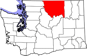
Nighthawk, Washington
Nighthawk is an unincorporated community on the Similkameen River in Okanogan County, Washington, United States of America. It was named for a nearby (and now-closed) mine.[1]

Desciption
Nighthawk is a (mostly former) logging area along Loomis-Oroville Highway west-northwest of Oroville, Washington. Nighthawk also features a 9am-5pm Canada–US border crossing and is located along the Burlington Northern Railroad. The town of Nighthawk used to be a booming mine town at the turn of the 20th century with hotels and a burlesque house, but now only has a population of about five people.
The Nighthawk-Chopaka Border Crossing is usually known as "the Nighthawk crossing" on the Canadian side, though the official name of the Canadian-side locality is Chopaka.
Climate
| Climate data for Osoyoos West, BC 1981-2010 (metric units) about 14 km NE of Nighthawk | |||||||||||||
| Jan | Feb | Mar | Apr | May | Jun | Jul | Aug | Sep | Oct | Nov | Dec | Year | |
| Average high °C | 2.0 | 5.9 | 12.5 | 17.9 | 22.1 | 25.7 | 29.4 | 29.1 | 23.8 | 15.8 | 7.1 | 1.6 | 16.1 |
| Average mean °C | -0.7 | 1.6 | 6.6 | 11.1 | 15.2 | 18.7 | 21.9 | 21.4 | 16.5 | 10.0 | 3.7 | -0.9 | 10.4 |
| Average low °C | -3.4 | -2.7 | 0.5 | 4.2 | 8.2 | 11.7 | 14.2 | 13.6 | 9.0 | 4.2 | 0.3 | -3.4 | 4.7 |
| Precipitation (cm) | 2.88 | 2.23 | 2.40 | 2.42 | 3.71 | 4.17 | 2.46 | 1.73 | 1.49 | 1.86 | 3.38 | 3.58 | 32.32 |
| Snowfall (cm) | 14.6 | 4.6 | 1.7 | 0.1 | 0.0 | 0.0 | 0.0 | 0.0 | 0.0 | 0.1 | 5.7 | 17.0 | 43.8 |
| Source: Environment Canada http://climate.weather.gc.ca/climate_normals/results_1981_2010_e.html?stnID=1043&autofwd=1 | |||||||||||||
| Climate data for Osoyoos West, BC 1981-2010 (English units) about 9 miles NE of Nighthawk | |||||||||||||
| Jan | Feb | Mar | Apr | May | Jun | Jul | Aug | Sep | Oct | Nov | Dec | Year | |
| Average high °F | 35.6 | 42.6 | 54.5 | 64.2 | 71.8 | 78.3 | 84.9 | 84.4 | 74.8 | 60.4 | 44.8 | 34.9 | 61.0 |
| Average mean °F | 30.7 | 34.9 | 43.9 | 52.0 | 59.4 | 65.7 | 71.4 | 70.5 | 61.7 | 50.0 | 38.7 | 30.4 | 50.7 |
| Average low °F | 25.9 | 27.1 | 32.9 | 39.6 | 46.8 | 53.1 | 57.6 | 56.5 | 48.2 | 39.6 | 32.5 | 25.9 | 40.5 |
| Precipitation (in) | 1.13 | 0.88 | 0.94 | 0.95 | 1.46 | 1.64 | 0.97 | 0.68 | 0.59 | 0.73 | 1.33 | 1.41 | 12.72 |
| Snowfall (in) | 5.7 | 1.8 | 0.7 | 0.0 | 0.0 | 0.0 | 0.0 | 0.0 | 0.0 | 0.0 | 2.2 | 6.7 | 17.2 |
| Source: Environment Canada http://climate.weather.gc.ca/climate_normals/results_1981_2010_e.html?stnID=1043&autofwd=1 | |||||||||||||
References
- Majors, Harry M. (1975). Exploring Washington. Van Winkle Publishing Co. p. 51. ISBN 978-0-918664-00-6.
- U.S. Geological Survey Geographic Names Information System: Nighthawk, Washington
- U.S. Geological Survey Geographic Names Information System: Nighthawk Customs
