List of State Register of Heritage Places in the Shire of Mundaring
This is a list of State Register of Heritage Places in the Shire of Mundaring, Western Australia. The State Register of Heritage Places is maintained by the Heritage Council of Western Australia.
As of 2020, 143 places are heritage-listed in the Shire of Mundaring,[1] of which 24 are on the State Register of Heritage Places.[2]
List
The Western Australian State Register of Heritage Places, as of 2020, lists the following 24 state registered places within the Shire of Mundaring:
| Place name | Place # | Location | Suburb or town | Co-ordinates | Built | Stateregistered | Notes | Photo |
|---|---|---|---|---|---|---|---|---|
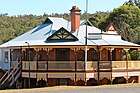
| Belle View | 3836 | 1100 Katharine Street | Bellevue | 31°54′14″S 116°01′31″E | 1887 | 2 June 1998 |
|
|
| Government Quarries (former) | 16788 | Hudman Road | Boya | 31°55′24″S 116°04′03″E | 1901 | 7 September 2006 |
|
 |
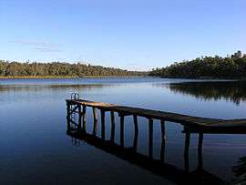
| Lake Leschenaultia | 8568 | 2135 Rosedale Road | Chidlow | 31°51′15″S 116°15′02″E | 1898 | 3 June 2005 |
|
 |
| Holmesdale | 1688 | Darlington Road | Darlington | 31°54′49″S 116°04′21″E | 1890 | 22 November 2005 |
|
|
| St Cuthbert's Anglican Church | 1685 | Corner Hillsden & Darlington Road | Darlington | 31°54′57″S 116°04′31″E | 1925 | 3 June 2005 |
|
 |
| Leithdale | 8554 | 5-7 Lukin Avenue | Darlington | 31°55′27″S 116°05′05″E | 1898 | 17 February 2006 |
|
|
| Glen Forrest Hall | 1691 | 52 McGlew Road | Glen Forrest | 31°54′35″S 116°05′59″E | 1897 | 14 December 2001 |
|
 |
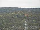
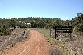
| John Forrest National Park | 8561 | Great Eastern Highway | Greenmount | 31°52′55″S 116°04′26″E | 1900 | 17 December 2004 |
|
 |
| Blackboy Hill Memorial | 4479 | Innamincka Road | Greenmount | 31°53′49″S 116°02′44″E | 1914 | 31 March 2006 |
|
 |
| Katharine Susannah Prichard's House | 1681 | 11 Old York Road | Greenmount | 31°53′58″S 116°03′15″E | 1896 | 28 February 1995 |
|
|
| Clayton Farm | 3839 | Clayton Road | Helena Valley | 31°55′05″S 116°02′29″E | 1861 | 14 March 2008 |
|
|
| Eastern Railway - Three Bridges | 2663 | Lot 10159 Great Eastern Highway | Hovea | 31°52′48″S 116°06′02″E | 1882 | 24 July 1992 |
|
|
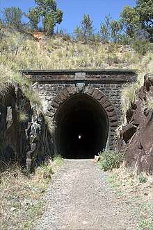
| Eastern Railway Deviation | 2660 | Lot 10159 Great Eastern Highway | Hovea | 31°52′56″S 116°04′16″E | 1894 | 14 February 2002 |
|
 |
| Mahogany Inn | 1693 | 4260 Great Eastern Highway | Mahogany Creek | 31°54′03″S 116°08′06″E | 1854 | 9 September 2003 |
|
 |
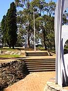
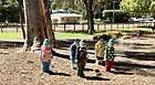
| Mundaring Sculpture Park | 8577 | Jacoby Street | Mundaring | 31°54′16″S 116°09′57″E | 1898 | 28 November 2003 |
|
 |
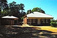
| Mundaring Station Master's House | 8531 | Jacoby Street | Mundaring | 31°54′14″S 116°09′55″E | 1902 |
|
 | |
| Faversham | 4546 | 2075 Jacoby Street | Mundaring | 31°54′18″S 116°09′17″E | 1911 | 7 September 2007 |
|
|
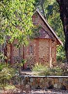
| Mundaring Weir Hotel | 1675 | Lot 502 Hall Road | Mundaring Weir | 31°57′08″S 116°10′01″E | 1898 | 20 April 2004 |
|
 |
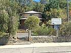
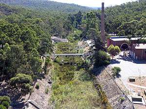
| No 1 Pumping Station Museum | 1677 | Mundaring Weir Road | Mundaring Weir | 31°57′21″S 116°09′47″E | 1902 | 4 May 2001 |
|
 |
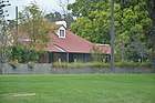
| Mundaring Weir Hall | 1676 | Weir Village Road | Mundaring Weir | 31°57′07″S 116°10′04″E | 1908 | 22 January 2002 |
|
|
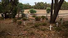
| Parkerville Children's Home & Cemetery | 8546 | Corner Roland & Beacon Roads, nearr corner Wilson Road | Parkerville | 31°52′23″S 116°08′15″E | 1903 | 24 November 2000 |
|
 |
| Hillston Boys Farm (former) | 4038 | 900 Woodlands Road | Stoneville | 31°51′20″S 116°09′40″E | 1955 | 1 October 1999 |
|
|
| Wooroloo Sanatorium (former) | 8566 | Linley Valley Road | Wooroloo | 31°48′33″S 116°19′40″E | 1915 | 30 August 2002 |
|
|
| Wooroloo Cemetery | 8571 | Off Linley Valley Road | Wooroloo | 31°48′33″S 116°19′40″E | 1906 | 30 August 2002 |
|
gollark: Was it submitted in the last year ⇒ No.Was it submitted in the last century ⇒ No.Was it submitted ⇒ No.A more accurate version.
gollark: Ah, clever.
gollark: Ah, of course he has not.
gollark: CCTweaked has it, luckiyl.
gollark: That reminds me, I should check if Dan merged my one line fix to the repeater crash.
References
- "Shire of Mundaring Heritage Places". inherit.stateheritage.wa.gov.au. Heritage Council of Western Australia. Retrieved 2 April 2020.
- "Shire of Mundaring State Register of Heritage Places". inherit.stateheritage.wa.gov.au. Heritage Council of Western Australia. Retrieved 2 April 2020.
This article is issued from Wikipedia. The text is licensed under Creative Commons - Attribution - Sharealike. Additional terms may apply for the media files.