Commonwealth Heritage List in Western Australia
This is a list of places on the Commonwealth Heritage List in Western Australia. The Commonwealth Heritage List is a heritage register which lists places of historic, cultural and natural heritage on Commonwealth land or in Commonwealth waters, or owned or managed by the Commonwealth Government. To be listed, a place has to meet one or more of the nine Commonwealth Heritage List criteria.[1]
List
Currently listed places
Listed are all 19 places in Western Australia that are currently on the Commonwealth Heritage List in the state as of 2020:[2]


Formerly listed places
Listed are all three places in Western Australia that were formerly on the Commonwealth Heritage List in the state as of 2020:[3]
| Place name | Place ID | Class | Address | Suburb or town | Coordinates | Notes | Photo |
|---|---|---|---|---|---|---|---|
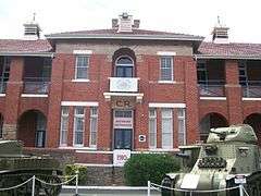
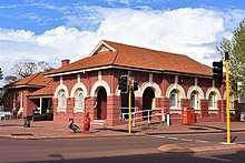
| ABC Regional Radio Studio | 106083 | Historic | 58 Tudhoe Street | Wagin | 33.3089°S 117.3438°E | The ABC Regional Radio Studio in Wagin was listed on the Commonwealth Heritage List in 2011 but its closure was announced in November 2014.[4]The Studio was the only Western Australian place removed from the Commonwealth Heritage List in 2018, along with eleven other places outside the state.[5] | |
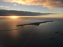
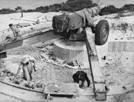
| Bushmead Rifle Range Commonwealth Area | 105549 | Natural | Midland Road | Helena Valley | 31.9237°S 116.0206°E | Sold by the Commonwealth, became the new suburb of Bushmead in 2017.[6][7] | |
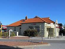
| Kalgoorlie Post Office | 105540 | Historic | 204 Hannan Street | Kalgoorlie | 30.7465°S 121.4731°E | Removed from the Commonwealth Heritage List on 17 September 2015[8] | 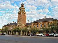 |
gollark: Make Minecraft (or at least redstone) in OpenGL compute shaders somehow, implement a computer in that, and then implement OpenGL on there, to obliterate THREE birds at once.
gollark: Or you could make a Verilog to Minecraft compiler.
gollark: 3: learn OpenGL in order to reimplement a voxel game capable of executing CPUs.
gollark: It's probably palaiologos' fault somehow.
gollark: Yes, it did complete eventually.
References
- "Commonwealth Heritage List criteria". environment.gov.au. Department of Agriculture, Water and the Environment. Retrieved 29 April 2020.
- "Search Results for Western Australia". environment.gov.au. Department of Agriculture, Water and the Environment. Retrieved 29 April 2020.
- "Search Results for current, former and proposed Commonwealth Heritage List places in Western Australia". environment.gov.au. Department of Agriculture, Water and the Environment. Retrieved 1 May 2020.
- Papas, Chloe (8 December 2014). "A look back at the ABC studio in Wagin". ABC Great Southern. Retrieved 1 May 2020.
- "Removing Places from the Commonwealth Heritage List 2018". legislation.gov.au. Australian Government. Retrieved 1 May 2020.
- "Bushmead hits a high note with accreditation". The West Australian. 30 May 2017. Retrieved 1 May 2020.
- Allan-Petale, David (21 June 2017). "Perth's newest suburb turns an old rifle range into a 'treechange' community". WAtoday. Retrieved 1 May 2020.
- "Government Buildings, Kalgoorlie". inherit.stateheritage.wa.gov.au. Heritage Council of Western Australia. Retrieved 1 May 2020.
This article is issued from Wikipedia. The text is licensed under Creative Commons - Attribution - Sharealike. Additional terms may apply for the media files.