List of Maine state parks
This list includes state parks, public reserved lands, and state historic sites in the U.S. state of Maine. They are operated by the Maine Department of Conservation, with the exceptions of Baxter State Park, which is operated by the Baxter State Park Authority, and Peacock Beach, which is under local management.
State parks
State historic sites
| Name | County | Town | Area[1] | Image | Remarks | |
|---|---|---|---|---|---|---|
| acres | ha | |||||
| Bible Point | Aroostook | 27 | 11 | Campsite of the young Teddy Roosevelt on Mattawamkeag Lake | ||
| Colburn House State Historic Site | Kennebec | Pittston | 6 | 2.4 | Home of patriot and shipbuilder Reuben Colburn | |
| Colonial Pemaquid State Historic Site | Lincoln | Bristol | 19 | 7.7 | 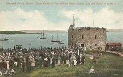 |
Site of colonial settlement dating from the early 1600s |
| Eagle Island State Historic Site | Cumberland | Harpswell | 17 | 6.9 | 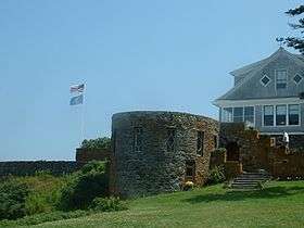 |
Casco Bay home of explorer Admiral Robert Peary |
| Fort Baldwin State Historic Site | Sagadahoc | Phippsburg | 10 | 4.0 | 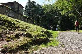 |
Early 20th-century coastal defense fortification near the mouth of the Kennebec River |
| Fort Edgecomb State Historic Site | Lincoln | Edgecomb | 3 | 1.2 | 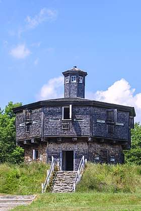 |
Two-story, octagonal wooden blockhouse on Davis Island |
| Fort Halifax State Historic Site | Kennebec | Winslow | 0.75 | 0.30 | .jpg) |
British colonial outpost on the Sebasticook River |
| Fort Kent State Historic Site | Aroostook | Fort Kent | 3 | 1.2 | .jpg) |
Fortification built during the Aroostook War at the confluence of the Fish and Saint John rivers |
| Fort Knox State Historic Site | Waldo | Prospect | 124 | 50 | Nineteenth-century coastal fortification on the Penobscot River | |
| Fort McClary State Historic Site | York | Kittery Point | 27 | 11 | 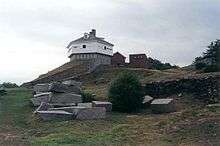 |
Nineteenth-century coastal fortification at the mouth of the Piscataqua River |
| Fort O'Brien State Historic Site | Washington | Machiasport | 2 | 0.81 | 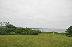 |
Site of fortification on the Machias River destroyed during both the American Revolutionary War and the War of 1812 |
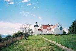
| Fort Popham State Historic Site | Sagadahoc | Phippsburg | 4 | 1.6 | 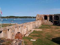 |
Civil War-era coastal fortification at the mouth of the Kennebec River |
| Fort Pownall | Waldo | Stockton Springs | 3 | 1.2 | 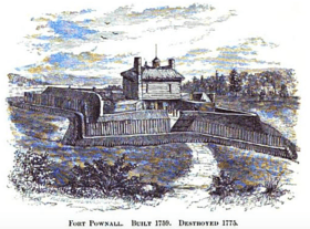 |
In Fort Point State Park |
| John Paul Jones State Historic Site | York | Kittery | 2 | 0.81 | Site of the Maine Sailors' and Soldiers' Memorial by Bashka Paeff | |
| Katahdin Iron Works | Piscataquis | T6R9 | 23 | 9.3 | Site of an ironworks in operation from 1845 to 1890 | |
| Storer Garrison State Historic Site | York | Wells | 0 | 0 | A plaque commemorating the site of the Storer Garrison | |
| Whaleback Shell Midden | Lincoln | Damariscotta | 11 | 4.5 | Oyster shell midden on the Damariscotta River | |
Public reserved lands
| Name | County | Town | Area[1] | Estab- lished |
River / lake / other |
Image | Remarks | |
|---|---|---|---|---|---|---|---|---|
| acres | ha | |||||||
| Bald Mountain | Franklin | 1,873 | 758 | |||||
| Bigelow Preserve | Franklin, Somerset | 35,000 | 14,000 | |||||
| Bradley | Penobscot | 9,113 | 3,688 | |||||
| Chains of Ponds | Franklin | 1,119 | 453 | |||||
| Chamberlain Lake | Piscataquis | 10,290 | 4,160 | |||||
| Cutler Coast | Washington | 12,238 | 4,953 | |||||
| Day's Academy | Piscataquis | 7,309 | 2,958 | |||||
| Dead River | Somerset | 7,031 | 2,845 | |||||
| Deboullie | Aroostook | 21,871 | 8,851 | |||||
| Dodge Point | Lincoln | 548 | 222 | |||||
| Donnell Pond | Hancock | 15,391 | 6,229 | |||||
| Duck Lake | Hancock, Washington | 25,220 | 10,210 | |||||
| Eagle Lake | Aroostook | 24,416 | 9,881 | |||||
| Four Ponds | Franklin | 6,018 | 2,435 | |||||
| Gero Island | Piscataquis | 4,051 | 1,639 | |||||
| Great Heath | Washington | 6,207 | 2,512 | |||||
| Holeb | Somerset | 20,155 | 8,156 | |||||
| Kennebec Highlands | Franklin, Kennebec | 6,076 | 2,459 | |||||
| Little Moose | Piscataquis | 15,055 | 6,093 | |||||
| Machias River Corridor | Washington | 10,026 | 4,057 | |||||
| Mahoosuc | Oxford | 31,807 | 12,872 | |||||
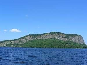
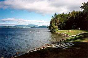
| Moosehead Lake | Piscataquis | 14,500 | 5,900 |  |
||||
| Mount Abram | Franklin | 6,214 | 2,515 | |||||
| Nahmakanta | Piscataquis | 43,966 | 17,792 | |||||
| Pineland | Cumberland | 646 | 261 | |||||
| Richardson | Oxford | 22,728 | 9,198 | |||||
| Rocky Lake | Washington | 11,150 | 4,510 | |||||
| Round Pond | Aroostook | 20,349 | 8,235 | |||||
| Salmon Brook Lake Bog | Aroostook | 1,857 | 752 | |||||
| Scraggly Lake | Penobscot | 9,092 | 3,679 | |||||
| Scopan | Aroostook | 20,135 | 8,148 | |||||
| Seboeis Unit | Penobscot, Piscataquis | 21,369 | 8,648 | |||||
| Seboomook | Somerset | 41,500 | 16,800 | |||||
| Telos | Aroostook | 22,962 | 9,292 | |||||
| Tumbledown | Franklin | 10,555 | 4,271 | 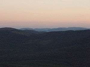 |
||||
| Wassataquoik | Penobscot | 2,099 | 849 | |||||
gollark: It has to be pink, obvioußly.
gollark: Again,```css* { color: pink !important;}```
gollark: Just add```css* { color: pink;}```
gollark: No.
gollark: bright pink > blurple
See also
- List of U.S. national parks
- Maine Wildlife Management Areas (WMA)
References
- "Outdoors in Maine: State Parks, Public Lands, and Historic Sites" (PDF). Department of Agriculture, Conservation and Forestry. September 2016. Retrieved August 11, 2017.
External links
This article is issued from Wikipedia. The text is licensed under Creative Commons - Attribution - Sharealike. Additional terms may apply for the media files.


.jpg)
