List of Idaho state parks
This is a list of Idaho state parks managed by the Idaho Department of Parks and Recreation.
Hold cursor over locations to display park name; click to go to park article.
State parks and trails
| Name | County | Size[1] (acreage or length) |
Elevation[1] (range, when available) |
Estab- lished[2] |
Image | Remarks[1] | ||
|---|---|---|---|---|---|---|---|---|
| Ashton to Tetonia Trail | Fremont, Teton | 29.6 mi | 47.6 km | 5,277–6,064 ft | 1,608–1,848 m | 2010 | Follows the abandoned railroad grade of the Teton Valley Branch of the Union Pacific Railroad. | |
| Bear Lake State Park | Bear Lake | 966 acres | 391 ha | 5,900 ft | 1,800 m | 1969 | Comprises two properties on the shore of Bear Lake. | |
| Bruneau Dunes State Park | Owyhee | 4,800 acres | 1,900 ha | 2,470 ft | 750 m | 1967 | 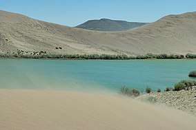 | Showcases dunes rising up to 470 feet (140 m) above several small lakes. |
| Castle Rocks State Park | Cassia | 1,692 acres | 685 ha | 5,620 ft | 1,710 m | 2003 |  | Features granite spires and an early-20th century ranch at the base of Cache Peak. |
| City of Rocks National Reserve | Cassia | 14,407 acres | 5,830 ha | 5,720 ft | 1,740 m | 1988 | Showcases granite spires and monoliths popular for rock climbing. | |
| Coeur d'Alene Parkway State Park | Kootenai | 5.7 mi | 9.2 km | 2,187 ft | 667 m | Provides a walking and bicycling path along the north shore of Lake Coeur d'Alene, as the east end of the North Idaho Centennial Trail. | ||
| Dworshak State Park | Clearwater | 850 acres | 340 ha | 1,600 ft | 490 m | 1989 | 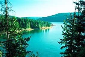 | Comprises three properties on the shore of the reservoir created by the Dworshak Dam. |
| Eagle Island State Park | Ada | 545 acres | 221 ha | 2,724 ft | 830 m | 1983 | 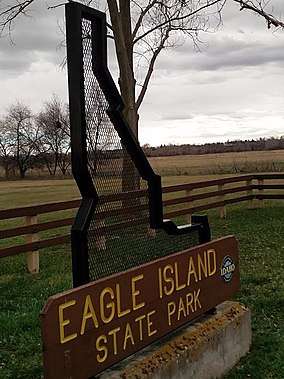 | Features day-use recreational facilities, including a swimming beach and water slide, near Boise. |
| Farragut State Park | Kootenai | 4,000 acres | 1,600 ha | 2,054 ft | 626 m | 1966 | .jpg) | Features recreational facilities on Lake Pend Oreille at the site of a former U.S. Navy training base. |
| Harriman State Park | Fremont | 11,000 acres | 4,500 ha | 6,120 ft | 1,870 m | 1977 | Preserves expansive wildlife habitat, a historic ranch, and fly fishing in Henrys Fork within the Greater Yellowstone Ecosystem. | |
| Hells Gate State Park | Idaho | 960 acres | 390 ha | 733 ft | 223 m | 1973 | 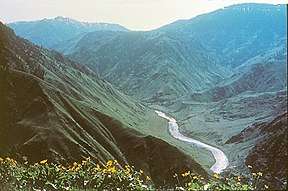 | Contains the mouth of Hells Canyon, the deepest canyon in North America. |
| Henrys Lake State Park | Fremont | 585 acres | 237 ha | 6,470 ft | 1,970 m | 1973 | 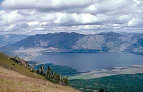 | Adjoins Henrys Lake 15 miles (24 km) west of Yellowstone National Park. |
| Heyburn State Park | Benewah | 8,106 acres | 3,280 ha | 2,128 ft | 649 m | 1908 |  | Preserves three lakes in the oldest state park in the Pacific Northwest. |
| Lake Cascade State Park | Valley | 500 acres | 200 ha | 4,828 ft | 1,472 m | 1999 | 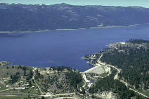 | Comprises properties dispersed around Lake Cascade's 86 miles (138 km) of shoreline. |
| Lake Walcott State Park | Minidoka | 65 acres | 26 ha | 4,700 ft | 1,400 m | 1999 | 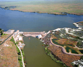 | Provides water recreation at the northwest end of Lake Walcott. |
| Land of the Yankee Fork State Park | Custer | 521 acres | 211 ha | 5,001–6,500 ft | 1,524–1,981 m | 1990 | 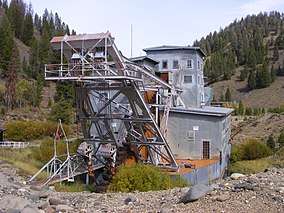 | Interprets Idaho's frontier mining history, including the ghost towns of Bayhorse, Bonanza, and Custer. |
| Lucky Peak State Park | Ada | 240 acres | 97 ha[3] | 2,750 ft | 840 m | 1956 | 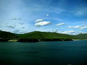 | Comprises three day-use areas east of Boise on Lucky Peak Lake and the Boise River. |
| Massacre Rocks State Park | Power | 990 acres | 400 ha | 4,400 ft | 1,300 m | 1967 | 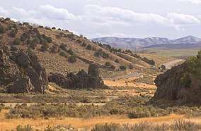 | Preserves a boulder field on the Snake River where emigrants on the Oregon and California Trails feared ambush by Native Americans. |
| McCroskey State Park | Benewah, Latah | 5,300 acres | 2,100 ha | 3,039–4,324 ft | 926–1,318 m | 1955 | 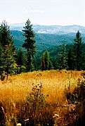 | Offers a scenic drive along a ridge overlooking the Palouse. |
| Old Mission State Park | Kootenai | 18 acres | 7.3 ha | 2,200 ft | 670 m | 1975 |  | Interprets the oldest standing building in Idaho, finished in 1853 as a Jesuit mission to the Coeur d'Alene people. |
| Ponderosa State Park | Valley | 1,515 acres | 613 ha | 5,050 ft | 1,540 m | 1973 | Preserves a peninsula jutting into Payette Lake. | |
| Priest Lake State Park | Bonner | 755 acres | 306 ha | 2,440 ft | 740 m | 1973 | Comprises three units around Priest Lake in the Selkirk Mountains. | |
| Round Lake State Park | Bonner | 142 acres | 57 ha | 2,122 ft | 647 m | 1965 | 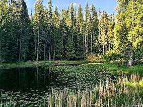 | Surrounds a 58-acre (23 ha) lake. |
| Thousand Springs State Park | Gooding | 1,500 acres | 610 ha | 2,800 ft | 850 m | 2005 |  | Comprises multiple units in the Hagerman Valley where numerous springs charged by the Snake River Aquifer flow out of the eastern valley wall. |
| Three Island Crossing State Park | Elmore | 613 acres | 248 ha | 2,484 ft | 757 m | 1968 | Interprets the site of a ford over the Snake River on the Oregon Trail, | |
| Trail of the Coeur d'Alenes | Benewah, Kootenai, Shoshone | 73 mi | 117 km | 2,200–3,280 ft | 670–1,000 m | 2004 | 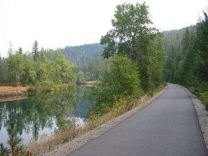 | Comprises a 73-mile (117 km) paved rail trail across the Idaho Panhandle. |
| Winchester Lake State Park | Lewis | 418 acres | 169 ha | 3,900 ft | 1,200 m | 1969 | Surrounds a 104-acre (42 ha) lake known for its rainbow trout fishing. | |
gollark: Oh, and how did the diplomacy with the Musk go?
gollark: What brands of quantum computer are available?
gollark: I say we should spend half our resources on making an asteroid mining probe, probably replace the quantum computer we put our fork on (or make a few more, for research), and look at starting on a solar power swarm.
gollark: Random headcanon: the SXS Musk's AI is actually uploaded Elon Musk.
gollark: The gas dwarf? Why? Solar panels work better closer in, and we're on... Bradbury, right?
See also
- List of U.S. national parks
References
- All data come from the respective Idaho state park's webpage unless otherwise noted.
- "History: State Lands in Idaho". Idaho Museum of Natural History. Retrieved October 16, 2017.
- "Idaho State Parks Fast Facts" (PDF). Lesson 6: State Park By Design. Idaho Parks and Recreation. Retrieved October 21, 2018.
External links
This article is issued from Wikipedia. The text is licensed under Creative Commons - Attribution - Sharealike. Additional terms may apply for the media files.