List of Indiana state historical markers in Noble County
This is a list of the Indiana state historical markers in Noble County.
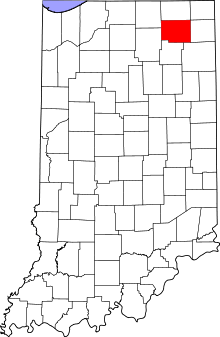
Location of Noble County in Indiana
This is intended to be a complete list of the official state historical markers placed in Noble County, Indiana, United States by the Indiana Historical Bureau. The locations of the historical markers and their latitude and longitude coordinates are included below when available, along with their names, years of placement, and topics as recorded by the Historical Bureau. There are 5 historical markers located in Noble County.[1]
Historical markers
| Marker title | Image | Year placed | Location | Topics |
|---|---|---|---|---|
| Camp Mitchell[2] | 1963 | Junction of Orchard and Rush Streets in Kendallville 41°26′28.5″N 85°15′59.4″W |
Military | |
| Chief Papakeecha's House one quarter mile south[3] | 1967 | Junction of County Roads 200N and 1150W, 0.8 miles west of State Road 5 on County Road 200N and 2.4 miles southwest of Cromwell 41°22′49.8″N 85°38′41″W |
American Indian/Native American | |
| Indian Oven 80 rods east[4] | 1967 | State Road 5 at a public access site entrance to Indian Village Lake at Indian Village 41°21′51″N 85°38′23″W |
American Indian/Native American, Military | |
| Sylvan Lake[5] | 1992 | State Road 9 at Sycamore Park by the Sylvan Lake dam and outlet site, near Rome City 41°29′57″N 85°22′32.7″W |
Transportation, Business, Industry, and Labor | |
| Noble County Seat/Noble County Courthouse[6] | 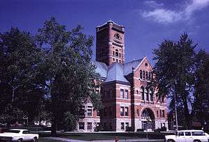 |
1999 | Courthouse Square in Albion 41°23′46″N 85°25′28″W |
Government Institutions, Buildings and Architecture |
gollark: There is, in fact, no escape.
gollark: --tel hangup
gollark: Æ emergency mitigation time.
gollark: OH NO
gollark: Heavserver has *excellent* bots.
See also
References
- "Indiana Historical Markers by County". State of Indiana. Retrieved 2012-03-15.
- Camp Mitchell, Indiana Historical Bureau, n.d. Accessed 2012-03-14.
- Chief Papakeecha's House one quarter mile south, Indiana Historical Bureau, n.d. Accessed 2012-03-14.
- Indian Oven 80 rods east, Indiana Historical Bureau, n.d. Accessed 2012-03-14.
- Sylvan Lake, Indiana Historical Bureau, n.d. Accessed 2012-03-14.
- Noble County Seat/Noble County Courthouse, Indiana Historical Bureau, n.d. Accessed 2012-03-14.
External links
Municipalities and communities of Noble County, Indiana, United States | ||
|---|---|---|
| Cities | Map of Indiana highlighting Noble County | |
| Towns | ||
| Townships | ||
| CDP | ||
| Unincorporated communities | ||
| Footnotes | ‡This populated place also has portions in an adjacent county or counties | |
This article is issued from Wikipedia. The text is licensed under Creative Commons - Attribution - Sharealike. Additional terms may apply for the media files.