Liberty Township, Fulton County, Indiana
Liberty Township is one of eight townships in Fulton County, Indiana. As of the 2010 census, its population was 1,614 and it contained 889 housing units.[3]
Liberty Township | |
|---|---|
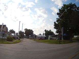 Intersection of Highway 25 and Center Street in Fulton | |
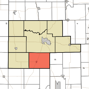 Location of Liberty Township in Fulton County | |
| Coordinates: 40°57′07″N 86°14′57″W | |
| Country | United States |
| State | Indiana |
| County | Fulton |
| Government | |
| • Type | Indiana township |
| Area | |
| • Total | 47.24 sq mi (122.4 km2) |
| • Land | 46.91 sq mi (121.5 km2) |
| • Water | 0.33 sq mi (0.9 km2) |
| Elevation | 794 ft (242 m) |
| Population (2010) | |
| • Total | 1,614 |
| • Density | 34.4/sq mi (13.3/km2) |
| FIPS code | 18-43254[2] |
| GNIS feature ID | 453553 |
Geography
According to the 2010 census, the township has a total area of 47.24 square miles (122.4 km2), of which 46.91 square miles (121.5 km2) (or 99.30%) is land and 0.33 square miles (0.85 km2) (or 0.70%) is water.[3]
Cities and towns
Adjacent townships
- Rochester Township (north)
- Allen Township, Miami County (east)
- Union Township, Miami County (southeast)
- Adams Township, Cass County (south)
- Bethlehem Township, Cass County (southwest)
- Wayne Township (west)
Major highways
Cemeteries
The township contains three cemeteries: Fulton, Mount Olive and Salem.
gollark: Great, I'll keep them and work out the ToDs and stuff.
gollark: I'm currently just interested in "is there actually a decent chance of someone being there".
gollark: Running three more experiments in four days because my last one went okay; is anyone available in 4d5h or so for catching?
gollark: I don't think it's 8-9 UV specifically. I stuck that one egg I actually experimented on properly in hatcheries but had very few ARers, and it turned.
gollark: If I were to release it generally, it'd need a GUI and stuff which I can't be bothered to make.
References
- "Liberty Township, Fulton County, Indiana". Geographic Names Information System. United States Geological Survey. Retrieved 2009-09-24.
- United States Census Bureau cartographic boundary files
- "US Board on Geographic Names". United States Geological Survey. 2007-10-25. Retrieved 2008-01-31.
- "U.S. Census website". United States Census Bureau. Retrieved 2008-01-31.
- "Population, Housing Units, Area, and Density: 2010 - County -- County Subdivision and Place -- 2010 Census Summary File 1". United States Census. Archived from the original on 2020-02-12. Retrieved 2013-05-10.
External links
Municipalities and communities of Fulton County, Indiana, United States | ||
|---|---|---|
| City | Map of Indiana highlighting Fulton County | |
| Towns | ||
| Townships | ||
| Unincorporated communities | ||
| Footnotes | ‡This populated place also has portions in an adjacent county or counties | |
This article is issued from Wikipedia. The text is licensed under Creative Commons - Attribution - Sharealike. Additional terms may apply for the media files.