Rochester Township, Fulton County, Indiana
Rochester Township is one of eight townships in Fulton County, Indiana. As of the 2010 census, its population was 10,181 and it contained 4,838 housing units.[3]
Rochester Township | |
|---|---|
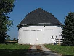
 Don Smiley Round Barn, west of Rochester | |
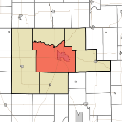
 Location of Rochester Township in Fulton County | |
| Coordinates: 41°03′10″N 86°14′25″W | |
| Country | United States |
| State | Indiana |
| County | Fulton |
| Government | |
| • Type | Indiana township |
| Area | |
| • Total | 83.95 sq mi (217.4 km2) |
| • Land | 82.57 sq mi (213.9 km2) |
| • Water | 1.38 sq mi (3.6 km2) |
| Elevation | 774 ft (236 m) |
| Population (2010) | |
| • Total | 10,181 |
| • Density | 123.3/sq mi (47.6/km2) |
| FIPS code | 18-65232[2] |
| GNIS feature ID | 453807 |
Geography
According to the 2010 census, the township has a total area of 83.95 square miles (217.4 km2), of which 82.57 square miles (213.9 km2) (or 98.36%) is land and 1.38 square miles (3.6 km2) (or 1.64%) is water.[3]
Cities and towns
- Rochester (the county seat)
Unincorporated towns
(This list is based on USGS data and may include former settlements.)
Adjacent townships
- Richland Township (north)
- Newcastle Township (northeast)
- Henry Township (east)
- Allen Township, Miami County (southeast)
- Liberty Township (south)
- Wayne Township (southwest)
- Union Township (west)
- Aubbeenaubbee Township (northwest)
Major highways
Cemeteries
The township contains five cemeteries: Antioch, Citizens, Independent Order of Odd Fellows, Mount Zion and Old Shelton.
gollark: Stuff is valued according to desirability which is based in rarity.
gollark: Er, I just have to note something here.
gollark: Or at least gold + silver.
gollark: You can probably get *two* CB Golds.
gollark: If you want to, just look at the hub.
References
- "US Board on Geographic Names". United States Geological Survey. 2007-10-25. Retrieved 2008-01-31.
- "U.S. Census website". United States Census Bureau. Retrieved 2008-01-31.
- "Population, Housing Units, Area, and Density: 2010 - County -- County Subdivision and Place -- 2010 Census Summary File 1". United States Census. Archived from the original on 2020-02-12. Retrieved 2013-05-10.
This article is issued from Wikipedia. The text is licensed under Creative Commons - Attribution - Sharealike. Additional terms may apply for the media files.