Lexington, Carroll County, Indiana
Lexington is an unincorporated community in Democrat Township, Carroll County, Indiana.
Lexington | |
|---|---|
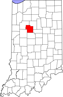 Carroll County's location in Indiana | |
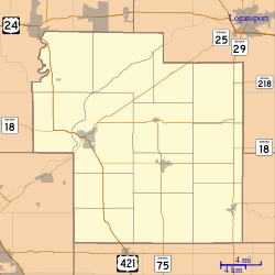 Lexington Location in Carroll County | |
| Coordinates: 40°27′32″N 86°29′20″W | |
| Country | United States |
| State | Indiana |
| County | Carroll |
| Township | Democrat |
| Elevation | 748 ft (228 m) |
| ZIP code | 46920 |
| FIPS code | 18-43128[1] |
| GNIS feature ID | 437810[2] |
History
Lexington was laid out in 1835.[3]
Geography
Lexington is located at 40°27′32″N 86°29′20″W.
gollark: Did you know? Your location is an increasingly good approximation for the location of the majority of bees.
gollark: As you can see, safety tends towards 0.
gollark: I use RedReader.
gollark: Try not using the official app, at least?
gollark: You can't actually escape.
References
- "U.S. Census website". United States Census Bureau. Retrieved 2008-01-31.
- "Lexington, Carroll County, Indiana". Geographic Names Information System. United States Geological Survey. Retrieved 2009-10-17.
- Odell, John Curtis (1916). History of Carroll County, Indiana: Its People, Industries and Institutions. B.F. Bowen. p. 83.
Municipalities and communities of Carroll County, Indiana, United States | ||
|---|---|---|
| City | Map of Indiana highlighting Carroll County | |
| Towns | ||
| Townships | ||
| Unincorporated communities |
| |
This article is issued from Wikipedia. The text is licensed under Creative Commons - Attribution - Sharealike. Additional terms may apply for the media files.