Lere, Nigeria
Lere is a Local Government Area in southern Kaduna State of Nigeria. It is located geographically at the latitude 10 degrees 39 North and longitude 8 degrees 57 East. Lere Local Government has an area of 320 km2 and a population of 339,740 in the 2006 census. Its headquarters are in the town of Saminaka. The postal code of the area is 811.[1]
Lere | |
|---|---|
LGA | |
| Country | |
| State | Kaduna State |
| Government | |
| • Type | Democracy |
| • Executive Chairman | Hon. Abubakar Buba |
| Area | |
| • Total | 120 sq mi (320 km2) |
| Population (2006) | |
| • Total | 339,740 |
| 2006 National Population Census | |
| Time zone | UTC+1 (WAT) |
Boundaries
Lere Local Government Area shares boundaries with Kauru Local Government Area to the west and south, Kubau Local Government Area to the northwest, Kano State to the north, Bauchi State to the east and Plateau State to southeast, respectively.[2][3]
Administrative Subdivisions
[4]Lere Local Government Area consists of 11 subdivisions namely:
- Abadawa
- Dan Alhaji
- Garu Mariri
- Gure Kahugu (Agbiri Aniragu)
- Kayarda
- Kudaru
- Lazuru Tuddai
- Lere
- Raminkura
- Sabon Birni
- Saminaka
Demographics
Population
Lere Local Government Area's population was recorded as 338,740, based on the March 21, 2006 census records. Its population was projected by the National Population Commission of Nigeria and National Bureau of Statistics to be 458,600 by March 21, 2016.[5]
People
Lere Local Government Area consists of a number of ethno-linguistic groups and subgroups largely speaking languages belonging to the East Kainji languages group of the Platoid languages such as: Abishi, Agbiri, Akurmi, Amala, Amap, Anaseni, Aniragu, Arumaruma, Avono, Avori, Azelle, Dungu, Koonu, Kuzamani (Lere), Ngmgbang, Tumi. Others include: Fulani Hausa, Igbo, Zaar.
Notable people
- Mozes Adams, footballer
References
- "Post Offices- with map of LGA". NIPOST. Archived from the original on 2012-11-26. Retrieved 2009-10-20.
- "Latest violence in Southern Kaduna Longest on record - Report". Premium Times Nigeria. February 12, 2017. Retrieved August 1, 2020.
- "Kaduna-State-Political-Map". VON. Retrieved August 7, 2020.
- "Lere, Kaduna State, Nigeria". Retrieved August 7, 2020.
- "City Population Figures for Kauru Local Government Area of Kaduna State".
State capital: Kaduna | ||
| Local Government Areas | 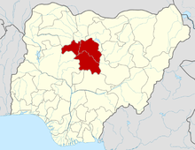 | |