Leeds, Maine
Leeds is a town in Androscoggin County, Maine, United States. The population was 2,326 at the 2010 census. It is included in both the Lewiston-Auburn, Maine Metropolitan Statistical Area and the Lewiston-Auburn, Maine Metropolitan New England City and Town Area.
Leeds, Maine | |
|---|---|
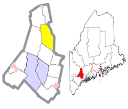
 Location of Leeds (in yellow) in Androscoggin County and the state of Maine | |
 Leeds, Maine Location in the United States | |
| Coordinates: 44°17′2″N 70°6′45″W | |
| Country | United States |
| State | Maine |
| County | Androscoggin |
| Incorporated | February 16, 1801 |
| Villages | Leeds Curtis Corner North Leeds South Leeds West Leeds |
| Area | |
| • Total | 43.41 sq mi (112.43 km2) |
| • Land | 40.05 sq mi (103.73 km2) |
| • Water | 3.36 sq mi (8.70 km2) |
| Elevation | 289 ft (88 m) |
| Population | |
| • Total | 2,326 |
| • Estimate (2012[3]) | 2,324 |
| • Density | 58.1/sq mi (22.4/km2) |
| Time zone | UTC-5 (Eastern (EST)) |
| • Summer (DST) | UTC-4 (EDT) |
| ZIP code | 04263 |
| Area code(s) | 207 |
| FIPS code | 23-38565 |
| GNIS feature ID | 0582552 |
History
Leeds was named after Leeds, England, the ancestral home of the town's first settlers.[4]
Geography
According to the United States Census Bureau, the town has a total area of 43.41 square miles (112.43 km2), of which 40.05 square miles (103.73 km2) is land and 3.36 square miles (8.70 km2) is water.[1]
Demographics
| Historical population | |||
|---|---|---|---|
| Census | Pop. | %± | |
| 1800 | 607 | — | |
| 1810 | 1,273 | 109.7% | |
| 1820 | 1,534 | 20.5% | |
| 1830 | 1,685 | 9.8% | |
| 1840 | 1,736 | 3.0% | |
| 1850 | 1,652 | −4.8% | |
| 1860 | 1,390 | −15.9% | |
| 1870 | 1,288 | −7.3% | |
| 1880 | 1,194 | −7.3% | |
| 1890 | 999 | −16.3% | |
| 1900 | 1,065 | 6.6% | |
| 1910 | 990 | −7.0% | |
| 1920 | 840 | −15.2% | |
| 1930 | 729 | −13.2% | |
| 1940 | 801 | 9.9% | |
| 1950 | 797 | −0.5% | |
| 1960 | 807 | 1.3% | |
| 1970 | 1,031 | 27.8% | |
| 1980 | 1,463 | 41.9% | |
| 1990 | 1,669 | 14.1% | |
| 2000 | 2,001 | 19.9% | |
| 2010 | 2,326 | 16.2% | |
| Est. 2014 | 2,309 | [5] | −0.7% |
| U.S. Decennial Census[6] | |||
As of 2000 the median income for a household in the town was $37,993, and the median income for a family was $42,557. Males had a median income of $30,245 versus $24,250 for females. The per capita income for the town was $15,602. About 5.9% of families and 9.8% of the population were below the poverty line, including 9.7% of those under age 18 and 9.7% of those age 65 or over.
2010 census
As of the census[2] of 2010, there were 2,326 people, 895 households, and 655 families residing in the town. The population density was 58.1 inhabitants per square mile (22.4/km2). There were 1,018 housing units at an average density of 25.4 per square mile (9.8/km2). The racial makeup of the town was 97.5% White, 0.3% African American, 0.5% Native American, 0.2% Asian, 0.3% from other races, and 1.2% from two or more races. Hispanic or Latino of any race were 1.7% of the population.
There were 895 households of which 32.6% had children under the age of 18 living with them, 58.7% were married couples living together, 8.3% had a female householder with no husband present, 6.3% had a male householder with no wife present, and 26.8% were non-families. 20.8% of all households were made up of individuals and 7.9% had someone living alone who was 65 years of age or older. The average household size was 2.60 and the average family size was 2.96.
The median age in the town was 41.3 years. 22.8% of residents were under the age of 18; 7.7% were between the ages of 18 and 24; 25.4% were from 25 to 44; 33.1% were from 45 to 64; and 10.9% were 65 years of age or older. The gender makeup of the town was 51.3% male and 48.7% female.
Voter registration
| Voter Registration and Party Enrollment as of January 2015[7] | |||||
|---|---|---|---|---|---|
| Party | Total Voters | Percentage | |||
| Unenrolled | 711 | 40.9% | |||
| Democratic | 469 | 27.0% | |||
| Republican | 464 | 26.7% | |||
| Green Independent | 95 | 5.4% | |||
| Total | 1,739 | 100% | |||
Notable people
- Kenneth M. Curtis, ambassador to Canada, president of Maine Maritime Academy, 68th governor of Maine
- Oliver O. Howard, Civil War era general, headed the Freedmen's Bureau, and Howard University
- Daniel Stanchfield, explorer, businessman, and member of the Minnesota Territorial House of Representatives
- Samuel B. Stanchfield, member of the Wisconsin State Senate and the Wisconsin State Assembly
Tourism
- Camp Tekakwitha,[8] at 44.297601°N 70.087254°W, is the only entirely French-speaking summer camp in United States, It is situated in Leeds, Maine. The property spreads over 11,000,000 square feet (1,000,000 m2) of timber land on the shores of Androscoggin Lake
- Monument Hill Leeds - Elev 669'. A short, 3/4 mile, hike from base (North Rd.) to a wooded summit- 200' elev gain. Located at the summit, the obelisk is a "Monument to Peace" after the Civil War.[9] Generals Oliver Otis Howard and Charles Henry Howard placed the obelisk in 1895 "on the great hill" where they as children had played with their brother, Reverend Roland Bailey Howard, Secretary of the American Peace Society.[10] It was Rev. Howard's desire, unfulfilled at the time of his death in 1892, to place a monument there to honor the Peace that came at the end of the Civil War.[11]Monument Hill
- Leeds borders the Androscoggin River and Androscoggin Lake. Running between these two bodies of water, through Leeds, is the Dead River. This small river has the unique ability to run two ways, depending on whether the Androscoggin Lake or River is higher.
References
- "US Gazetteer files 2010". United States Census Bureau. Archived from the original on 2012-12-20. Retrieved 2012-12-16.
- "U.S. Census website". United States Census Bureau. Retrieved 2012-12-16.
- "Population Estimates". United States Census Bureau. Archived from the original on 2013-06-11. Retrieved 2013-07-06.
- Yates, Edgar A.P. (Jun 13, 1928). "Some Maine town names". The Lewiston Daily Sun. p. 4. Retrieved 17 October 2015.
- "Annual Estimates of the Resident Population for Incorporated Places: April 1, 2010 to July 1, 2014". Archived from the original on May 23, 2015. Retrieved June 4, 2015.
- "Census of Population and Housing". Census.gov. Retrieved June 4, 2015.
- http://maine.gov/sos/cec/elec/data/r-e-active.pdf
- http://www.campdevacances.com/
- Peace Monument
- Howard Bros Archived 2013-07-24 at the Wayback Machine
- http://abacus.bates.edu/~ljuraska/lhs/Notes%20on%20Peace%20Monument.pdf
External links
- Varney, George J. (1886), Gazetteer of the state of Maine. Leeds, Boston: Russell
- Map showing Leeds, Maine, ca. 1750 from the Maine Memory Network
- Maine Genealogy: Leeds, Androscoggin County, Maine
