Le Fieu
Le Fieu is a commune in the Gironde department in Nouvelle-Aquitaine in southwestern France.
Le Fieu | |
|---|---|
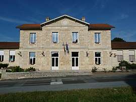 The town hall in Le Fieu | |
Location of Le Fieu 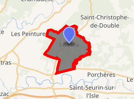
| |
 Le Fieu  Le Fieu | |
| Coordinates: 45°03′37″N 0°01′57″W | |
| Country | France |
| Region | Nouvelle-Aquitaine |
| Department | Gironde |
| Arrondissement | Libourne |
| Canton | Le Nord-Libournais |
| Intercommunality | Pays de Coutras |
| Government | |
| • Mayor (2008–2014) | Michel Vacher |
| Area 1 | 14.67 km2 (5.66 sq mi) |
| Population (2017-01-01)[1] | 523 |
| • Density | 36/km2 (92/sq mi) |
| Time zone | UTC+01:00 (CET) |
| • Summer (DST) | UTC+02:00 (CEST) |
| INSEE/Postal code | 33166 /33230 |
| Elevation | 24–91 m (79–299 ft) (avg. 87 m or 285 ft) |
| 1 French Land Register data, which excludes lakes, ponds, glaciers > 1 km2 (0.386 sq mi or 247 acres) and river estuaries. | |
Geography
Le Fieu is about 49 km to the northeast of Bordeaux and around 23 km to the Northeast of Libourne. The commune borders the commune of Les Églisottes-et-Chalaures in the North, Saint-Christophe-de-Double in the Northeast, Porchères in the Southeast, Coutras in the South and Southeast and Les Peintures in the West.
Population
| Year | Pop. | ±% |
|---|---|---|
| 1962 | 413 | — |
| 1968 | 465 | +12.6% |
| 1975 | 378 | −18.7% |
| 1982 | 366 | −3.2% |
| 1990 | 379 | +3.6% |
| 1999 | 373 | −1.6% |
| 2008 | 479 | +28.4% |
gollark: Surprisingly cheap, that.
gollark: I use it because it makes running random cool apps easy.
gollark: What you need is a compromise solution *everyone* will hate.
gollark: Why *do* people hate proxmox?
gollark: Is MiB 2^20 or something else?
See also
References
- "Populations légales 2017". INSEE. Retrieved 6 January 2020.
| Wikimedia Commons has media related to Le Fieu. |
| Authority control |
|
|---|
This article is issued from Wikipedia. The text is licensed under Creative Commons - Attribution - Sharealike. Additional terms may apply for the media files.