Cours-de-Monségur
Cours-de-Monségur is a commune in the Gironde department in Nouvelle-Aquitaine in southwestern France.
Cours-de-Monségur | |
|---|---|
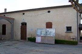 The town hall in Cours-de-Monségur | |
Location of Cours-de-Monségur 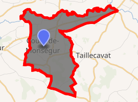
| |
 Cours-de-Monségur  Cours-de-Monségur | |
| Coordinates: 44°39′07″N 0°07′08″E | |
| Country | France |
| Region | Nouvelle-Aquitaine |
| Department | Gironde |
| Arrondissement | Langon |
| Canton | Le Réolais et Les Bastides |
| Intercommunality | Monségurais |
| Government | |
| • Mayor (2008–2014) | Yannick Jousseaume |
| Area 1 | 9.64 km2 (3.72 sq mi) |
| Population (2017-01-01)[1] | 284 |
| • Density | 29/km2 (76/sq mi) |
| Time zone | UTC+01:00 (CET) |
| • Summer (DST) | UTC+02:00 (CEST) |
| INSEE/Postal code | 33136 /33580 |
| Elevation | 24–121 m (79–397 ft) (avg. 83 m or 272 ft) |
| 1 French Land Register data, which excludes lakes, ponds, glaciers > 1 km2 (0.386 sq mi or 247 acres) and river estuaries. | |
Population
| Year | Pop. | ±% |
|---|---|---|
| 1962 | 321 | — |
| 1968 | 329 | +2.5% |
| 1975 | 318 | −3.3% |
| 1982 | 286 | −10.1% |
| 1990 | 230 | −19.6% |
| 1999 | 249 | +8.3% |
| 2008 | 274 | +10.0% |
gollark: I had vaguely assumed it was basically radar or something, and the X-raying let them know density (ish).
gollark: Arguably it was me. However, this is you, as a result.
gollark: Indeed. It's really convenient.
gollark: Yes, everyone else should share my preferences or they're wrong.
gollark: I don't think you know how preferences work.
See also
References
- "Populations légales 2017". INSEE. Retrieved 6 January 2020.
| Wikimedia Commons has media related to Cours-de-Monségur. |
| Authority control |
|
|---|
This article is issued from Wikipedia. The text is licensed under Creative Commons - Attribution - Sharealike. Additional terms may apply for the media files.