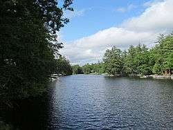
Lake Monomonac
Lake Monomonac is an artificial lake that straddles the border between Rindge, New Hampshire, and Winchendon, Massachusetts, in the United States. It was created from a small pond in New Hampshire by the construction of dams on the North Branch of the Millers River, a part of the Connecticut River watershed.
| Lake Monomonac | |
|---|---|
 South end of Lake Monomonac | |
| Location | Cheshire County, New Hampshire; Worcester County, Massachusetts |
| Coordinates | 42°43′3″N 71°59′43″W |
| Primary inflows | North Branch Millers River |
| Primary outflows | North Branch Millers River |
| Basin countries | United States |
| Max. length | 2.7 mi (4.3 km) |
| Max. width | 0.7 mi (1.1 km) |
| Surface area | 594 acres (2.4 km2) |
| Average depth | 10 ft (3.0 m) |
| Max. depth | 22 ft (6.7 m) |
| Surface elevation | 1,045 feet (318.5 m) |
| Islands | Blueberry Island; Paradise Island |
| Settlements | Rindge, NH; Winchendon, MA |
Lake Monomonac is 594 acres (240 ha) in size,[1] with 411 acres (166 ha) in New Hampshire and the remaining 183 acres (74 ha) in Massachusetts. The lake has a maximum recorded depth of 22 feet (6.7 m) and an average depth of 10 feet (3.0 m).[1]
The lake is classified as a warmwater fishery, with observed species including smallmouth and largemouth bass, black crappie, chain pickerel, white perch, pumpkinseed, bluegill, horned pout, and green sunfish.[1]
See also
- List of lakes in Massachusetts
- List of lakes in New Hampshire