Lésignac-Durand
Lésignac-Durand is a commune in the Charente department in the Nouvelle-Aquitaine region in southwestern France.
Lésignac-Durand | |
|---|---|
The lake in Lésignac | |
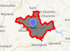
Location of Lésignac-Durand 
| |
 Lésignac-Durand  Lésignac-Durand | |
| Coordinates: 45°48′44″N 0°38′17″E | |
| Country | France |
| Region | Nouvelle-Aquitaine |
| Department | Charente |
| Arrondissement | Confolens |
| Canton | Charente-Bonnieure |
| Intercommunality | Haute-Charente |
| Government | |
| • Mayor (2008–2014) | Michel Duteil |
| Area 1 | 19.74 km2 (7.62 sq mi) |
| Population (2017-01-01)[1] | 187 |
| • Density | 9.5/km2 (25/sq mi) |
| Time zone | UTC+01:00 (CET) |
| • Summer (DST) | UTC+02:00 (CEST) |
| INSEE/Postal code | 16183 /16310 |
| Elevation | 193–296 m (633–971 ft) (avg. 245 m or 804 ft) |
| 1 French Land Register data, which excludes lakes, ponds, glaciers > 1 km2 (0.386 sq mi or 247 acres) and river estuaries. | |
Geography
The commune is found within the Rochechouart meteorite crater.
Population
| Year | Pop. | ±% |
|---|---|---|
| 1962 | 289 | — |
| 1968 | 399 | +38.1% |
| 1975 | 352 | −11.8% |
| 1982 | 299 | −15.1% |
| 1990 | 228 | −23.7% |
| 1999 | 184 | −19.3% |
| 2008 | 188 | +2.2% |
Personalities
- Antoine Thomas, Sieur de Lézignac, adviser to the king holding the Présidial seat of Angoumois.
- The Thomas family members were aldermen, mayors of Angoulême, and advisers to the Présidial of Angoulême in the seventeenth century. The family was ennobled in 1639, 1667 and 1736.
gollark: Well, the issue is this:- I would be very annoyed if linking to things was case-sensitive- I can make SQLite look up stuff case-insensitively, but this would cause further bee with other components probably
gollark: Hmm, am I going to horribly regret having Minoteaur canonicalize titles to Title Case Or Something?
gollark: I might be able to get it to forward onto another radioserver with less limited capabilities, and I actually could pretty easily wrangle another HTTP audio streaming thing if necessary.
gollark: The software is almost entirely incapable of playing anything except music from the OIR libraries.
gollark: OIR isn't entirely capable of running events.
See also
References
- "Populations légales 2017". INSEE. Retrieved 6 January 2020.
| Wikimedia Commons has media related to Lésignac-Durand. |
This article is issued from Wikipedia. The text is licensed under Creative Commons - Attribution - Sharealike. Additional terms may apply for the media files.