Kodarma
Kodarma (also spelled as Koderma) is a city and a notified area in Koderma district in the Indian state of Jharkhand. The district is bound on the north by the Nawada district of Bihar, on the south by Hazaribagh district of Jharkhand, on the east by Giridih district of Jharkhand and on the west by the Gaya district of Bihar.
Kodarma | |
|---|---|
city | |
 | |
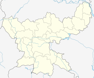
 Kodarma Location in Jharkhand, India  Kodarma Kodarma (India) | |
| Coordinates: 24.47°N 85.6°E | |
| Country | |
| State | Jharkhand |
| District | Kodarma |
| Named for | Kadram rishi |
| Elevation | 397 m (1,302 ft) |
| Population (2011) | |
| • Total | 24,633 |
| Languages | |
| • Official | Hindi, Santali, Khortha |
| Time zone | UTC+5:30 (IST) |
| PIN | 825410 |
| Telephone code | 06534 |
| Vehicle registration | JH-12 |
| Website | koderma |
Geography
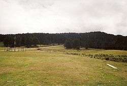
Koderma district lies in the Chhota Nagpur Plateau at 397 m (1,302 ft) above the sea level.[1] The area exhibits undulating topography comprising hills, hillocks, plains and mounds. The northern part of the district is occupied by Koderma Reserve Forest. The highest peak is Debour Ghati (677 m) which is the boundary of Jharkhand and Bihar states. The section line from south to north from Jharkhand to Bihar passes through Hazaribag plateau. The rocks at the edge of this plateau have been cut deeply by innumerable streams. There are a number of rills and gullies of various types such as figure or shoe-lace gullies.
The main rivers flowing through the district are Barakar, Barsoi and Sakri river.[2] Barakar River flows from west to east in the southern part of the district and supports the Tilaiya Dam project, a multipurpose dam constructed on it. Poanchkhara, Keso, Akto, Gurio, Gukhana Nadi are the main tributaries of the Barakar River. Sakri River is the main river in the northern part of the district which flows from south east to northwest. Mahua, banyan, sakhua, palash, peepal, neem, khajoor, bamboo are the flora of the area. Fauna such as leopard, bear, pig, deer, and hare are found in the forest area of Koderma Reserve forest. Koderma is surrounded by forests and many natural resources, Dhawajadhari Pahar (hill) that is dedicated to Lord Shiva and on the Mahashivratri many devotees get together to worship.
At one time, Koderma was considered as the mica capital of India.[3][4][5] During that time, the townships of Koderma and Jhumri Tilaiya had seen the rise of several mica tycoons. Now, it is a fast developing city in Jharkhand state. Koderma holds the world record in terms of holding the largest deposits of mica in the world.
Demographics
As per 2011 Census of India, Kodarma Nagar Parishad had a total population of 24,633 of which 12,941 were males and 11,692 females. Scheduled Castes numbered 1,691 and Scheduled Tribes numbered 153.[6]
As of 2001 India census,[7] Kodarma had a population of 17,160. Males constitute 53% of the population and females 47%. Kodarma has an average literacy rate of 63%, higher than the national average of 59.5%: male literacy is 71%, and female literacy is 53%. In Kodarma, 17% of the population is under 6 years of age.
Education
There are a number of schools and degree colleges in Kodarma:
- Capital University is a private university established in 2018.
- Jharkhand Vidhi Mahavidyalaya
- Jagannath Jain College[8]
- Govt. Polytechnic, Koderma[9]
- Grizzly College of Education[10]
- Ramgovind Institute of Technology,[11] it is a private polytechnic college
- Koderma Industrial Training Centre, Koderma
Koderma is widely known for one of the most prestigious Sainik School at Tilaiya. It is one known for training boys for future defence entrances.
Transport
Road
Koderma is located along National Highway 31 that connects Ranchi and Patna and Koderma Giridih state highway.
Railway
Koderma railway station is on the Grand Chord railway line of East Central Railway connecting Calcutta and Delhi via Dhanbad. The railway station is actually located in adjacent Jhumri Tilaiya town and not in Koderma town which is some distance away (9 km).
Three new railway lines are being laid from Koderma railway station in three different directions:
- Koderma-Giridih 111 km long
- Koderma-Hazaribagh 79 km long (eventually to Ranchi railway junction, 200 km from Koderma via Barkakana Junction)
- Koderma-Tilaiya (Bihar)
The 85-km-long railway line from Koderma to Kawar towards Giridih has been commissioned in August 2015 and a DMU passenger train has started running on this 86 km section. This has made Koderma a grand railway junction. In 2013 it was only commissioned to Nawadih station of Koderma district.
The railway line to Hazaribagh has been laid. It began regular running as of 20 February 2015. One passenger train is running Hazaribagh Town to Koderma Station. Now this train is upgraded and runs between Koderma junction to Barkakana junction.
Hospitals
Sadar Hospital is the government owned public hospital in the city.[12]
Economy
Koderma is known for the world's largest reserve of mica and was once a bustling town along with its neighbourhood town Jhumri Telaiya. During the 1960s, the city had one of the world's biggest mica tycoons and traders. USSR was the biggest consumer of mica's extracted from Koderma and exported there for making space and military equipments. Later, Govt. of Bihar took over the mica mines under Bihar Mica Syndicate which got formed as Bihar State Mineral Development Corp. (now Jharkhand State Mineral Development Corporation).
Tilaiya Hydel Power Plant was built at Tilaiya Dam which got established in 1953 by Damodar Valley Corporation.
Koderma Thermal Power Station a coal-based 1000MW power plant of DVC was established in 2012 employing thousands of people.[13]
Hazaribagh-Koderma Industrial Area setuped by RIADA and operates many small & middle scale industries in the region. R.K.Sahana & Sons (Sahana Minerals) are one of the biggest miners of mica, quartz and felspar in Koderma.
Religion
Among the major temples in Kodarma are
- Shree Sankat Mochan Trust Mandir, Built by Lal Khatuwala
- Kali Mandir, built by Samonta Family
- Dwajadhari Pahari Mandir
- Balaji Temple, Station road
Commercial places
The main commercial hub or place where most of the business happens is Station Road & Jhanda chowk area. The town is growing and one of the first mall-type premium commercial complexes is coming.
See also
- Kodarma district
References
- "Chota Nagpur Plateau - Wikipedia". en.m.wikipedia.org. Retrieved 28 April 2020.
- "Koderma | Welcome To Koderma District Website | India". Retrieved 29 April 2020.
- "Which State is the Largest Mica Producer?". Maps of India. 22 August 2017. Retrieved 1 March 2020.
- "A Report on Child Labour in Mica Mines of Koderma & Giridih District of Jharkhand". Child in Need Institute. 10 January 2018. Retrieved 1 March 2020.
- "Ground Water Information Booklet Koderma District, Jharkhand State" (PDF). Central Ground water Board Ministry of Water Resources (Govt. of India). September 2013. p. 5. Retrieved 1 March 2020.
- "2011 Census – Primary Census Abstract Data Tables". Jharkhand – District-wise. Registrar General and Census Commissioner, India. Retrieved 16 December 2015.
- "Census of India 2001: Data from the 2001 Census, including cities, villages and towns (Provisional)". Census Commission of India. Archived from the original on 16 June 2004. Retrieved 1 November 2008.
- "Welcome to Jagannath Jain College, Jhumri Telaiya". jjcollege.edu.in. Retrieved 16 January 2020.
- "Government Polytechnic Koderma". gp-koderma.org. Retrieved 16 January 2020.
- "Welcome to Grizzly College of Education, Jhumri Telaiya, Koderma. Affiliated to Vinoba Bhave University,Hazaribag(Jharkhand)". www.grizzlycollege.org. Retrieved 16 January 2020.
- "Ramgovind Group Of Colleges - Koderma". www.rgc.edu.in. Retrieved 16 January 2020.
- Ray, Dhritiman (23 September 2018). "Modi lays foundations of two 300 bed medical colleges in Jharkhand". The Times of India. Retrieved 17 May 2019.
- "First unit of Koderma Thermal Power commissioned". The Economic Times. 4 November 2012. Retrieved 16 January 2020.