Kinderbeuern
Kinderbeuern (also known locally as Kinderbeuern-Hetzhof) is an Ortsgemeinde – a municipality belonging to a Verbandsgemeinde, a kind of collective municipality – in the Bernkastel-Wittlich district in Rhineland-Palatinate, Germany.
Kinderbeuern | |
|---|---|
Location of Kinderbeuern within Bernkastel-Wittlich district 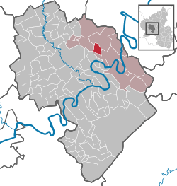 | |
 Kinderbeuern  Kinderbeuern | |
| Coordinates: 50°0′33.5″N 7°1′24.45″E | |
| Country | Germany |
| State | Rhineland-Palatinate |
| District | Bernkastel-Wittlich |
| Municipal assoc. | Traben-Trarbach |
| Subdivisions | 2 |
| Government | |
| • Mayor | Heinz Christen (CDU) |
| Area | |
| • Total | 5.56 km2 (2.15 sq mi) |
| Elevation | 168 m (551 ft) |
| Population (2018-12-31)[1] | |
| • Total | 1,005 |
| • Density | 180/km2 (470/sq mi) |
| Time zone | CET/CEST (UTC+1/+2) |
| Postal codes | 54538 |
| Dialling codes | 06532 |
| Vehicle registration | WIL |
Geography
Location
Kinderbeuern lies in the Alf valley at the foot of the Kondelwald, a forested hill region. The outlying centre of Hetzhof lies not far north on the Kammerbach. Kinderbeuern belongs to the Verbandsgemeinde of Traben-Trarbach.
Neighbouring municipalities
Kinderbeuern's neighbours in the Alf valley are Bausendorf, Bengel and Sengwald, likewise in the Alf valley, but an outlying centre of the municipality of Kinheim on the Moselle.
History
Originally, Kinderbeuern (1296: Kynheymerbüren) was an outlying settlement in the Alf valley of the municipality of Kinheim on the Moselle and until 1740 was united with Kinheim[2] Kinderbeuern had its first documentary mention in 1296. Beginning in 1794, Kinderbeuern lay under French rule. In 1814 it was assigned to the Kingdom of Prussia at the Congress of Vienna. Since 1947, it has been part of the then newly founded state of Rhineland-Palatinate.
Politics
Municipal council
The council is made up of 16 council members, who were elected by proportional representation at the municipal election held on 7 June 2009, and the honorary mayor as chairman.
The municipal election held on 7 June 2009 yielded the following results:[3]
| SPD | CDU | FWG | Total | |
| 2009 | 7 | 9 | - | 16 seats |
| 2004 | 7 | 7 | 2 | 16 seats |
Economy and infrastructure
In Kinderbeuern there are one kindergarten and one primary school. Within the municipality, Bundesstraßen 421 and 49 meet. To the west runs the Autobahn A 1. In each of the neighbouring municipalities of Ürzig and Bengel is a railway station on the Koblenz-Trier railway line.
References
- "Bevölkerungsstand 2018 - Gemeindeebene". Statistisches Landesamt Rheinland-Pfalz (in German). 2019.
- Erwin Schaaf. Verbandsgemeinde Kröv-Bausendorf. Land und Leute in alten Fotos. Geiger-Verlag, Horb am Neckar 2006, S. 114-115.
- Kommunalwahl Rheinland-Pfalz 2009, Gemeinderat
- Kinderbeuern’s arms
External links
| Wikimedia Commons has media related to Kinderbeuern. |
- Kinderbeuern (in German)
| Authority control |
|
|---|