Sehlem, Rhineland-Palatinate
Sehlem is an Ortsgemeinde – a municipality belonging to a Verbandsgemeinde, a kind of collective municipality – in the Bernkastel-Wittlich district in Rhineland-Palatinate, Germany.
Sehlem | |
|---|---|
_COA.svg.png) Coat of arms | |
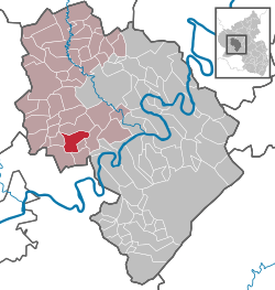
Location of Sehlem within Bernkastel-Wittlich district  | |
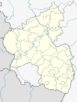
 Sehlem  Sehlem | |
| Coordinates: 49°54′13″N 6°50′17″E | |
| Country | Germany |
| State | Rhineland-Palatinate |
| District | Bernkastel-Wittlich |
| Municipal assoc. | Wittlich-Land |
| Government | |
| • Mayor | Norbert Mehrfeld |
| Area | |
| • Total | 11.25 km2 (4.34 sq mi) |
| Elevation | 160 m (520 ft) |
| Population (2018-12-31)[1] | |
| • Total | 969 |
| • Density | 86/km2 (220/sq mi) |
| Time zone | CET/CEST (UTC+1/+2) |
| Postal codes | 54518 |
| Dialling codes | 06508 |
| Vehicle registration | WIL |
Geography
Location
The municipality lies in the Eifel and belongs to the Verbandsgemeinde of Wittlich-Land, whose seat is in Wittlich, although that town is itself not in the Verbandsgemeinde.
History
Sehlem was part of the Electorate of Trier. Beginning in 1794, Sehlem lay under French rule. In 1814 it was assigned to the Kingdom of Prussia at the Congress of Vienna. Since 1947, it has been part of the then newly founded state of Rhineland-Palatinate.
Politics
Municipal council
The council is made up of 12 council members, who were elected by proportional representation at the municipal election held on 7 June 2009, and the honorary mayor as chairman.
The municipal election held on 7 June 2009 yielded the following results:[2]
| WG Mehrfeld | WG Molitor | WG Lehnen | WG Zehe | Total | |
| 2009 | 5 | 2 | 4 | 1 | 12 seats |
Mayors
In the mayoral election, Norbert Mehrfeld defeated Franz-Josef Molitor with a total of 54.9% of the vote to his opponent's 45.1%.
Coat of arms
The German blazon reads: Über grünem Schildfuß, darin zwei silberne Leisten, in Silber ein rotes Balkenkreuz, belegt mit grünem sechsspeichigem Rad.
The municipality's arms might in English heraldic language be described thus: Argent a cross gules, surmounting the whole a wheel spoked of six vert, in a base of the third two bars of the first.
Economy and infrastructure
Transport
Sehlem lies on the Autobahn A 1 and has at its disposal a railway station on the Koblenz-Trier line.
References
- "Bevölkerungsstand 2018 - Gemeindeebene". Statistisches Landesamt Rheinland-Pfalz (in German). 2019.
- Kommunalwahl Rheinland-Pfalz 2009, Gemeinderat