Kajo Keji Airstrip
Kajo Keji is an airstrip serving the town of Kajo Keji, in South Sudan.[1]
Kajo Keji Airport | |||||||||||
|---|---|---|---|---|---|---|---|---|---|---|---|
| Summary | |||||||||||
| Airport type | Public, Civilian | ||||||||||
| Owner | Civil Aviation Authority of South Sudan | ||||||||||
| Location | Kajo Keji, | ||||||||||
| Elevation AMSL | 3,123 ft / 952 m | ||||||||||
| Coordinates | 03°51′19″N 31°39′32″E | ||||||||||
| Map | |||||||||||
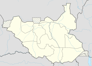 Kajo Location of Kago Kaju Airport in South Sudan | |||||||||||
| Runways | |||||||||||
| |||||||||||
Overview
Kajo Keji Airstrip (IATA: n/a, ICAO: HSKJ) is located in Kajo Keji County, in Central Equatoria State, in the town of Kajo Keji, near the International border with the Republic of Uganda.
The distance between Juba International Airport and Kajo Keji Airstrip by air is approximately 112.8 km (70.1 mi).[2] The geographic coordinates of Kago Kaju Airport are: 3° 51' 19.00"N, 31° 39' 32.00"E (Latitude: 3.9170; Longitude: 31.6670). This airport sits at an elevation of 952 metres (2,500 ft) above sea level.[3] The airstrip has a single unpaved runway, the dimensions of which, are not publicly known at this time.
gollark: Besides, our computers are fast.
gollark: Actually, I was just bored.
gollark: Will is NOT to be freed.
gollark: Of course not.
gollark: No, those were the ones in the identical environment except for assimilation-y agents™ chambers™.
References
- Public Private Cooperation - Fragile States Peace, Security and Development Network p. 12
- "112.8 Km - Total Flight Distance from Juba International Airport (JUB) to Kajo Keji Airstrip". www.distancesto.com. Retrieved 2018-08-24.
- elevationmap.net. "Kajo Keji Airstrip on the Elevation Map. Topographic Map of Kajo Keji Airstrip". elevationmap.net. Retrieved 2018-08-24.
External links
State capital: Juba | ||
| Counties | 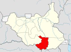 | |
| Populated places | ||
| Universities | ||
| Airports |
| |
| Other | ||
This article is issued from Wikipedia. The text is licensed under Creative Commons - Attribution - Sharealike. Additional terms may apply for the media files.