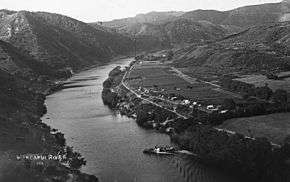
Kaiwhaiki
Kaiwhaiki is a settlement 18 kilometres (11 mi) upriver from Whanganui, New Zealand.

Kaiwhaiki in the 1840s was a small pā of a two to three dozen people.[1] In Ronaldson's 1847 survey, the inhabitants were noted as being of the hapū Ngāti Rongomaitawhiri.[2][1] In 1852 Kaiwhaiki became the first settlement on the Whanganui River to host a Catholic mission.[3] By the early 1860s, it was described as a "large pa" and its population were mostly Kingites, opposed to the colonial government.[1]
Kaiwhaiki is the home of the Ngā Paerangi hapū of the iwi Te Āti Haunui-a-Pāpārangi;[3] their unique twin-gabled wharenui Te Kiritahi was built in 1912.[4][5] It was the birthplace of composer and choirmaster Morvin Simon, who led the nationally known Kaiwhaiki-based kapa haka group Te Matapihi.
A quarry near Kaiwhaiki supplied the shellrock used to build the Durie Hill war memorial tower in Whanganui.[3]
Marae
Kaiwhaiki currently has three marae:
- Kaiwhaiki Marae and Te Kiritahi|Te Kiritahi or Rongotepoi meeting house are affiliated with Ngā Paerangi
- Rākato Marae and Rākato meeting house are affiliated with Ngāti Hine o Te Rā
- Whangaehu Marae and its Rangitahuahua meeting house are affiliated with Ngāti Apa[6][7]
References
- Walton, A. (1994). "Settlement Patterns in the Whanganui River Valley, 1839–1864" (PDF). New Zealand Journal of Archaeology. 16: 123–168.
- Ronaldson, W. (1847) "List of Pas with their Chiefs etc on the River Wanganui." Letterbook, Whanganui Regional Museum.
- Beaglehole, Diana (20 March 2014). "Whanganui places: River Settlements". Te Ara: The Encyclopedia of New Zealand. Retrieved 21 November 2015.
- "Kaiwhaiki Pā". Māori Maps. Archived from the original on 8 December 2015. Retrieved 23 November 2015.
- "History of Kaiwhaiki Marae published". Radio New Zealand News. 11 December 2012. Retrieved 22 November 2015.
- "Te Kāhui Māngai directory". tkm.govt.nz. Te Puni Kōkiri.
- "Māori Maps". maorimaps.com. Te Potiki National Trust.