Rangitaiki River
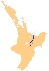
The Rangitaiki River is the longest river in the Bay of Plenty region in New Zealand's North Island. It is 155 kilometres (96 mi) long, and rises inland from northern Hawkes Bay to the east of the Kaingaroa Forest. The Rangitaiki catchment covers an area of 3005 km2. It flows in a generally northeastward direction, passing through the town of Murupara and skirting close to the western edge of Te Urewera National Park before turning northwards, flowing past Edgecumbe and into the Bay of Plenty close to Thornton.
The Rangitaiki River system
There are two man-made lakes on the Rangitaiki formed by hydro-electric dams, Lake Āniwaniwa (formerly Lake Aniwhenua)[1] and Lake Matahina.
Gallery
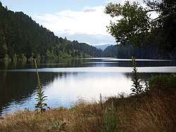 Lake Matahina
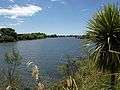 Rangitaiki River
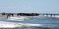 River fishing at Thornton
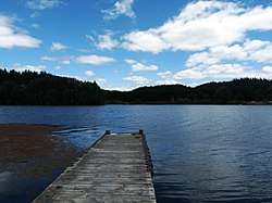 Lake Āniwaniwa
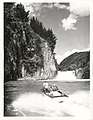 Recreational jet boating on the Rangitaiki River, 1971
gollark: ~~burn Go~~
gollark: ~~use Rust~~
gollark: _judges_
gollark: (I don't actually know Java)
gollark: It's not *my* project, I just link to it lots.
References
- Deed of Settlement between the Crown and Te Rūnanga o Ngāti Manawa (PDF) (Report). New Zealand Government. 2009. Retrieved 13 May 2020.
Lake Aniwhenua will be changed to Lake Āniwaniwa and Aniwhenua Falls will be changed to Āniwaniwa Falls.
This article is issued from Wikipedia. The text is licensed under Creative Commons - Attribution - Sharealike. Additional terms may apply for the media files.