Interstate 65 in Alabama
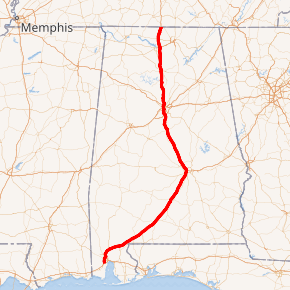
Interstate 65 (I-65) meanders across 366 miles (589 km) of the Alabama countryside linking six of the state's ten largest cities. The highway links together many important roadways that make commerce inside and outside of the state's boundaries possible. It starts at Interstate 10 near Mobile. The route passes through the major cities of Montgomery, Birmingham, and Decatur before entering Tennessee in the north near the town of Ardmore.
| ||||
|---|---|---|---|---|
I-65 highlighted in red | ||||
| Route information | ||||
| Maintained by ALDOT | ||||
| Length | 366.229 mi[1] (589.388 km) | |||
| Major junctions | ||||
| South end | ||||
| ||||
| North end | ||||
| Location | ||||
| Counties | Mobile, Baldwin, Escambia, Conecuh, Butler, Lowndes, Montgomery, Elmore, Autauga, Chilton, Shelby, Jefferson, Blount, Cullman, Morgan, Limestone | |||
| Highway system | ||||
| ||||
.svg.png)
The entire Alabama portion of I-65 is dedicated as Heroes Highway,[2] in honor of the CIA officer Johnny "Mike" Spann and all of the people who died during the September 11 attacks.
Route description
.jpg)
I-65 starts its northward journey in Mobile at an interchange with Interstate 10, not far from the Gulf of Mexico. From there it runs northeast, intersecting with I-165 in Prichard, Alabama and crossing the Mobile River delta at the General W.K. Wilson Jr. Bridge. En route to Montgomery, it passes county seats Evergreen (Conecuh County) and Greenville (Butler County). In the case of a hurricane evacuation on Alabama's coast, I-65 can be converted to an evacuation route where all lanes flow in the northbound direction from Mobile to Montgomery. This process is known as contra-flow. The terrain on this stretch of road is slightly hilly, aside from a stretch in southern Conecuh County near Castleberry, where the road is slightly mountainous as it descends over 400 feet (120 m) into the southern plains of Alabama.

At Montgomery, it intersects the southern terminus of I-85 and crosses the Alabama River north of the city. The Hyundai Motor Company's automotive plant in Montgomery is located just off I-65. It can be accessed using the Pintlala-Hope Hull exit (number 164).
At Chilton County, I-65 enters the Birmingham, Alabama, metropolitan area. Approximately halfway between Montgomery and Birmingham, it passes Clanton the county seat, where the water tower, visible from the road, is shaped and painted to resemble a huge peach. Between mile markers 212 and 219, I-65 was designated "War on Terror Memorial Highway" in 2014.
From mile marker 242 to 290 I-65 carries at least 6 lanes of traffic. I-65 intersects I-459 in Hoover, then passes through the cities of Vestavia Hills and Homewood, which often generate heavy traffic. As the interstate passes by downtown Birmingham, south-bound travelers have a view of the Vulcan statue atop Red Mountain. At the north edge of downtown, I-65 intersects I-20/I-59 with a cross-over interchange, often called "Malfunction Junction".
North of Birmingham at mile 266, interchange ramps provide access to parallel US 31. It is here that I-65 meets the eastern terminus of I-22, which heads northwest to Memphis, Tennessee, filling in a gap in the Interstate system. The interstate then continues 98 miles (158 km) in the general direction of Huntsville, passing the city of Cullman on the way. After entering the Decatur Metropolitan Area, in southern Morgan County, the interstate passes Decatur. The highway connects the Decatur and Huntsville Metropolitan Areas as it crosses Wheeler Lake (Tennessee River) on a 2.6-mile (4.2 km) bridge. The interstate emerges again into the fringes of Decatur, in an open area of seemingly "endless" cotton fields where it intersects, inside Decatur, with SR 20, US 72 Alternate, and the spur-route, I-565 to Huntsville.
Between Walkers Chapel Road in Fultondale and the Tennessee River in Decatur (Limestone County), I-65 has been designated the "Ronald Reagan Memorial Highway". The sign designating the north end of this portion of road cites Reagan's speech in Decatur on July 4, 1984. The interstate then continues, passing Athens, and merges with US 31. The 2 routes travel concurrently approximately 12 miles to the Tennessee state line.
In the Birmingham/Hoover vicinity, a plan to widen the interstate from North Birmingham to Alabaster has been proposed. The project is to widen the interstate by adding a HOV lane and keeping the original 3 lanes making it four lanes in each direction. This is planned to stretch to the Pelham area. From there on the interstate will widen from 2 lanes each way to 3 lanes each way into the Helena/Alabaster area.
Near the northern border of Alabama with Tennessee on southbound I-65 is located the Alabama Welcome Center and rest area. The unique feature of this rest area compared to others is the existence of a large Saturn IB rocket erected on the site as a memorial to Alabama's—and in particular, Huntsville's—contribution to NASA's space exploration.[4]
History
In 1997, at Georgiana (Exit 114), honoring legendary country musician and Alabama native Hank Williams, the interstate was designated as Hank Williams' Memorial "Lost Highway", after one of his songs. This designation continues northward until mile 179 north of Montgomery. From the state's capital, I-65 doglegs northwards, bypassing Prattville and Clanton before going through Metropolitan Birmingham, Alabama. From exit 242 to 290, this highway carries at least six lanes of traffic. A portion of the interstate running through Birmingham, has been nicknamed "Malfunction Junction" for its numerous wrecks. These accidents include two separate occasions of the support beams melting after crashes by 18-wheelers, and the numerous collisions that happen every year, result from the junction with I-20 and I-59.
In 2004, following the death of President Ronald Reagan, a lengthy segment of I-65 from Jefferson County to Limestone County was designated the Ronald Reagan Memorial Highway. The sign designating the north end of the segment includes a statement from Reagan's speech at Point Mallard Aquatic Center in nearby Decatur on July 4, 1984.
Future
Just a few miles north of I-22 will be the new interchange (exit 274), which will be the Corridor X-1 and has been designated as I-422. This loop route will connect I-65 with I-59 northeast of Birmingham and I-20/I-59 southwest of Birmingham, and this will serve as an Interstate Highway bypass of Birmingham, augmenting the existing I-459, which already provides the southern loop of Birmingham. Construction of this interchange is still several years away, but right-of-way is in the process of being acquired to build I-422.
Exit list
| County | Location | mi[5] | km | Exit | Destinations | Notes |
|---|---|---|---|---|---|---|
| Mobile | Mobile | 0.000 | 0.000 | 0 | Southbound exit and northbound entrance; southern terminus; I-10 exit 20; directional T interchange | |
| 1.930 | 3.106 | 1 | ||||
| 3.64 | 5.86 | 3 | Airport Boulevard | Serves Mobile Regional Airport and University of South Alabama | ||
| 4.48 | 7.21 | 4 | Dauphin Street | |||
| 5.56 | 8.95 | 5A | Springhill Avenue | Serves Spring Hill College | ||
| 5.752 | 9.257 | 5B | ||||
| Prichard | 8.412 | 13.538 | 8 | |||
| 9.640 | 15.514 | 9 | I-165 exit 0 northbound; tri-stack interchange | |||
| Chickasaw | 10.616 | 17.085 | 10 | West Lee Street | ||
| Saraland | 13.067 | 21.029 | 13 | |||
| 17.397 | 27.998 | 15 | Celeste Road – Saraland, Citronelle | |||
| | 19.495 | 31.374 | 19 | |||
| | 21.505 | 34.609 | 22 | Sailor Road – Creola | ||
| Mobile River Tensaw River | 24.220 | 38.978 | General W.K. Wilson Jr. Bridge | |||
| Baldwin | | 31.793 | 51.166 | 31 | ||
| | 33.935 | 54.613 | 34 | |||
| | 37.724 | 60.711 | 37 | Two-lane on-ramp for I-65 north towards Montgomery | ||
| | 45.044 | 72.491 | 45 | Rabun, Perdido | ||
| Escambia | | 53.574 | 86.219 | 54 | ||
| | 57.656 | 92.788 | 57 | |||
| Barnett Crossroads | 69.356 | 111.618 | 69 | |||
| Conecuh | | 77.402 | 124.566 | 77 | ||
| | 83.372 | 134.174 | 83 | |||
| Evergreen, Conecuh County | 92.930 | 149.556 | 93 | |||
| 96.509 | 155.316 | 96 | ||||
| | 100.685 | 162.037 | 101 | |||
| Butler | | 107.345 | 172.755 | 107 | Hank Williams Road – Grace, Garland | |
| | 113.969 | 183.415 | 114 | |||
| Greenville | 127.661 | 205.450 | 128 | Southern end of SR 10 Truck overlap | ||
| 130.046 | 209.289 | 130 | Northern end of SR 10 Truck overlap | |||
| Lowndes | | 141.531 | 227.772 | 142 | ||
| | 151.108 | 243.185 | 151 | |||
| | 157.628 | 253.678 | 158 | |||
| Montgomery | | 163.792 | 263.598 | 164 | ||
| Montgomery | 166 | Future southern terminus of Montgomery bypass; future southern terminus of I-85 | ||||
| 167.103 | 268.926 | 167 | Southern end of US 80/SR 8 overlap | |||
| 168.213 | 270.713 | 168 | Northern end of US 80/SR 8 overlap; southern end of US 82/SR 6 overlap | |||
| 169.513 | 272.805 | 169 | Edgemont Avenue | Southbound exit and northbound entrance | ||
| 170.093 | 273.738 | 170 | Fairview Avenue | |||
| 171.157 | 275.450 | 171 | I-85 no number signed; future I-685, exit 0 | |||
| 171.748– 171.824 | 276.402– 276.524 | 172 | Herron Street, Clay Street – Downtown Montgomery | |||
| 172.013 | 276.828 | Bridge over the Alabama River | ||||
| 172.725 | 277.974 | 173 | Unsigned SR 152 | |||
| Elmore | Millbrook | 175.535 | 282.496 | 176 | Northbound exit and southbound entrance | |
| Millbrook–Prattville city line | 178.961 | 288.010 | 179 | Northern end of US 82/SR 6 overlap; southern end of SR 14 overlap | ||
| Prattville | 181.282 | 291.745 | 181 | Northern end of SR 14 overlap | ||
| Autauga | 186.426 | 300.024 | 186 | |||
| Chilton | | 200.366 | 322.458 | 200 | Verbena | |
| Clanton | 205.340 | 330.463 | 205 | |||
| 208.35 | 335.31 | 208 | Lake Mitchell Road – Clanton, Lake Mitchell | |||
| 211.876 | 340.981 | 212 | Peach Tower exit | |||
| | 219.256 | 352.858 | 219 | Jemison, Thorsby | ||
| Shelby | Calera | 228.380 | 367.542 | 228 | ||
| 231.206 | 372.090 | 231 | ||||
| 233.976 | 376.548 | 234 | Shelby County Airport | |||
| | 238.321 | 383.540 | 238 | |||
| Pelham | 241.841 | 389.205 | 242 | |||
| 246.062 | 395.998 | 246 | ||||
| Hoover | 247.262 | 397.930 | 247 | |||
| Jefferson | 250.083 | 402.470 | 250 | I-459 exit 15 | ||
| 251.967 | 405.502 | 252 | ||||
| 253.697 | 408.286 | 254 | Alford Avenue | |||
| Homewood | 255.087 | 410.523 | 255 | Lakeshore Parkway | ||
| 256.117 | 412.180 | 256 | Oxmoor Road – Homewood | Signed as exits 256A (west) and 256B (east) southbound | ||
| Birmingham | 257.557 | 414.498 | 258 | Green Springs Avenue | ||
| 258.827– 258.957 | 416.542– 416.751 | 259A | University Boulevard (northbound) 6th Avenue South (southbound) | Signed as exit 259 northbound | ||
| 259.127 | 417.024 | 259B | 4th Avenue South & 3rd Avenue South | Southbound exit (4th Avenue) and northbound entrance (3rd Avenue) | ||
| 259.697– 259.937 | 417.942– 418.328 | 260 | Signed as exit 260B northbound | |||
| 260.562 | 419.334 | 261 | Signed as exits 261B (east/north) and 261C (west/south); I-20/59 exits 124B-C; hybrid interchange | |||
| 261.369 | 420.633 | 262A | 16th Street | Northbound exit and southbound entrance | ||
| 261.952 | 421.571 | 262B | Finley Boulevard (SR 378) | |||
| 262.611– 262.685 | 422.631– 422.751 | 263 | 32nd Avenue (northbound) 33rd Avenue (southbound) | |||
| 263.462 | 424.001 | 264 | Daniel Payne Drive/Lewisburg Road | Ramp to I-65 north also connects to I-22 west | ||
| Fultondale | 264.010 | 424.883 | 265A | Eastern terminus of I-22; I-22 exit 95 | ||
| 264.997 | 426.471 | 265B | ||||
| 266.61 | 429.07 | 267 | Walker Chapel Road | |||
| Gardendale | 269.76 | 434.14 | 271 | Fieldstown Road | ||
| 271.29 | 436.60 | 272 | Mt. Olive Road | |||
| | 274.72 | 442.12 | 275 | |||
| Warrior | 279.46 | 449.75 | 280 | |||
| 280.48 | 451.39 | 281 | Old US 31 – Warrior | |||
| 281.24 | 452.61 | 282 | Cane Creek Road – Robbins, Warrior | |||
| Blount | Smoke Rise | 284.361 | 457.635 | 284 | Southern end of US 31/SR 3 overlap | |
| 287.370 | 462.477 | 287 | Northern end of US 31/SR 3 overlap | |||
| | 289.33 | 465.63 | 289 | Empire, Blount Springs | ||
| Cullman | | 291.861 | 469.705 | 291 | ||
| | 299.446 | 481.912 | 299 | Southern end of SR 69 overlap | ||
| | 303.490 | 488.420 | 304 | Northern end of SR 69 overlap | ||
| Good Hope | 307.55 | 494.95 | 305 | |||
| Cullman | 307.464 | 494.815 | 308 | |||
| 310.039 | 498.959 | 310 | ||||
| Morgan | | 318.161 | 512.030 | 318 | ||
| | 321.855 | 517.975 | 322 | Pike Road – Falkville, Eva | ||
| Hartselle | 324.938 | 522.937 | 325 | Thompson Road | ||
| 327.474 | 527.018 | 328 | ||||
| Decatur–Priceville city line | 333.337 | 536.454 | 334 | |||
| Wheeler Lake Tennessee River | 336.619 | 541.736 | Bridge over Wheeler Lake and Tennessee River | |||
| Limestone | Huntsville | 340.002 | 547.180 | 340 | Signed as exits 340A (west) and 340B (east) southbound; I-565 exit 1 westbound & 1A-B eastbound; eastern terminus of SR 20; western terminus of I-565 | |
| Tanner | 347.412 | 559.105 | 347 | Huntsville–Browns Ferry Road | ||
| Athens | 351.024 | 564.918 | 351 | |||
| 354.157 | 569.960 | 354 | Southern end of US 31 overlap; unsigned northern terminus of SR 3 | |||
| Elkmont | 360.918 | 580.841 | 361 | Thach Road | ||
| | 364.826 | 587.131 | 365 | Northern terminus of SR 53 | ||
| | 366.229 | 589.388 | Continuation into Tennessee | |||
1.000 mi = 1.609 km; 1.000 km = 0.621 mi
| ||||||
Lane configurations
- Total Mileage in Alabama-366.00 miles
- From Interstate 10 Exit 0 to Exit 13 (Saraland) (3-4 lanes each way, 4th lane exit only)
- From Exit 13 to Exit 167 U.S. Highway 80 west (Selma) (2 lanes each way)
- From Exit 167 to Exit 181 (Prattville)/(Wetumpka) (3 lanes each way)
- From Exit 181 to Exit 242 County Road 52 (Pelham) (2 lanes each way)
- From Exit 242 to Exit 261 Interstate 20/Interstate 59 (3-4 lanes each way, 5 lanes at Malfunction Junction)
- From Exit 261 to Exit 267 Walker Chapel Road (Fultondale) (4 lanes each way)
- From Exit 267 to Blount County/Cullman County line Mile marker 291 (3 lanes each way)
- From Mile marker 291 to Tennessee state line (2 lanes each way)
See also


References
- "FHWA Route Log and Finder List: Table 1". Federal Highway Administration. Retrieved 4 October 2014.
- "Heroes Highway of Alabama". Montgomerygop.net. Archived from the original on 2008-05-13. Retrieved 2009-08-05.
- Simon, Scott (July 23, 2005). "Alabama Billboard's Message Changes". All Things Considered. NPR. Archived from the original on 2007-07-14. Retrieved July 26, 2013.
- Hughes, Bayne (April 6, 2014). "Iconic rocket due for repair". Decatur Daily. Retrieved April 8, 2014.
- "Milepost/General Highway Maps". Alabama Department of Transportation. Archived from the original on April 2, 2015. Retrieved April 14, 2016.
External links

| Previous state: Terminus |
Alabama | Next state: Tennessee |