Ickham and Well
Ickham and Well is a mostly rural civil parish east of Canterbury in Kent, South East England.
| Ickham and Well | |
|---|---|
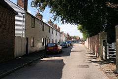 The Street, Ickham | |
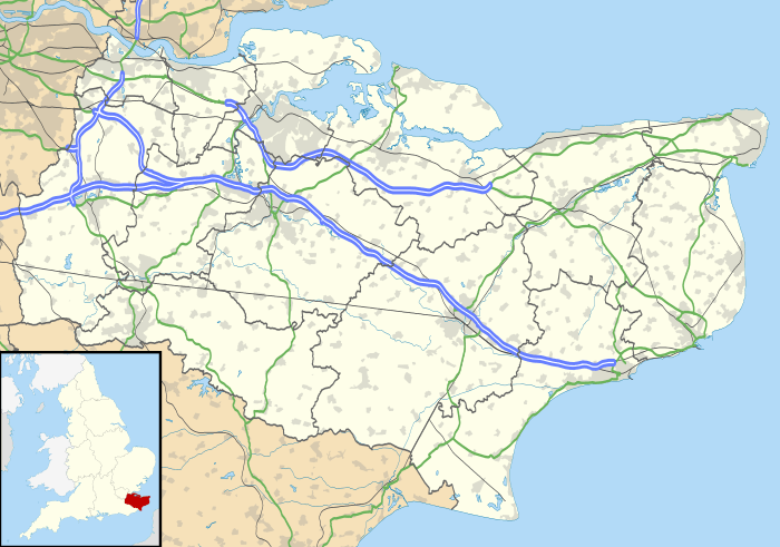 Ickham and Well Location within Kent | |
| Area | 9.3 km2 (3.6 sq mi) |
| Population | 437 (Civil Parish 2011)[1] |
| • Density | 47/km2 (120/sq mi) |
| OS grid reference | TR221581 |
| Civil parish |
|
| District | |
| Shire county | |
| Region | |
| Country | England |
| Sovereign state | United Kingdom |
| Post town | CANTERBURY |
| Postcode district | CT3 |
| Dialling code | 01227 |
| Police | Kent |
| Fire | Kent |
| Ambulance | South East Coast |
| UK Parliament | |
The parish covers the villages of Ickham and Bramling just off the A257 Sandwich Road. It has several listed buildings in architecture of old, well-preserved houses, with the 13th-century Parish Church of St John the Evangelist in the midst. A recent archaeological excavation at Ickham has revealed evidence of Roman metalwork and copper brooches.[2]
Geography
Ickham centres on a single road.
The Rivers Little Stour and Wingham flow through the parish before joining with the Great Stour to become the River Stour.
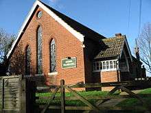
Ickham Village hall
gollark: Those are bad at transcoding and generally have slow storage.
gollark: I don't think your assumptions there are accurate. At all.
gollark: I disagree. Horses are not particularly cool animals.
gollark: Although we don't have the :transistor: emoji.
gollark: The transistor cult is still unofficially extant. You could always join that.
References
- Key Statistics; Quick Statistics: Population Density United Kingdom Census 2011 Office for National Statistics Retrieved 21 November 2013
- Canterbury City Council
External links

Kent Portal | |
| Unitary authorities | |
| Boroughs or districts | |
| Major settlements |
|
| Rivers | See: Rivers of Kent |
| Topics |
|
This article is issued from Wikipedia. The text is licensed under Creative Commons - Attribution - Sharealike. Additional terms may apply for the media files.