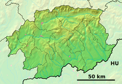
Hrušov, Veľký Krtíš District
Hrušov (Hungarian: Magasmajtény) is a village and municipality in the Veľký Krtíš District of the Banská Bystrica Region of southern Slovakia. Hrušov is located in a historical region Hont.
Hrušov | |
|---|---|
Municipality | |
 Hrušov Location of Hrušov in the Banská Bystrica Region  Hrušov Location of Hrušov in Slovakia | |
| Coordinates: 48°10′N 19°8′E | |
| Country | |
| Region | Banská Bystrica |
| District | Veľký Krtíš |
| First mentioned | 1285 |
| Area | |
| • Total | 23.31 km2 (9.00 sq mi) |
| Elevation | 349 m (1,145 ft) |
| Time zone | UTC+1 (CET) |
| • Summer (DST) | UTC+2 (CEST) |
| Postal code | 991 42 |
| Area code(s) | +421-47 |
| Car plate | VK |
| Website | www.hrusov.sk |
History
In historical records, the village was first mentioned in 1285 (1285 Huruso, 1312 Hurson, 1342 Hruso). It belonged to Bzovík castle and in the 19th century to Hussáry and, after, to Esztergom's ecclesiastical Capitol.
Genealogical resources
The records for genealogical research are available at the state archive "Statny Archiv in Banska Bystrica, Slovakia"
- Roman Catholic church records (births/marriages/deaths): 1787-1894 (parish A)
gollark: Sinthorioformic false flag attack confirmed‽
gollark: Meh, GTech™ mostly has domes.
gollark: Are you sure it wasn't just a LyricTech™ one? Does your monitoring system notice if one utterly stops sending data?
gollark: It says theirs are working fine too.
gollark: GTech™ facilities are all operating at 106% efficiency, I'll check the HTech™ IRC monitoring system/
External links

- Official website

- https://web.archive.org/web/20071217080336/http://www.statistics.sk/mosmis/eng/run.html
- http://www.e-obce.sk/obec/hrusov/hrusov.html
- Surnames of living people in Hrusov
This article is issued from Wikipedia. The text is licensed under Creative Commons - Attribution - Sharealike. Additional terms may apply for the media files.