Čebovce
Čebovce (Hungarian: Csáb) is a village in the Veľký Krtíš District of the Banská Bystrica Region of southern Slovakia.
Čebovce | |
|---|---|
Village | |
 | |
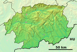 Čebovce Location of Čebovce in the Banská Bystrica Region  Čebovce Čebovce (Slovakia) | |
| Coordinates: 48°11′N 19°14′E | |
| Country | Slovakia |
| Region | Banská Bystrica |
| District | Veľký Krtíš |
| First mentioned | 1052 |
| Area | |
| • Total | 16.21 km2 (6.26 sq mi) |
| Elevation | 225 m (738 ft) |
| Population (2006-12-31) | |
| • Total | 1,037 |
| • Density | 64/km2 (170/sq mi) |
| Postal code | 991 25 |
| Area code(s) | +421-47 |
| Car plate | VK |
History
This Hungarian village was first mentioned in 1240 (as Chab). It belonged to Zichy, Balassa and Somogyi noble families. After World War I, in the Peace Treaties of 1920 it was given to the newly formed Czechoslovakia. From 1938 to 1944 it returned to Hungary but the Paris Peace Treaties in 1946 gave it to Czechoslovakia, again.
Geography
The municipality lies at an altitude of 225 metres and covers an area of 16.21 km2. It has a population of 1,029 people.
Genealogical resources
The records for genealogical research are available at the state archive "Statny Archiv in Banska Bystrica, Slovakia"
- Roman Catholic church records (births/marriages/deaths): 1755-1890 (parish A)
gollark: Actually, huh, I'm not certain if you can, I will recheck.
gollark: You *could* pretend to be a browser, but you would then have to deal with their login page and cookies and stuff.
gollark: <@!426660245738356738> You can actually use use the API for editing pastes.
gollark: Alternatively, it's a bug of some sort with `gfind`, or your pattern takes too long to... process.
gollark: Make sure it yields.
External links
This article is issued from Wikipedia. The text is licensed under Creative Commons - Attribution - Sharealike. Additional terms may apply for the media files.