Hempstead Lake State Park
Hempstead Lake State Park is a 737-acre (2.98 km2) state park located in Nassau County, New York in the United States.[2] The park is located in West Hempstead and is one of three state parks within the Town of Hempstead. There is a quick-access entrance at exit 18 from the Southern State Parkway. The park contains the largest freshwater lake in Nassau County.
| Hempstead Lake State Park | |
|---|---|
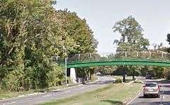
 Peninsula Boulevard as it runs beneath a pedestrian bridge at Hempstead Lake State Park. | |
 Location of Hempstead Lake State Park within New York State | |
| Type | State park |
| Location | Lakeside Drive West Hempstead, New York[1] |
| Coordinates | 40°41′02″N 73°38′24″W |
| Area | 737 acres (2.98 km2)[2] |
| Operated by | New York State Office of Parks, Recreation and Historic Preservation |
| Visitors | 323,863 (in 2014)[3] |
| Open | All year |
| Website | Hempstead Lake State Park |
The park offers picnic tables with pavilions, tennis courts, a playground, playing fields, recreation programs, hiking, biking, a bridle path, fishing, ice fishing, ice skating, cross-country skiing, snowmobiling, and a boat launch. The park contains three ponds for fishing that are stocked with several varieties of fish. Wooded picnic areas provide shade.
History
The central feature of this park is Hempstead Lake, first proposed in 1870 to supply water to Brooklyn, New York. The Mill River,[4] also known as Hempstead Creek was dammed to form the 167-acre[5] reservoir. Following the annexation of Brooklyn by New York City in 1898, the reservoir's use as a source of water declined.
In 1925, the route of Southern State Parkway was laid through the reservoir's grounds, and the property was designated as a state park. The highway originally looped around Hempstead Lake's southern shore between exits 18 and 19. In 1947, an earthen dam was laid across the northern third of Lake Hempstead, straightening the route of the parkway across the lake. A decade later, Peninsula Boulevard was extended along the eastern side of the park partially reusing the parkway's old route.[6]
The reconfiguration of Southern State Parkway created two lakes from the reservoir's northern third: Northeast Pond and Northwest Pond.[7] Excess water exiting Hempstead Lake continues into McDonald Pond and South Pond before leaving the park.
See also
References
- "Hempstead Lake State Park". NYS Office of Parks, Recreation & Historic Preservation. Retrieved September 29, 2016.
- "Section O: Environmental Conservation and Recreation, Table O-9". 2014 New York State Statistical Yearbook (PDF). The Nelson A. Rockefeller Institute of Government. 2014. p. 672. Archived from the original (PDF) on September 16, 2015. Retrieved February 19, 2016.
- "State Park Annual Attendance Figures by Facility: Beginning 2003". Data.ny.gov. Retrieved September 29, 2016.
- Hidden waters of NYC: Mill River, Hempstead
- New York State Department of Environmental Conservation "Hempstead Lake, Hempstead Lake State Park Fishing Information" http://www.dec.ny.gov/outdoor/24167.html
- Anderson, Steve "Southern State Parkway: historical overview NYC Roads http://www.nycroads.com/roads/southern/
- Kadinsky, Sergey "Mill River, Hempstead, NY" Hidden Waters Blog October 16, 2017 https://hiddenwatersblog.wordpress.com/2017/10/16/hempriv/
External links

- New York State Parks: Hempstead Lake State Park
