Grade II listed buildings in Brighton and Hove: S
As of February 2001, there were 1,124 listed buildings with Grade II status in the English city of Brighton and Hove.[2] The total at 2009 was similar.[3] The city, on the English Channel coast approximately 52 miles (84 km) south of London, was formed as a unitary authority in 1997 by the merger of the neighbouring towns of Brighton and Hove. Queen Elizabeth II granted city status in 2000.[4]
_(NHLE_Code_1187598)_(August_2013)_(3).JPG)
In England, a building or structure is defined as "listed" when it is placed on a statutory register of buildings of "special architectural or historic interest" by the Secretary of State for Culture, Media and Sport, a Government department, in accordance with the Planning (Listed Buildings and Conservation Areas) Act 1990.[5] English Heritage, a non-departmental public body, acts as an agency of this department to administer the process and advise the department on relevant issues.[6] There are three grades of listing status. The Grade II designation is the lowest, and is used for "nationally important buildings of special interest".[7] Grade II* is used for "particularly important buildings of more than special interest";[7] there are 69 such buildings in the city. There are also 24 Grade I listed buildings (defined as being of "exceptional interest" and greater than national importance, and the highest of the three grades)[7] in Brighton and Hove.
This list summarises 133 Grade II-listed buildings and structures whose names begin with S. Numbered buildings with no individual name are listed by the name of the street they stand on. Some listings include contributory fixtures such as surrounding walls or railings in front of the building. These are summarised by notes alongside the building name.
Listed buildings
| Note | Listing includes |
| [A] | Attached railings |
| [B] | Attached railings and piers |
| [C] | Attached railings and wall bracket |
| [D] | Attached walls |
| [E] | Attached walls and railings |
| [F] | Attached walls, piers and gate |
| [G] | Attached walls, piers and railings |
| Building name | Area | Image | Notes | Refs |
| St Anne's Convent (former) (More images) | Hove 50.8277°N 0.1556°W | %2C_Lansdowne_Road%2C_Hove_(NHLE_Code_1206258)_(January_2012)_(1).jpg) | The building has early 19th-century origins as a villa called Wick Lodge. It was extended before 1909, when it was in use as "a school for ladies"; then in 1947 it was acquired by the Poor Servants of the Mother of God. When listed in 1971 it was a day centre; later, a Buddhist group bought it and converted the main building into a cultural centre and the three-bay chapel into a shrine and registered place of worship. The building is Classical/Greek Revival in style, of brick and painted render, with a three-bay south façade and nine bays to the west. | [8][9] |
| St Anne's Convent Lodge | Hove 50.8274°N 0.1564°W | _(January_2012).JPG) | Like the adjacent villa to which it was the lodge, this building (now in residential use and known as St Michael's Lodge) dates from the early 19th century and is Classical in style. The symmetrical façade has one storey with three bays, on which a projecting Doric porch flanked by round-arched windows. At the northeast corner there is a two-storey extension. | [10] |
| 2, 4 and 6 St Aubyns[B] | Hove 50.8256°N 0.1780°W | _(August_2010).jpg) | . | [11] |
| St Aubyns School (former) | Rottingdean 50.8044°N 0.0575°W | _(August_2010).JPG) | . | [12] |
| St Augustine's Church (More images) | Preston Park 50.8383°N 0.1399°W | _(February_2020)_(8).JPG) | This former Anglican church, which closed in 2003, opened in 1896 and was extended in 1914. It served the areas of middle-class housing around Stanford Avenue and the south end of Preston Park. Granville Streatfield designed it in the Perpendicular Gothic style. Built of red brick with stone dressings, it has a long nave and chancel (5½ and 4 bays respectively); the latter has an apse supported by a series of flying buttresses. | [13][14] [15] |
| 2–5 St Catherine's Terrace[A] | Hove 50.8250°N 0.1727°W | _(September_2013)_(1).jpg) | . | [16] |
| St Christopher's Inn (former Princes Hotel)[A] (More images) | Brighton 50.8196°N 0.1383°W | %2C_Grand_Junction_Road%2C_Brighton_(NHLE_Code_1380519)_(January_2017)_(2).JPG) | . | [17] |
| St George's Church[A] (More images) | Kemp Town 50.8182°N 0.1193°W | _(April_2013)_(3).jpg) | . | [18] |
| 1a–13 St George's Place[A] | Brighton 50.8273°N 0.1357°W | _(June_2019).JPG) | . | [19] |
| 14 St George's Place | Brighton 50.8277°N 0.1357°W | _(September_2010).jpg) | . | [20] |
| 2 St George's Road | Kemptown 50.8195°N 0.1243°W | _(July_2010).jpg) | . | [21] |
| 73–83 St George's Road | Kemptown 50.8177°N 0.1184°W | _(July_2010).jpg) | . | [22] |
| 10 St George's Terrace[A] | Kemptown 50.8198°N 0.1254°W | _(July_2010).jpg) | . | [23] |
| 11–14 St George's Terrace[A] | Kemptown 50.8197°N 0.1253°W | _(June_2010).JPG) | . | [24] |
| 1–6 St James's Place[A] | Kemptown 50.8216°N 0.1354°W | _(September_2010).jpg) | . | [25] |
| 1–4 St James's Street | Kemptown 50.8211°N 0.1358°W | _(September_2010).jpg) | . | [26] |
| 9 St James's Street | Kemptown 50.8211°N 0.1353°W | _(September_2010).jpg) | . | [27] |
| 87 and 87a St James's Street[A] | Kemptown 50.8205°N 0.1329°W | _(September_2010).jpg) | . | [28] |
| 88 St James's Street | Kemptown 50.8205°N 0.1326°W | _(September_2010).jpg) | . | [29] |
| 89 St James's Street | Kemptown 50.8206°N 0.1327°W | _(September_2010).jpg) | . | [30] |
| 90 St James's Street | Kemptown 50.8206°N 0.1328°W | _(September_2010).jpg) | . | [31] |
| 95–99 St James's Street | Kemptown 50.8206°N 0.1333°W | _(September_2010).jpg) | . | [32] |
| 101 St James's Street | Kemptown 50.8207°N 0.1336°W | _(September_2010).jpg) | . | [33] |
| 102 St James's Street | Kemptown 50.8207°N 0.1337°W | _(September_2010).jpg) | . | [34] |
| 107–111a St James's Street[A] | Kemptown 50.8208°N 0.1343°W | _(September_2010).jpg) | . | [35] |
| 116 and 117 St James's Street | Kemptown 50.8209°N 0.1352°W | _(September_2010).jpg) | . | [36] |
| 118 St James's Street | Kemptown 50.8208°N 0.1353°W | _(September_2010).jpg) | . | [37] |
| 120 and 121 St James's Street | Kemptown 50.8209°N 0.1355°W | _(September_2010).jpg) | . | [38] |
| 124 St James's Street | Kemptown 50.8209°N 0.1358°W | _(September_2010).jpg) | . | [39] |
| 130 St James's Street | Kemptown 50.8210°N 0.1362°W | _(January_2012).JPG) | . | [40] |
| St John the Baptist's Church (More images) | Hove 50.8268°N 0.1650°W | _(May_2019)_(4).jpg) | . | [41] |
| St John the Evangelist's Church (More images) | Preston Village 50.8444°N 0.1511°W | _(August_2013)_(3).JPG) | . | [42] |
| 1–7 St John's Place | Hove 50.8267°N 0.1654°W | _(August_2010).jpg) | . | [43] |
| St Joseph's Convent of Mercy (former) (More images) | Kemptown 50.8191°N 0.1249°W | %2C_13_Bristol_Road%2C_Kemptown%2C_Brighton_(NHLE_Code_1380029)_(January_2012)_(1).jpg) | . | [44] |
| St Joseph's Rest Home[A] | Kemptown 50.8193°N 0.1256°W | _(July_2015).jpg) | . | [45] |
| St Joseph's Rest Home Chapel | Kemptown 50.8193°N 0.1255°W | _(July_2010).jpg) | . | [46] |
| St Leonard's Church (More images) | Aldrington 50.8329°N 0.2038°W | _(December_2019)_(6).JPG) | . | [47] |
| St Luke's Church (More images) | Queen's Park 50.8276°N 0.1242°W | _(July_2019)_(2).JPG) | . | [48] |
| St Luke's School (More images) | Queen's Park 50.8270°N 0.1214°W | _(January_2015).JPG) | . | [49] |
| St Luke's Swimming Baths | Queen's Park 50.8275°N 0.1227°W | _(July_2010).jpg) | . | [50] |
| 10 St Luke's Terrace | Queen's Park 50.8274°N 0.1224°W | _(July_2010).jpg) | . | [51] |
| 2 and 3 St Margaret's Place[A] | Brighton 50.8226°N 0.1480°W | _(December_2010).jpg) | . | [52] |
| St Mark's Church (former) (More images) | Kemptown 50.8177°N 0.1120°W | _(February_2014)_(1).jpg) | . | [53] |
| St Mary's Convent (More images) | Portslade 50.8433°N 0.2174°W | _(August_2010)_(1).JPG) | . | [54] |
| St Mary's Hall School[G] | Kemptown 50.8183°N 0.1132°W | _(July_2010).jpg) | . | [55] |
| St Mary's Church (More images) | Preston Park 50.8448°N 0.1460°W | _(November_2015)_(1).jpg) | . | [56] |
| St Mary Magdalen's Church[E] (More images) | Brighton 50.8255°N 0.1496°W | .JPG) | . | [57] |
| St Mary Magdalen's Church: Clergy House[D] | Brighton 50.8255°N 0.1493°W | _(July_2010).jpg) | . | [58] |
| St Mary Magdalen's Church: school buildings | Brighton 50.8256°N 0.1499°W | _(July_2010).jpg) | . | [59] |
| St Patrick's Church (More images) | Hove 50.8260°N 0.1575°W | _(September_2018).jpg) | . | [60] |
| St Peter's Church (More images) | Aldrington 50.8334°N 0.1848°W | _(March_2020)_(1).jpg) | . | [61] |
| St Peter's Church Hall | Aldrington 50.8336°N 0.1849°W | _(October_2014).JPG) | . | [62] |
| 1–3 St Peter's Place | Brighton 50.8295°N 0.1354°W | _(September_2010).jpg) | . | [63] |
| 4–9 St Peter's Place[A] | Brighton 50.8295°N 0.1351°W | _(January_2012).JPG) | . | [64] |
| St Philip's Church (More images) | Aldrington 50.8306°N 0.1889°W | _(September_2012)_(7).JPG) | . | [65] |
| St Stephen's Schools (former) (More images) | Brighton 50.8255°N 0.1538°W | _(December_2017)_(3).JPG) | . | [66] |
| St Wilfrid's Church (former) (More images) | Elm Grove 50.8317°N 0.1210°W | _(September_2018)_(1).JPG) | . | [67] |
| Saltdean Barn[D] | Saltdean 50.8045°N 0.0408°W | _(August_2010).JPG) | The first houses in Saltdean date from the early 1920s, just before it was incorporated into the Borough of Brighton, but this barn was built no later than the mid-19th century. It retains its original cart entrance, and is built of flint dressed with red brick. | [68][69] |
| 123 Saltdean Vale | Saltdean 50.8100°N 0.0355°W | _(August_2010).JPG) | This is another barn of the mid-19th century, originally known as Newlands Barn. The main structure and a lower section attached to the east end are both now in residential use. There is a cart entrance on the east face, and the walls are of flint dressed with red brick. | [70] |
| Sassoon Mausoleum (More images) | Kemptown 50.8178°N 0.1189°W | _(April_2013)_(1).JPG) | . | [71] |
| Seat next to East Pylon | Patcham 50.8807°N 0.1651°W | . | [72] | |
| Seat next to West Pylon | Patcham 50.8806°N 0.1654°W | %2C_Patcham_(NHLE_Code_1381682).jpg) | . | [73] |
| 11a Second Avenue | Hove 50.8267°N 0.1665°W | _(July_2010).jpg) | . | [74] |
| 21 Second Avenue[E] | Hove 50.8254°N 0.1670°W | _(July_2010).jpg) | . | [75] |
| 24 Second Avenue | Hove 50.8249°N 0.1670°W | _(July_2010).jpg) | . | [76] |
| Secret Garden (More images) | Kemptown 50.8176°N 0.1082°W | _(September_2019)_(1).JPG) | . | [77] |
| Seven Stars Inn (More images) | The Lanes 50.8223°N 0.1419°W | _(September_2019)_(1).JPG) | . | [78] |
| Shelter on King's Esplanade (near Lansdowne Place) | Hove 50.8224°N 0.1578°W | _(NHLE_Code_1280525)_(January_2012).jpg) | . | [79] |
| Shelter on King's Esplanade (near Waterloo Street) | Hove 50.8229°N 0.1620°W | %2C_Hove_(NHLE_Code_1187563)_(January_2012).jpg) | . | [80] |
| Shelter on Western Esplanade (near Berriedale Avenue) | Hove 50.8252°N 0.1940°W | _(NHLE_Code_1292365)_(August_2013)_(2).JPG) | . | [81] |
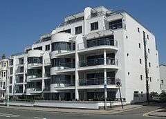
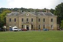
| Shelter on Western Esplanade (near Hove Lagoon) | Hove 50.8261°N 0.1982°W | _(NHLE_Code_1187598)_(August_2013)_(2).JPG) | . | [1] |
| Shelter on Western Esplanade (near Langdale Gardens) | Hove 50.8251°N 0.1926°W | _(NHLE_Code_1210002)_(August_2013)_(2).JPG) | . | [82] |
| Shelter opposite Eaton Place | East Cliff 50.8163°N 0.1170°W | _(September_2018).JPG) | . | [83] |
| Shelter opposite Grand Hotel | Brighton 50.8210°N 0.1475°W | _(July_2010).jpg) | . | [84] |
| Shelter opposite Lower Rock Gardens | East Cliff 50.8190°N 0.1306°W | _(June_2010).jpg) | . | [85] |
| Shelter opposite Marine Square | East Cliff 50.8173°N 0.1221°W | _(June_2010).jpg) | . | [86] |
| Shelter opposite Metropole Hotel | Brighton 50.8212°N 0.1487°W | _(July_2010).jpg) | . | [87] |
| Shelter opposite Oriental Place | Brighton 50.8221°N 0.1540°W | _(August_2010).jpg) | . | [88] |
| Shelter opposite Preston Street | Brighton 50.8217°N 0.1516°W | _(July_2010).jpg) | . | [89] |
| Shelter opposite Ship Street | Brighton 50.8201°N 0.1422°W | _(December_2010).jpg) | . | [90] |
| Shelter opposite Western Street | Brighton 50.8225°N 0.1564°W | _(July_2010).jpg) | . | [91] |
| 7 Ship Street | The Lanes 50.8209°N 0.1423°W | _(July_2010).jpg) | . | [92] |
| 8 Ship Street | The Lanes 50.8210°N 0.1423°W | _(July_2010).jpg) | . | [93] |
| 14 Ship Street | The Lanes 50.8213°N 0.1421°W | _(July_2010).jpg) | . | [94] |
| 14a Ship Street | The Lanes 50.8214°N 0.1421°W | _(July_2010).jpg) | . | [95] |
| 15 Ship Street and Ship Street Chambers | The Lanes 50.8215°N 0.1421°W | _(July_2010).jpg) | . | [96] |
| 16 and 17 Ship Street[A] | The Lanes 50.8216°N 0.1420°W | _(July_2010).jpg) | . | [97] |
| 22 Ship Street | The Lanes 50.8219°N 0.1418°W | _(March_2014).jpg) | . | [98] |
| 28 and 29 Ship Street | The Lanes 50.8224°N 0.1417°W | _(July_2010).jpg) | . | [99] |
| 53–55 Ship Street | The Lanes 50.8224°N 0.1415°W | _(July_2010).jpg) | . | [100] |
| 57 Ship Street[C] | The Lanes 50.8221°N 0.1414°W | _(July_2010).jpg) | . | [101] |
| 58 Ship Street[A] | The Lanes 50.8220°N 0.1415°W | _(July_2010).jpg) | . | [102] |
| 59 Ship Street | The Lanes 50.8217°N 0.1417°W | _(August_2010).jpg) | . | [103] |
| 62 Ship Street | The Lanes 50.8215°N 0.1418°W | _(July_2010).jpg) | . | [104] |
| 63 Ship Street | The Lanes 50.8215°N 0.1417°W | _(July_2010).jpg) | . | [105] |
| 64 Ship Street | The Lanes 50.8214°N 0.1418°W | _(July_2010).jpg) | . | [106] |
| 68 Ship Street | The Lanes 50.8211°N 0.1419°W | _(July_2010).jpg) | . | [107] |
| 69 Ship Street | The Lanes 50.8210°N 0.1420°W | _(July_2010).jpg) | . | [108] |
| 13–16 Ship Street Gardens | The Lanes 50.8215°N 0.1423°W | _(July_2010).jpg) | . | [109] |
| 1–8 Sillwood Place | Brighton 50.8236°N 0.1528°W | _(July_2010)_(1).jpg) | . | [110] |
| 9 Sillwood Place[A] | Brighton 50.8238°N 0.1526°W | _(July_2010).jpg) | . | [111] |
| 10 and 11 Sillwood Place | Brighton 50.8239°N 0.1526°W | _(July_2010).jpg) | . | [112] |
| 13 and 14 Sillwood Road | Brighton 50.8238°N 0.1514°W | _(July_2010).jpg) | . | [113] |
| 32–47 Sillwood Road[E] | Brighton 50.8239°N 0.1518°W | _(July_2010).jpg) | . | [114] |
| Smugglers Inn | The Lanes 50.8211°N 0.1423°W | _(July_2010).jpg) | . | [115] |
| South African War Memorial (More images) | Brighton 50.8218°N 0.1507°W | _(March_2014).JPG) | . | [116] |
| South Gate of the Royal Pavilion[F] (More images) | Brighton 50.8223°N 0.1383°W | _(January_2012).JPG) | . | [117] |
| 7, 9 and 11 South Road | Preston Village 50.8422°N 0.1520°W | _(September_2011)_(3).jpg) | . | [118] |
| Stable block at Patcham Place | Patcham 50.8647°N 0.1532°W | _(August_2010).JPG) | . | [119] |
| Stables at Ovingdean Grange (former) | Ovingdean 50.8165°N 0.0758°W | _(February_2011).JPG) | . | [120] |
| Stables at The Timbers (former) | Rottingdean 50.8067°N 0.0596°W | _(August_2010).JPG) | . | [121] |
| Stag's Head pub (More images) | Portslade 50.8432°N 0.2205°W | _(December_2019)_(1).JPG) | . | [122] |
| Stanford Junior School[G] (More images) | Prestonville 50.8358°N 0.1476°W | %2C_Prestonville%2C_Brighton_(December_2013)_(2).JPG) | . | [123] |
| Stanmer Church (More images) | Stanmer 50.8703°N 0.1019°W | _(4).JPG) | . | [124] |
| 1 and 2 Stanmer Park | Stanmer 50.8723°N 0.1019°W | _(February_2010).jpg) | . | [125] |
| 3–6 Stanmer Park | Stanmer 50.8726°N 0.1020°W | _(April_2013).JPG) | . | [126] |
| 7–10 Stanmer Park | Stanmer 50.8726°N 0.1016°W | _(April_2013).JPG) | . | [127] |
| 13–16 Stanmer Park | Stanmer 50.8721°N 0.1016°W | _(February_2010).jpg) | . | [128] |
| Stanmer Park Lower Lodge (north) (More images) | Stanmer 50.8619°N 0.0930°W | %2C_Stanmer_(NHLE_Code_1380953)_(April_2013)_(2).JPG) | . | [129] |
| Stanmer Park Lower Lodge (south) (More images) | Stanmer 50.8618°N 0.0932°W | %2C_Stanmer_(NHLE_Code_1380954)_(April_2013).JPG) | . | [130] |
| Star Inn (More images) | Kemptown 50.8207°N 0.1357°W | %2C_7%E2%80%939_Manchester_Street%2C_Brighton_(NHLE_Code_1381703)_(September_2015).JPG) | . | [131] |
| Statue of King Edward VII (Peace Memorial) (More images) | Brighton 50.8225°N 0.1570°W | %2C_King's_Road%2C_Brighton_(NHLE_Code_1381644)_(July_2010).jpg) | . | [132] |
| Statue of King George IV (More images) | Brighton 50.8234°N 0.1369°W | _(July_2010).jpg) | . | [133] |
| Statue of Queen Victoria, Grand Avenue (More images) | Hove 50.8246°N 0.1693°W | _(January_2017)_(1).JPG) | . | [134] |
| Statue of Queen Victoria, Victoria Gardens (More images) | Brighton 50.8238°N 0.1366°W | _(July_2010).jpg) | . | [135] |
| Statue of Sir John Cordy Burrows (More images) | Brighton 50.8204°N 0.1379°W | .jpg) | . | [136] |
| Steine House[G] (More images) | Brighton 50.8212°N 0.1384°W | %2C_55_Old_Steine%2C_Brighton_(NHLE_Code_1380672)_(May_2018)_(1).jpg) | . | [137] |
| 1 Steine Lane[A] | Brighton 50.8213°N 0.1384°W | _(September_2010).jpg) | . | [138] |
| 13a and 14 Stone Street | Brighton 50.8241°N 0.1504°W | _(October_2012)_(2).JPG) | . | [139] |
| Store shed at Stanmer Park | Stanmer 50.8695°N 0.1043°W | _(April_2013).JPG) | . | [140] |
| Studio at St Margaret's School (former) | Rottingdean 50.8062°N 0.0566°W | _(August_2010).JPG) | . | [141] |
| Sussex Masonic Club | Brighton 50.8257°N 0.1429°W | _(October_2011).jpg) | . | [142] |
| Sussex Tavern (More images) | The Lanes 50.8213°N 0.1395°W | _(August_2010).JPG) | . | [143] |
See also
References
Notes
- Historic England. "Shelter at TQ 270 045, Western Esplanade (Grade II) (1187598)". National Heritage List for England. Retrieved 15 May 2020.
- "Images of England — Statistics by County (East Sussex)". Images of England. English Heritage. 2007. Archived from the original on 27 December 2012. Retrieved 27 December 2012.
- Collis 2010, p. 178.
- "Our city by the sea". The Argus. Newsquest Media Group. 18 December 2000. Archived from the original on 17 February 2013. Retrieved 17 February 2013.
- "Planning (Listed Buildings and Conservation Areas) Act 1990 (c. 9)". The UK Statute Law Database. Ministry of Justice. 24 May 1990. Archived from the original on 24 January 2013. Retrieved 11 November 2012.
- "What English Heritage Does". English Heritage. 2012. Archived from the original on 24 January 2013. Retrieved 24 January 2013.
- "Listed Buildings". English Heritage. 2012. Archived from the original on 24 January 2013. Retrieved 24 January 2013.
- Historic England. "St Anne's Convent, Lansdowne Road, BN3 1DN (Grade II) (1206258)". National Heritage List for England. Retrieved 15 May 2020.
- Middleton 2002, Vol. 15, p. 93.
- Historic England. "Lodge to St Anne's Convent, Lansdowne Road, BN3 1DN (Grade II) (1298641)". National Heritage List for England. Retrieved 15 May 2020.
- Historic England. "Nos 2-6 (even) Including Piers and Railings 2-6, St Aubyns, BN3 2TB (Grade II) (1292549)". National Heritage List for England. Retrieved 15 May 2020.
- Historic England. "St Aubyns School 76, High Street (Grade II) (1381622)". National Heritage List for England. Retrieved 15 May 2020.
- Historic England. "Church of St Augustine, Stanford Avenue (Grade II) (1380950)". National Heritage List for England. Retrieved 15 May 2020.
- Carder 1990, §130.
- Elleray 2004, p. 7.
- Historic England. "St Catherine's Terrace and Attached Railings 2-5, Kingsway, BN3 2RR (Grade II) (1280426)". National Heritage List for England. Retrieved 15 May 2020.
- Historic England. "Princes Hotel and Attached Railings, Grand Junction Road (Grade II) (1380519)". National Heritage List for England. Retrieved 15 May 2020.
- Historic England. "Church of St George the Martyr and Railings, St Georges Road (Grade II) (1380852)". National Heritage List for England. Retrieved 15 May 2020.
- Historic England. "Numbers 1a-13 and Attached Railings 1a-13, St Georges Place (Grade II) (1380848)". National Heritage List for England. Retrieved 15 May 2020.
- Historic England. "14, St Georges Place (Grade II) (1380849)". National Heritage List for England. Retrieved 15 May 2020.
- Historic England. "2, St Georges Road (Grade II) (1380850)". National Heritage List for England. Retrieved 15 May 2020.
- Historic England. "73-83, St Georges Road (Grade II) (1380851)". National Heritage List for England. Retrieved 15 May 2020.
- Historic England. "Number 10 and Attached Railings 10, St Georges Terrace (Grade II) (1380855)". National Heritage List for England. Retrieved 15 May 2020.
- Historic England. "Numbers 11-14 and Attached Railings 11-14, St George's Terrace (Grade II) (1380856)". National Heritage List for England. Retrieved 15 May 2020.
- Historic England. "Numbers 1-6 and Attached Railings 1-6, St James's Place (Grade II) (1380857)". National Heritage List for England. Retrieved 15 May 2020.
- Historic England. "1-4, St James's Street (Grade II) (1380861)". National Heritage List for England. Retrieved 15 May 2020.
- Historic England. "9, St James's Street (Grade II) (1380862)". National Heritage List for England. Retrieved 15 May 2020.
- Historic England. "Numbers 87 and 87a and Attached Railings 87 and 87a, St James's Street (Grade II) (1380863)". National Heritage List for England. Retrieved 15 May 2020.
- Historic England. "88, St James's Street (Grade II) (1380864)". National Heritage List for England. Retrieved 15 May 2020.
- Historic England. "89, St James's Street (Grade II) (1380865)". National Heritage List for England. Retrieved 15 May 2020.
- Historic England. "90, St James's Street (Grade II) (1380866)". National Heritage List for England. Retrieved 15 May 2020.
- Historic England. "95-99, St James's Street (Grade II) (1380868)". National Heritage List for England. Retrieved 15 May 2020.
- Historic England. "101, St James's Street (Grade II) (1380869)". National Heritage List for England. Retrieved 15 May 2020.
- Historic England. "102, St James's Street (Grade II) (1380870)". National Heritage List for England. Retrieved 15 May 2020.
- Historic England. "Numbers 107-111a and Attached Railings 107-111a, St James's Street (Grade II) (1380873)". National Heritage List for England. Retrieved 15 May 2020.
- Historic England. "116 and 117, St James's Street (Grade II) (1380874)". National Heritage List for England. Retrieved 15 May 2020.
- Historic England. "118, St James's Street (Grade II) (1380875)". National Heritage List for England. Retrieved 15 May 2020.
- Historic England. "120 and 121, St James's Street (Grade II) (1380877)". National Heritage List for England. Retrieved 15 May 2020.
- Historic England. "124, St James's Street (Grade II) (1380881)". National Heritage List for England. Retrieved 15 May 2020.
- Historic England. "130, St James's Street (Grade II) (1380882)". National Heritage List for England. Retrieved 15 May 2020.
- Historic England. "Church of St John the Baptist, Church Road, BN3 2EG (Grade II) (1187551)". National Heritage List for England. Retrieved 15 May 2020.
- Historic England. "Church of St John the Evangelist, Preston Road (Grade II) (1380756)". National Heritage List for England. Retrieved 15 May 2020.
- Historic England. "1-7, St John's Place, BN3 2FJ (Grade II) (1280737)". National Heritage List for England. Retrieved 15 May 2020.
- Historic England. "St Josephs Convent of Mercy 13, Bristol Road (Grade II) (1380029)". National Heritage List for England. Retrieved 15 May 2020.
- Historic England. "St Josephs Convent and Attached Railings 4, Bristol Road (Grade II) (1380027)". National Heritage List for England. Retrieved 15 May 2020.
- Historic England. "Chapel of St Josephs Convent, Bristol Road (Grade II) (1380028)". National Heritage List for England. Retrieved 15 May 2020.
- Historic England. "Church of St Leonard, New Church Road, BN3 4AB (Grade II) (1298645)". National Heritage List for England. Retrieved 15 May 2020.
- Historic England. "Church of St Luke, Queens Park Terrace (Grade II) (1380790)". National Heritage List for England. Retrieved 15 May 2020.
- Historic England. "St Lukes School, St Lukes Terrace (Grade II) (1380894)". National Heritage List for England. Retrieved 15 May 2020.
- Historic England. "St Lukes Pool, St Lukes Terrace (Grade II) (1380895)". National Heritage List for England. Retrieved 15 May 2020.
- Historic England. "Caretakers House 10, St Lukes Terrace (Grade II) (1380888)". National Heritage List for England. Retrieved 15 May 2020.
- Historic England. "Numbers 2 and 3 and Attached Railings 2 and 3, St Margarets Place (Grade II) (1380898)". National Heritage List for England. Retrieved 15 May 2020.
- Historic England. "Church of St Mark, Eastern Road (Grade II) (1380483)". National Heritage List for England. Retrieved 15 May 2020.
- Historic England. "St Mary's Convent, Manor Road, BN3 5SG (Grade II) (1298643)". National Heritage List for England. Retrieved 15 May 2020.
- Historic England. "St Marys Hall School and Attached Railings Terrace Walls and Piers, Eastern Road (Grade II) (1380484)". National Heritage List for England. Retrieved 15 May 2020.
- Historic England. "Roman Catholic Church of St Mary, 5 Surrenden Road, Preston Park, Brighton, BN1 6PA (Grade II) (1426315)". National Heritage List for England. Retrieved 15 May 2020.
- Historic England. "Church of St Mary Magdalene and Attached Walls and Railings, Upper North Street (Grade II) (1381058)". National Heritage List for England. Retrieved 15 May 2020.
- Historic England. "Clergy House to Church of St Mary Magdalene and Attached Wall 55, Upper North Street (Grade II) (1381055)". National Heritage List for England. Retrieved 15 May 2020.
- Historic England. "School Buildings Next to Church of St Mary Magdalene, Upper North Street (Grade II) (1381059)". National Heritage List for England. Retrieved 15 May 2020.
- Historic England. "Church of St Patrick and Wall Fronting Road, Cambridge Road (Grade II) (1280980)". National Heritage List for England. Retrieved 15 May 2020.
- Historic England. "Roman Catholic Church of St Peter and Presbytery, Tamworth Road, BN3 4AB (Grade II) (1209728)". National Heritage List for England. Retrieved 15 May 2020.
- Historic England. "Church Hall of St Peter's Roman Catholic Church, Tamworth Road, BN3 4AB (Grade II) (1298649)". National Heritage List for England. Retrieved 15 May 2020.
- Historic England. "1, 2 and 3, St Peters Place (Grade II) (1380899)". National Heritage List for England. Retrieved 15 May 2020.
- Historic England. "Numbers 4-9 and Attached Railings 4-9, St Peters Place (Grade II) (1380902)". National Heritage List for England. Retrieved 15 May 2020.
- Historic England. "Church of St Philip, New Church Road, BN3 4AB (Grade II) (1187579)". National Heritage List for England. Retrieved 15 May 2020.
- Historic England. "Former St Stephens Schools, Borough Street, BN1 3BG (Grade II) (1380019)". National Heritage List for England. Retrieved 15 May 2020.
- Historic England. "St Wilfrids Flats, Elm Grove (Grade II) (1380499)". National Heritage List for England. Retrieved 15 May 2020.
- Historic England. "Saltdean Barn and Attached Walls, Saltdean Park (Grade II) (1380904)". National Heritage List for England. Retrieved 15 May 2020.
- Clunn 1953, p. 116.
- Historic England. "123, Saltdean Vale (Grade II) (1381692)". National Heritage List for England. Retrieved 15 May 2020.
- Historic England. "The Hanbury Arms Public House 83, St Georges Road (Grade II) (1380706)". National Heritage List for England. Retrieved 15 May 2020.
- Historic England. "Seat Next to the East Pylon, London Road (Grade II) (1381680)". National Heritage List for England. Retrieved 15 May 2020.
- Historic England. "Seat Next to the West Pylon, London Road (Grade II) (1381682)". National Heritage List for England. Retrieved 15 May 2020.
- Historic England. "11a, Second Avenue, BN3 2LL (Grade II) (1187582)". National Heritage List for England. Retrieved 15 May 2020.
- Historic England. "No 21 Including Walls and Railings 21, Second Avenue, BN3 2LL (Grade II) (1292517)". National Heritage List for England. Retrieved 15 May 2020.
- Historic England. "24, Second Avenue, BN3 2LN (Grade II) (1187583)". National Heritage List for England. Retrieved 15 May 2020.
- Historic England. "North, south and west garden walls, vault and garden structures comprising the Secret Garden, Kemp Town, Brighton (Grade II) (1415852)". National Heritage List for England. Retrieved 15 May 2020.
- Historic England. "O'Neils Public House 27, Ship Street (Grade II) (1380936)". National Heritage List for England. Retrieved 15 May 2020.
- Historic England. "Shelter at TQ 298 041, King's Esplanade (Grade II) (1280525)". National Heritage List for England. Retrieved 15 May 2020.
- Historic England. "Shelter at TQ 296 042, King's Esplanade (Grade II) (1187563)". National Heritage List for England. Retrieved 15 May 2020.
- Historic England. "Shelter at TQ 273 044, Western Esplanade (Grade II) (1292365)". National Heritage List for England. Retrieved 15 May 2020.
- Historic England. "Shelter at TQ 274 044, Western Esplanade (Grade II) (1210002)". National Heritage List for England. Retrieved 15 May 2020.
- Historic England. "Shelter Opposite the End of Eaton Place, Marine Parade (Grade II) (1381758)". National Heritage List for England. Retrieved 15 May 2020.
- Historic England. "Shelter Opposite the Grand Hotel, Kings Road (Grade II) (1381651)". National Heritage List for England. Retrieved 15 May 2020.
- Historic England. "Shelter Facing the End of Lower Rock Gardens, Marine Parade (Grade II) (1381756)". National Heritage List for England. Retrieved 15 May 2020.
- Historic England. "Shelter Opposite Marine Square, Marine Parade (Grade II) (1381757)". National Heritage List for England. Retrieved 15 May 2020.
- Historic England. "Shelter Opposite the Metropole Hotel, Kings Road (Grade II) (1381652)". National Heritage List for England. Retrieved 15 May 2020.
- Historic England. "Shelter Facing the End of Oriental Place, Kings Road (Grade II) (1381648)". National Heritage List for England. Retrieved 15 May 2020.
- Historic England. "Shelter Facing the End of Preston Street, Kings Road (Grade II) (1381649)". National Heritage List for England. Retrieved 15 May 2020.
- Historic England. "Shelter Facing the End of Ship Street, Kings Road (Grade II) (1381650)". National Heritage List for England. Retrieved 15 May 2020.
- Historic England. "Shelter Opposite the End of Western Street, Kings Road (Grade II) (1381653)". National Heritage List for England. Retrieved 15 May 2020.
- Historic England. "7, Ship Street (Grade II) (1380906)". National Heritage List for England. Retrieved 15 May 2020.
- Historic England. "8, Ship Street (Grade II) (1380907)". National Heritage List for England. Retrieved 15 May 2020.
- Historic England. "14, Ship Street (Grade II) (1380909)". National Heritage List for England. Retrieved 15 May 2020.
- Historic England. "14a, Ship Street (Grade II) (1380913)". National Heritage List for England. Retrieved 15 May 2020.
- Historic England. "Number 15 and Ship Street Chambers 15, Ship Street (Grade II) (1380914)". National Heritage List for England. Retrieved 15 May 2020.
- Historic England. "Numbers 16 and 17 and Attached Railings 16 and 17, Ship Street (Grade II) (1380915)". National Heritage List for England. Retrieved 15 May 2020.
- Historic England. "22, Ship Street (Grade II) (1380916)". National Heritage List for England. Retrieved 15 May 2020.
- Historic England. "28 and 29, Ship Street (Grade II) (1380918)". National Heritage List for England. Retrieved 15 May 2020.
- Historic England. "53, 54 and 55, Ship Street (Grade II) (1380920)". National Heritage List for England. Retrieved 15 May 2020.
- Historic England. "Number 57 and Attached Railings and Wall Bracket 57, Ship Street (Grade II) (1380921)". National Heritage List for England. Retrieved 15 May 2020.
- Historic England. "Number 58 and Attached Railings 58, Ship Street (Grade II) (1380922)". National Heritage List for England. Retrieved 15 May 2020.
- Historic England. "59, Ship Street (Grade II) (1380923)". National Heritage List for England. Retrieved 15 May 2020.
- Historic England. "62, Ship Street (Grade II) (1380924)". National Heritage List for England. Retrieved 15 May 2020.
- Historic England. "63, Ship Street (Grade II) (1380926)". National Heritage List for England. Retrieved 15 May 2020.
- Historic England. "64, Ship Street (Grade II) (1380927)". National Heritage List for England. Retrieved 15 May 2020.
- Historic England. "68, Ship Street (Grade II) (1380929)". National Heritage List for England. Retrieved 15 May 2020.
- Historic England. "69, Ship Street (Grade II) (1380931)". National Heritage List for England. Retrieved 15 May 2020.
- Historic England. "13-16, Ship Street Gardens (Grade II) (1380937)". National Heritage List for England. Retrieved 15 May 2020.
- Historic England. "1-8, Sillwood Place (Grade II) (1380938)". National Heritage List for England. Retrieved 15 May 2020.
- Historic England. "Number 9 and Attached Railings 9, Sillwood Place (Grade II) (1380939)". National Heritage List for England. Retrieved 15 May 2020.
- Historic England. "10 and 11, Sillwood Place (Grade II) (1380940)". National Heritage List for England. Retrieved 15 May 2020.
- Historic England. "13 and 14, Sillwood Road (Grade II) (1380941)". National Heritage List for England. Retrieved 15 May 2020.
- Historic England. "Numbers 32-47 and Attached Walls and Railings 32-47, Sillwood Road (Grade II) (1380942)". National Heritage List for England. Retrieved 15 May 2020.
- Historic England. "Smugglers Public House 10, Ship Street (Grade II) (1380908)". National Heritage List for England. Retrieved 15 May 2020.
- Historic England. "South African War Memorial, Regency Square (Grade II) (1380815)". National Heritage List for England. Retrieved 15 May 2020.
- Historic England. "The South Gate and Attached Walls and Piers and Wooden Gates, Pavilion Buildings (Grade II) (1380710)". National Heritage List for England. Retrieved 15 May 2020.
- Historic England. "7, 9 and 11, South Road (Grade II) (1380946)". National Heritage List for England. Retrieved 15 May 2020.
- Historic England. "South West Stable Block to Patcham Place, London Road (Grade II) (1381687)". National Heritage List for England. Retrieved 15 May 2020.
- Historic England. "Former Stables to Ovingdean Grange, Greenways (Grade II) (1380553)". National Heritage List for England. Retrieved 15 May 2020.
- Historic England. "Former Stables to the South of The Timbers, The Green (Grade II) (1381020)". National Heritage List for England. Retrieved 15 May 2020.
- Historic England. "The Stags Head Public House 35 and 37, High Street, BN41 2LH (Grade II) (1187559)". National Heritage List for England. Retrieved 15 May 2020.
- Historic England. "Stanford County Junior School Including Walls and Gate Piers and Railings, Stanford Road (Grade II) (1380951)". National Heritage List for England. Retrieved 15 May 2020.
- Historic England. "Stanmer Church, Stanmer Park (Grade II) (1380955)". National Heritage List for England. Retrieved 15 May 2020.
- Historic England. "1 and 2, Stanmer Park (Grade II) (1380964)". National Heritage List for England. Retrieved 15 May 2020.
- Historic England. "3-6, Stanmer Park (Grade II) (1380965)". National Heritage List for England. Retrieved 15 May 2020.
- Historic England. "7-10, Stanmer Park (Grade II) (1380966)". National Heritage List for England. Retrieved 15 May 2020.
- Historic England. "13-16, Stanmer Park (Grade II) (1380967)". National Heritage List for England. Retrieved 15 May 2020.
- Historic England. "Lower Lodge, Stanmer Park (Grade II) (1380953)". National Heritage List for England. Retrieved 15 May 2020.
- Historic England. "Lower Lodge, Stanmer Park (Grade II) (1380954)". National Heritage List for England. Retrieved 15 May 2020.
- Historic England. "The Star Inn, Manchester Street (Grade II) (1381703)". National Heritage List for England. Retrieved 15 May 2020.
- Historic England. "Edward VII Memorial Monument, Kings Road (Grade II) (1381644)". National Heritage List for England. Retrieved 15 May 2020.
- Historic England. "Statue of George IV Near the North Gate of the Royal Pavilion, Church Street (Grade II) (1380397)". National Heritage List for England. Retrieved 15 May 2020.
- Historic England. "Statue of Queen Victoria, Grand Avenue, BN3 2LF (Grade II) (1187555)". National Heritage List for England. Retrieved 15 May 2020.
- Historic England. "Statue of Queen Victoria, Victoria Gardens (Grade II) (1380678)". National Heritage List for England. Retrieved 15 May 2020.
- Historic England. "Statue of Sir John Cordy Burrows, Old Steine (Grade II) (1380679)". National Heritage List for England. Retrieved 15 May 2020.
- Historic England. "Steine House and Attached Walls Piers and Railings 55, Old Steine (Grade II) (1380672)". National Heritage List for England. Retrieved 15 May 2020.
- Historic England. "Number 1 and Attached Railings 1, Steine Lane (Grade II) (1380968)". National Heritage List for England. Retrieved 15 May 2020.
- Historic England. "13A and 14 Stone Street, Brighton (Grade II) (1409670)". National Heritage List for England. Retrieved 15 May 2020.
- Historic England. "Store Shed, Stanmer Park (Grade II) (1380962)". National Heritage List for England. Retrieved 15 May 2020.
- Historic England. "Former Studio in the Grounds of Church of England Primary School (school Not Included), Whiteway Lane (Grade II) (1381111)". National Heritage List for England. Retrieved 15 May 2020.
- Historic England. "Sussex Masonic Club 25, Queens Road (Grade II) (1380794)". National Heritage List for England. Retrieved 15 May 2020.
- Historic England. "The Sussex Tavern 33 and 34, East Street (Grade II) (1380471)". National Heritage List for England. Retrieved 15 May 2020.
Bibliography
- Antram, Nicholas; Morrice, Richard (2008). Brighton and Hove. Pevsner Architectural Guides. London: Yale University Press. ISBN 978-0-300-12661-7.CS1 maint: ref=harv (link)
- Brighton Polytechnic. School of Architecture and Interior Design (1987). A Guide to the Buildings of Brighton. Macclesfield: McMillan Martin. ISBN 1-869865-03-0.CS1 maint: ref=harv (link)
- Carder, Timothy (1990). The Encyclopaedia of Brighton. Lewes: East Sussex County Libraries. ISBN 0-86147-315-9.CS1 maint: ref=harv (link)
- Clunn, Harold P. (1953). The Capital-by-the-Sea. Brighton: The Southern Publishing Co Ltd.CS1 maint: ref=harv (link)
- Collis, Rose (2010). The New Encyclopaedia of Brighton. (based on the original by Tim Carder) (1st ed.). Brighton: Brighton & Hove Libraries. ISBN 978-0-9564664-0-2.CS1 maint: ref=harv (link)
- Dale, Antony (1991). Brighton Cemeteries. Brighton: Brighton Borough Council.CS1 maint: ref=harv (link)
- Elleray, D. Robert (2004). Sussex Places of Worship. Worthing: Optimus Books. ISBN 0-9533132-7-1.CS1 maint: ref=harv (link)
- Fines, Ken (2002). A History of Brighton & Hove. Chichester: Phillimore & Co. ISBN 1-86077-231-5.CS1 maint: ref=harv (link)
- Middleton, Judy (2002). The Encyclopaedia of Hove & Portslade. Brighton: Brighton & Hove Libraries.CS1 maint: ref=harv (link)
- Musgrave, Clifford (1981). Life in Brighton. Rochester: Rochester Press. ISBN 0-571-09285-3.CS1 maint: ref=harv (link)
- Myall, Steve (2008). The Victorian Development of the Clifton, Montpelier and Powis Estates of Brighton. Lewes: Pomegranate Press. ISBN 978-0-9559006-0-0.CS1 maint: ref=harv (link)
.jpg)
.jpg)