Fusine
Fusine is a comune (municipality) in the Province of Sondrio in the Italian region Lombardy, located about 90 kilometres (56 mi) northeast of Milan and about 11 kilometres (7 mi) southwest of Sondrio. As of 31 December 2004, it had a population of 650 and an area of 37.5 square kilometres (14.5 sq mi).[3] Its territory was historically part of Carniola.
Fusine | |
|---|---|
| Comune di Fusine | |
Location of Fusine 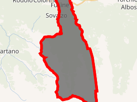
| |
 Fusine Location of Fusine in Italy 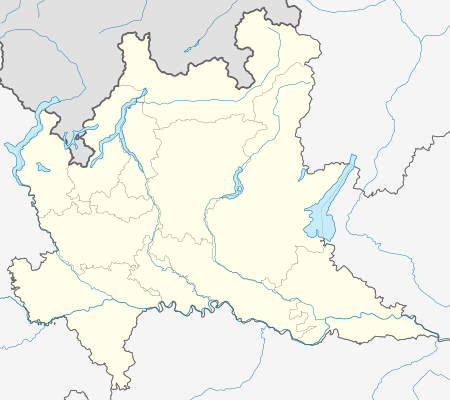 Fusine Fusine (Lombardy) | |
| Coordinates: 46°8′N 9°44′E | |
| Country | Italy |
| Region | Lombardy |
| Province | Province of Sondrio (SO) |
| Area | |
| • Total | 37.5 km2 (14.5 sq mi) |
| Elevation | 285 m (935 ft) |
| Population (Dec. 2004)[2] | |
| • Total | 650 |
| • Density | 17/km2 (45/sq mi) |
| Time zone | UTC+1 (CET) |
| • Summer (DST) | UTC+2 (CEST) |
| Postal code | 23010 |
| Dialing code | 0342 |
| Website | Official website |
Fusine borders the following municipalities: Berbenno di Valtellina, Cedrasco, Colorina, Foppolo, Forcola, Postalesio, Tartano.
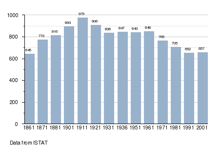
Demographic evolution
gollark: Yes.
gollark: Oh, this might be useful, rooted android phones can emulate USB sticks.
gollark: At the very extreme end, some phones can write to flash drives.
gollark: Oh, right. It's not doing that; Ethernet disables connections which would cause loops (there are newer standards which use them more efficiently though), yggdrasil does not have to do that.
gollark: Then it uses magic algorithms™ to route traffic between nodes.
References
- "Superficie di Comuni Province e Regioni italiane al 9 ottobre 2011". Istat. Retrieved 16 March 2019.
- "Popolazione Residente al 1° Gennaio 2018". Istat. Retrieved 16 March 2019.
- All demographics and other statistics: Italian statistical institute Istat.
This article is issued from Wikipedia. The text is licensed under Creative Commons - Attribution - Sharealike. Additional terms may apply for the media files.