Francavilla Angitola
Francavilla Angitola is a comune (municipality) in the Province of Vibo Valentia in the Italian region Calabria, located about 30 kilometres (19 mi) southwest of Catanzaro and about 20 kilometres (12 mi) northeast of Vibo Valentia. As of 31 December 2004, it had a population of 2,093 and an area of 28.3 square kilometres (10.9 sq mi).[3]
Francavilla Angitola | |
|---|---|
| Comune di Francavilla Angitola | |
 | |
Location of Francavilla Angitola 
| |
 Francavilla Angitola Location of Francavilla Angitola in Italy 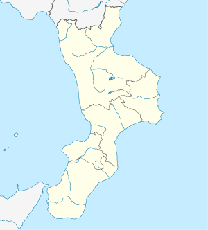 Francavilla Angitola Francavilla Angitola (Calabria) | |
| Coordinates: 38°47′N 16°16′E | |
| Country | Italy |
| Region | Calabria |
| Province | Province of Vibo Valentia (VV) |
| Area | |
| • Total | 28.3 km2 (10.9 sq mi) |
| Population (Dec. 2004)[2] | |
| • Total | 2,093 |
| • Density | 74/km2 (190/sq mi) |
| Demonym(s) | Francavillesi |
| Time zone | UTC+1 (CET) |
| • Summer (DST) | UTC+2 (CEST) |
| Postal code | 89815 |
| Dialing code | 0968 |
Francavilla Angitola borders the following municipalities: Curinga, Filadelfia, Maierato, Pizzo, Polia.
In the località of Ponte Angitola, in the comune, is the Roman settlement and river crossing named Ad Fluvium Angitulam or Annicia.[4]
Demographic evolution

gollark: That is currently my top idea. But it has annoying tradeoffs.
gollark: And phones or something similar will probably replace basically all other personal computing hardware soon™, so aaaaaa.
gollark: I'm picking a phone to replace my mysteriously failed one, but apparently in my absence the phone market became even more bad.
gollark: It's just a solid aluminium sphere with no visible interfaces.
gollark: Can't wait for the next fully wireless iPhone.
References
- "Superficie di Comuni Province e Regioni italiane al 9 ottobre 2011". Istat. Retrieved 16 March 2019.
- "Popolazione Residente al 1° Gennaio 2018". Istat. Retrieved 16 March 2019.
- All demographics and other statistics: Italian statistical institute Istat.
- Richard Talbert, Barrington Atlas of the Greek and Roman World, (ISBN 0-691-03169-X), Map 46.
This article is issued from Wikipedia. The text is licensed under Creative Commons - Attribution - Sharealike. Additional terms may apply for the media files.