Flodaigh, Lewis
Flodaigh is a small island in Loch Roag on the west coast of Lewis in the Outer Hebrides of Scotland. It is about 33 hectares (82 acres) in extent and the highest point is 48 metres (157 ft). Its name derives from the Old Norse for "flat island".
| Gaelic name | Flodaigh |
|---|---|
| Meaning of name | "flat island" |
| Location | |
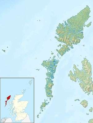 Flodaigh Flodaigh shown within the Outer Hebrides | |
| OS grid reference | NB104333 |
| Coordinates | 58.18°N 6.91°W |
| Physical geography | |
| Island group | Lewis |
| Area | 39 ha[1] |
| Highest elevation | 48 metres (157 ft)[2] |
| Administration | |
| Sovereign state | United Kingdom |
| Country | Scotland |
| Council area | Western Isles |
| Demographics | |
| Population | Uninhabited |
Inland, the nearest settlement is opposite the hamlet of Cairisiadar. The island was last inhabited in 1827 when it was cleared to make way for a sheep farm.[3]
The small islet of Gousam lies to the north east and the larger islands of Fuaigh Beag and Fuaigh Mòr further east.
Notes
- Rick Livingstone’s Tables of the Islands of Scotland (pdf) Argyll Yacht Charters. Retrieved 12 December 2011.
- Ordnance Survey. OS Maps Online (Map). 1:25,000. Leisure.
- Haswell-Smith, Hamish (2004). The Scottish Islands. Edinburgh: Canongate. p. 306. ISBN 978-1-84195-454-7.
| Inhabited islands | ||
|---|---|---|
| Other islands | ||
| Settlements |
| |
| Districts | ||
| Geographical features | ||
| Historical sites | ||
|  | ||||||||||||||||
|
| |||||||||||||||||
| |||||||||||||||||
| |||||||||||||||||
| |||||||||||||||||
| |||||||||||||||||
| |||||||||||||||||
| |||||||||||||||||
gollark: What?
gollark: @golalark?
gollark: If you're running it without signature verification you can just load the omnidisk with one of the all-permissions-granted no-disk-ID-check UUIDs.
gollark: The omnidisk again, somehow?
gollark: I would do that anyway.
This article is issued from Wikipedia. The text is licensed under Creative Commons - Attribution - Sharealike. Additional terms may apply for the media files.