Tolsta Chaolais
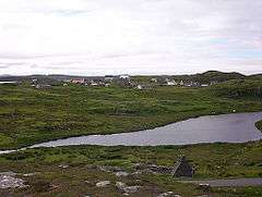
Tolsta Chaolais (also Tolastadh Chaolais, Tolstadh a' Chaolais) is a village on the Isle of Lewis, Scotland. It consists of about forty houses, clustered around Loch a' Bhaile, about 1 mile (1.5 kilometres) from the A858 road between Callanish and Carloway. The name has a Norse element, Tolsta, combined with a Gaelic element, Caolas, and means "Farm by the Strait".[1] Tolsta Chaolais is in the parish of Uig,[2] and has a building as a place of worship for all denominations.[1]
| Tolsta Chaolais | |
|---|---|
 Tolsta Chaolais village, across Loch a' Bhaile | |
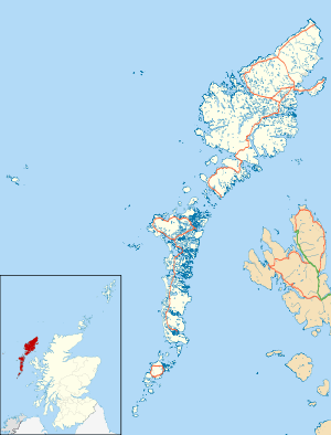
 Tolsta Chaolais Location within the Outer Hebrides | |
| Language | Scottish Gaelic English |
| OS grid reference | NB194379 |
| Civil parish | |
| Council area |
|
| Lieutenancy area | |
| Country | Scotland |
| Sovereign state | United Kingdom |
| Post town | ISLE OF LEWIS |
| Postcode district | HS2 |
| Dialling code | 01851 |
| Police | Scotland |
| Fire | Scottish |
| Ambulance | Scottish |
| UK Parliament | |
| Scottish Parliament | |
In 1979 the village was photographed by Fay Godwin as part of a landscape photography project funded by the Arts Council of Great Britain. One of Godwin's photographs of Tolsta Chaolais was published in her 1985 book of rural landscapes, Land.[3]
In 2013, the village was the location of much of the filming for the CBeebies children's television programme Katie Morag.[4]
References
- "Tolsta Chaolais". Hebridean Connections. Retrieved 18 December 2014.
- "Lewis, Tolsta Chaolais". Royal Commission on the Ancient and Historical Monuments of Scotland. Retrieved 18 December 2014.
- Land by Fay Godwin, Heinnemann 1985, ISBN 0-434-30305-4
- "Katie Morag to film on location on the Isle of Lewis". Highlands and Islands Enterprise. 14 February 2013. Retrieved 18 December 2014.
External links
| Wikimedia Commons has media related to Tolsta Chaolais. |
- Village website
- Canmore - Lewis, Tolsta Chaolais, War Memorial site record
- Canmore - Lewis, Tolsta Chaolais, Horizontal Mill site record