Fermignano
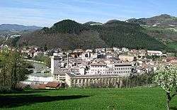
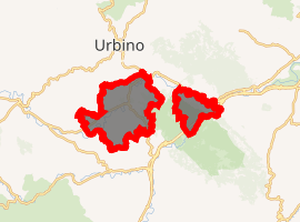
Fermignano is a comune (municipality) in the Province of Pesaro e Urbino in the Italian region Marche, located about 70 kilometres (43 mi) west of Ancona and about 35 kilometres (22 mi) southwest of Pesaro.
Fermignano | |
|---|---|
| Comune di Fermignano | |
 | |
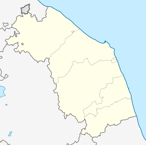
Location of Fermignano 
| |
 Fermignano Location of Fermignano in Italy  Fermignano Fermignano (Marche) | |
| Coordinates: 43°41′N 12°39′E | |
| Country | Italy |
| Region | Marche |
| Province | Pesaro e Urbino (PU) |
| Government | |
| • Mayor | Emanuele Feduzi |
| Area | |
| • Total | 43.3 km2 (16.7 sq mi) |
| Population (2006)[2] | |
| • Total | 8,384 |
| • Density | 190/km2 (500/sq mi) |
| Demonym(s) | Fermignanesi |
| Time zone | UTC+1 (CET) |
| • Summer (DST) | UTC+2 (CEST) |
| Postal code | 61033 |
| Dialing code | 0722 |
| Patron saint | St. Anne |
| Saint day | 26 July |
| Website | Official website |
Renaissance architect Donato Bramante was born here.
History
Fermignano's history can be traced to 200 BC, with the name probably deriving from someone named Firmidio. The city grew up around a bridge over the Metauro river.[3] Over the centuries, Fermignano was under the jurisdiction of the Duchy of Urbino. From 1607, it was given its own administrative council.
gollark: Obelisks are cuboids, the artifact of apiocity (class μ-23) is a sphere.
gollark: Fun fact: the auction is not actually for an obelisk so this is irrelevant.
gollark: Not even by you?
gollark: That seems excessively high, you *may* be banninated.
gollark: The obelisk *may* be attained.
References
- "Superficie di Comuni Province e Regioni italiane al 9 ottobre 2011". Istat. Retrieved 16 March 2019.
- All demographics and other statistics: Italian Statistical Institute (Istat)
- History of Fermignano Archived 2012-09-10 at Archive.today
This article is issued from Wikipedia. The text is licensed under Creative Commons - Attribution - Sharealike. Additional terms may apply for the media files.