Etah district
Etah district is one of the districts of Uttar PradeshIndia since 1854. Etah town is the district headquarters. Etah district is a part of Aligarh Division. There are Three Tehsil, 8 Block, 18 Police station and 892 Villages.The driving distance from New Delhi to Etah is 206 km and Lucknow to Etah 267 km.[1]
Etah district | |
|---|---|
District of Uttar Pradesh | |
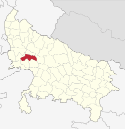 Location of Etah district in Uttar Pradesh | |
| Country | India |
| State | Uttar Pradesh |
| Division | Aligarh |
| Headquarters | Etah |
| Tehsils | Sadar Etah,Aliganj, Awagarh,Jalesar |
| Government | |
| • Lok Sabha constituencies | Etah |
| Area | |
| • Total | 2,651 km2 (1,024 sq mi) |
| Population (2011) | |
| • Total | 1,774,480 |
| • Density | 670/km2 (1,700/sq mi) |
| Demographics | |
| • Literacy | 75.27% |
| Time zone | UTC+05:30 (IST) |
| Vehicle registration | UP 82 |
| Major highways | NH 91,SH 31,33,85 |
| Website | http://etah.nic.in/ |
Geography
Etah is located at 27.63°N 78.67°E.[2]
Civic Administration
Etah is one of the 75 administrative Districts of Uttar Pradesh with its headquarters located at Etah. As in the case of all other Districts of the country, the Collector and District Magistrate is the administrative head of Etah District.As per Provisional population figures of 2011 Census:- Area: 4,446 km2
No. of Municipal Bodies: 9
No. of Nyay Panchayats: 72
No. of Tehsils: 4
No. of Parliamentary Constituency: 3
Division: ALIGARH Division
Jalesar, Awagarh Come Under Agra Division
No. of Blocks: 8
No. of Gram Panchayats: 576
No. of Villages: 892
No. of Assembly: 4.
No. of Police station: 18.
Demographics
According to the 2011 census Etah district has a population of 1,774,480. This gives it a ranking of 272nd in India (out of a total of 640). The district has a population density of 717 inhabitants per square kilometre (1,860/sq mi) . Its population growth rate over the decade 2001-2011 was 12.77%. Etah has a sex ratio of 863 females for every 1000 males, and a literacy rate of 73.27%.
At the time of the 2011 Census of India, 99.25% of the population in the district spoke Hindi and 0.71% Urdu as their first language.[3]
| Year | Pop. | ±% p.a. |
|---|---|---|
| 1901 | 467,166 | — |
| 1911 | 471,233 | +0.09% |
| 1921 | 448,730 | −0.49% |
| 1931 | 465,371 | +0.36% |
| 1941 | 532,585 | +1.36% |
| 1951 | 608,080 | +1.33% |
| 1961 | 696,873 | +1.37% |
| 1971 | 853,095 | +2.04% |
| 1981 | 1,011,479 | +1.72% |
| 1991 | 1,229,949 | +1.97% |
| 2001 | 1,531,645 | +2.22% |
| 2011 | 1,774,480 | +1.48% |
| source:[4] | ||
Transport
District has 8 Railway Station/Halt.Length of Railway Line in the district is 55 km. and it comes under North Central Railway zone.
Towns and villages are well equipped with a web of roads as it is the major way of transportation in the region. National Highway 91 (Delhi-Kolkata) pass from the middle of the district. Etah Bus Station is situated on National Highway 91. Uttar Pradesh State Road Transport Corporation operates buses to all cities in Uttar Pradesh. Etah is well connected by road.It is located on National Highway 91. You can reach it easily here. Uttar Pradesh Roadways bus is directly available from here to Agra,Aligarh, Delhi,Noida,Aliganj,Farrukhabad, Awagarh,Jalesar, Kasganj,Tundla, Shikohabad,Mainpuri, Etawah, Kanpur, Lucknow.
Economy
There are no large industries here, but there are some factories here. Hindustan Unilever Ltd. Brass casting work is going on at Jalesar on a large scale. Etah is an agricultural region. Farming is one of the main employment of the people of Etah. The land of Etah is very fertile Economy of Etah District is agrarian in character. The geography and the climate are favourable for production of crops like paddy, sugarcane, sunflower, oilseeds, etc. This town behaves as a nodal point for accumulation and marketing of such products. Except a few agro Palaceprocessing.
AGRICULTURE SECTOR
Agriculture
Livestock
Forestry & Logging
Fishing
INDUSTRY SECTOR
Mining & Quarrying
Manufacturing (Registered & Unregistered)
Electricity, Gas & Water Supply Construction
SERVICE SECTOR
Trade, Hotels and Restaurants
Railways
Transport by other means and Storage Communications
Banking and Insurance
Real Estates, Ownership of dwelling and Business Services
Public Administration
Other services.
Tourist places
- Atranji khera
- Patna Bird Sanctuary
- Awagarh Fort
- Gurukul
- Kailash Temple
Development
Work is under construction on the ultra mega power plant here, work on the Etah-Malawan new rail route is going on, Etah-Kasganj new track approved by the Railways in budget 2017–2018, work on Etah Medical College is underway, work on Etah Sewerage Work is underway on Etah-Aligarh bypass, most of all main roads are under construction, some of Etah roads have recently been added to the national highway. Agra-Bareilly National Highway,Etah-Farrukhabad Highway.
Nearby Districts
References
- "Distance between New Delhi, Delhi and Etah, Uttar Pradesh 142 Miles / 228 Km". www.distancebetweencities.co.in.
- Falling Rain Genomics, Inc – Etah. Fallingrain.com. Retrieved on 2014-01-02.
- 2011 Census of India, Population By Mother Tongue
- Decadal Variation In Population Since 1901
External links
Places adjacent to Etah district | |
|---|---|