Erving, Massachusetts
Erving is a town in Franklin County, Massachusetts, United States. The population was 1,800 at the 2010 census.[1] It is part of the Springfield, Massachusetts metropolitan statistical area.
Erving, Massachusetts | |
|---|---|
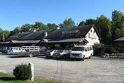 Freight House Antiques | |
 Seal | |
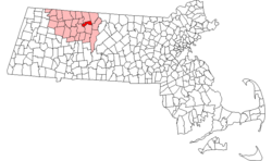 Location in Franklin County in Massachusetts | |
| Coordinates: 42°36′00″N 72°23′55″W | |
| Country | United States |
| State | Massachusetts |
| County | Franklin |
| Settled | 1801 |
| Incorporated | 1838 |
| Government | |
| • Type | Open town meeting |
| Area | |
| • Total | 14.4 sq mi (37.3 km2) |
| • Land | 13.9 sq mi (35.9 km2) |
| • Water | 0.5 sq mi (1.3 km2) |
| Elevation | 475 ft (145 m) |
| Population (2010) | |
| • Total | 1,800 |
| • Density | 130/sq mi (48/km2) |
| Time zone | UTC-5 (Eastern) |
| • Summer (DST) | UTC-4 (Eastern) |
| ZIP code | 01344 |
| Area code(s) | 413 |
| FIPS code | 25-21780 |
| GNIS feature ID | 0618163 |
| Website | www |
History
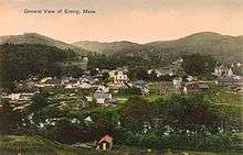
Erving is located along the Mohawk Trail. The area was part of the Pocomtuc Indian Nation, whose villages included Squawkeag in what is now Northfield, and Peskeompscut in what is now Turners Falls. Eventually, most of the native population was displaced and/or sold into slavery as a result of King Philip's War and a series of massacres of local Indian villages.[2]
Subsequently, Erving was first settled in 1801 and officially incorporated—it being the last unincorporated land in Massachusetts—in 1838. What is now Erving was once the farm of John Erving, the first colonial in the area. Noted in the 19th century for timber and grazing, the town had seven sawmills, two chair factories, one pail factory, one children's carriage factory, and one bit-brace factory. Large numbers of railroad ties and telegraph poles were cut in the abundant forests here, as many as 1,495,000 in one year.[3] Today, Erving has a school, a police and fire department, public library, several small stores and restaurants.
Geography
According to the United States Census Bureau, the town has a total area of 14.4 square miles (37 km2), of which 13.9 square miles (36 km2) is land and 0.5 square miles (1.3 km2) (3.61%) is water. The Millers River, a tributary of the Connecticut River, passes through the town.
The terrain of Erving is hilly and rugged; most of the developed area of the town is located along the river. Northfield Mountain and its peaks occupy much of the northern two-thirds of the town. The mountain is the location of a pumped storage hydroelectric facility.
Erving is situated along Route 2, a heavily traveled state highway.
Outdoor recreation
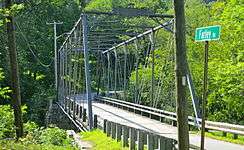
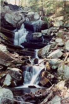
The town is home to a number of topographic features popular among outdoor recreation enthusiasts. Erving State Forest has recreation and seasonal camping facilities. The Millers River is used for fishing and whitewater kayaking. Northfield Mountain hosts cross country ski trails, hiking trails, and rock climbing ascents, including the 114 mile (183 km) Metacomet-Monadnock Trail and the Farley Ledges rock climbing area.
Demographics
| Year | Pop. | ±% |
|---|---|---|
| 1850 | 449 | — |
| 1860 | 527 | +17.4% |
| 1870 | 579 | +9.9% |
| 1880 | 872 | +50.6% |
| 1890 | 972 | +11.5% |
| 1900 | 973 | +0.1% |
| 1910 | 1,148 | +18.0% |
| 1920 | 1,295 | +12.8% |
| 1930 | 1,263 | −2.5% |
| 1940 | 1,328 | +5.1% |
| 1950 | 1,322 | −0.5% |
| 1960 | 1,272 | −3.8% |
| 1970 | 1,260 | −0.9% |
| 1980 | 1,326 | +5.2% |
| 1990 | 1,372 | +3.5% |
| 2000 | 1,467 | +6.9% |
| 2010 | 1,800 | +22.7% |
| * = population estimate. Source: United States Census records and Population Estimates Program data.[4][5][6][7][8][9][10][11][12][13] | ||
As of the census[14] of 2000, there were 1,467 people, 600 households, and 400 families residing in the town. The population density was 105.7 people per square mile (40.8/km2). There were 630 housing units at an average density of 45.4 per square mile (17.5/km2). The racial makeup of the town was 96.80% White, 0.14% African American, 0.82% Native American, 0.14% Asian, 0.41% from other races, and 1.70% from two or more races. Hispanic or Latino of any race were 0.89% of the population.
There were 600 households, out of which 29.2% had children under the age of 18 living with them, 53.3% were married couples living together, 8.0% had a female householder with no husband present, and 33.3% were non-families. 26.7% of all households were made up of individuals, and 12.2% had someone living alone who was 65 years of age or older. The average household size was 2.45 and the average family size was 2.94.
In the town, the population was spread out, with 22.9% under the age of 18, 6.5% from 18 to 24, 30.5% from 25 to 44, 26.3% from 45 to 64, and 13.8% who were 65 years of age or older. The median age was 39 years. For every 100 females, there were 101.2 males. For every 100 females age 18 and over, there were 99.1 males.
The median income for a household in the town was $40,039, and the median income for a family was $47,212. Males had a median income of $35,511 versus $26,711 for females. The per capita income for the town was $19,107. About 4.7% of families and 6.7% of the population were below the poverty line, including 8.5% of those under age 18 and 5.1% of those age 65 or over.
References
- "Profile of General Population and Housing Characteristics: 2010 Demographic Profile Data (DP-1): Erving town, Franklin County, Massachusetts". United States Census Bureau. Retrieved August 28, 2012.
- Peske-ompsk-ut. Turners Falls, Mass.: Printed at the "Reporter" job office. 1875. p. 21.
- Genealogy in Franklin County, Massachusetts -- Town of Erving
- "Total Population (P1), 2010 Census Summary File 1". American FactFinder, All County Subdivisions within Massachusetts. United States Census Bureau. 2010.
- "Massachusetts by Place and County Subdivision - GCT-T1. Population Estimates". United States Census Bureau. Retrieved July 12, 2011.
- "1990 Census of Population, General Population Characteristics: Massachusetts" (PDF). US Census Bureau. December 1990. Table 76: General Characteristics of Persons, Households, and Families: 1990. 1990 CP-1-23. Retrieved July 12, 2011.
- "1980 Census of the Population, Number of Inhabitants: Massachusetts" (PDF). US Census Bureau. December 1981. Table 4. Populations of County Subdivisions: 1960 to 1980. PC80-1-A23. Retrieved July 12, 2011.
- "1950 Census of Population" (PDF). Bureau of the Census. 1952. Section 6, Pages 21-10 and 21-11, Massachusetts Table 6. Population of Counties by Minor Civil Divisions: 1930 to 1950. Retrieved July 12, 2011.
- "1920 Census of Population" (PDF). Bureau of the Census. Number of Inhabitants, by Counties and Minor Civil Divisions. Pages 21-5 through 21-7. Massachusetts Table 2. Population of Counties by Minor Civil Divisions: 1920, 1910, and 1920. Retrieved July 12, 2011.
- "1890 Census of the Population" (PDF). Department of the Interior, Census Office. Pages 179 through 182. Massachusetts Table 5. Population of States and Territories by Minor Civil Divisions: 1880 and 1890. Retrieved July 12, 2011.
- "1870 Census of the Population" (PDF). Department of the Interior, Census Office. 1872. Pages 217 through 220. Table IX. Population of Minor Civil Divisions, &c. Massachusetts. Retrieved July 12, 2011.
- "1860 Census" (PDF). Department of the Interior, Census Office. 1864. Pages 220 through 226. State of Massachusetts Table No. 3. Populations of Cities, Towns, &c. Retrieved July 12, 2011.
- "1850 Census" (PDF). Department of the Interior, Census Office. 1854. Pages 338 through 393. Populations of Cities, Towns, &c. Retrieved July 12, 2011.
- "U.S. Census website". United States Census Bureau. Retrieved 2008-01-31.
External links
| Wikimedia Commons has media related to Erving, Massachusetts. |
