Erebuni Fortress
Erebuni Fortress (Armenian: Էրեբունի), also known as Arin Berd (Armenian: Արին Բերդ; meaning the "Fortress of Blood"), is an Urartian fortified city, located in Yerevan, Armenia. It is 1,017 metres (3,337 ft) above sea level.[1] It was one of several fortresses built along the northern Urartian border and was one of the most important political, economic and cultural centers of the vast kingdom. The name Yerevan itself is derived from Erebuni.[2]
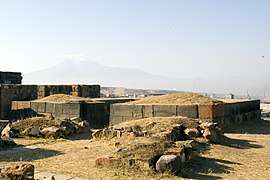
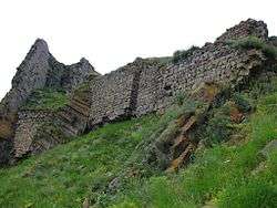
 Walls of Erebuni Fortress | |
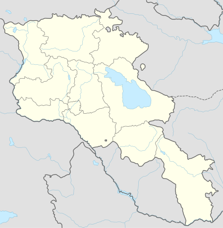
 Shown within Armenia | |
| Location | Between the Nor Aresh District and Vardashen District, Yerevan, Armenia |
|---|---|
| Coordinates | 40.1406°N 44.5381°E |
| Type | fortified settlement |
| Height | Site sits approximately 1,017 metres (3,335 ft) above sea level. Arin Berd hill is 65 metres (215 ft) above ground level. |
| History | |
| Builder | King Argishti I |
| Material | stone (foundation/lower walls), adobe brick (upper walls), |
| Founded | 782 B.C. |
| Cultures | Kingdom of Urartu:Yervandian, Marian and Achaemenid |
| Site notes | |
| Excavation dates | Late 19th-century, 1950-1968, 2008-Present |
| Archaeologists | A. Ivanovsky (19th c.), Konstantine Hovhannisyan and Boris Piotrovsky (1950-1968) |
| Condition | Ruins; Extant foundations and lower walls, sections of the site remain to be excavated. |
| Ownership | City of Yerevan, public property |
| Management | Erebuni Historical & Archaeological Museum-Reserve; separate entry fees are required for museum and fortress |
| Public access | Yes |
| Website | Erebuni Historical & Archaeological Reserve: Erebuni |
| Active excavation | |
Etymology
On an inscription found at Karmir Blur, the Urartian verb erebu-ni is used in the sense of "to seize, pillage, steal, or kidnap" followed by a changing direct object. Scholars have conjectured that the word, as an unchanging direct object, may also mean "to take" or "to capture" and thus believe that the Erebuni at the time of its founding meant "capture", "conquest", or "victory."[3]
The Circassian folklorist Amjad Jaimoukha gives an alternative etymology,[4] however: eri (referring to the Èrs, a hypothetical people with no references in any historical record) + buni. According to Jamoukha, buni comes from the Nakh root which spawned the Chechen word bun meaning shelter or cabin; the root however simply means "lair" or "shelter" and has an Indo-European root. Chechen "bun" initially derives from the Armenian word buyn (բույն) for "nest" or "lair", from Proto-Indo-European *bʰeuH-no-, from *bʰeuH- (“to be; to grow”). Cognates include Sanskrit भुवन (bhúvana, "world"), Albanian bun ("shepherd's hut") and Middle Persian بن bun ("bottom"). It may have spawned the word van in Armenian (a language with a strong Urartian substratum), which similarly means shelter. Van as a root is also present in numerous other placenames in historical Armenia, including the city Van, Lake Sevan, and Nakhichevan, so it is probable that the van in Yerevan is another direct translation of the root. Jaimoukha states furthermore that the name of the Èr also serves as the root for the Arax valley (the Erashki gorge) and for the Medieval Georgian name used in the Georgian Chronicles for Lake Sevan- "Lake Ereta". Jamoukha's theories are not widely accepted by any mainstream linguists, anthropologists, or historians.
History

Erebuni was founded by Urartian King Argishti I (r. ca. 785–753 BC) in 782 BC.[5] It was built on top of a hill called Arin Berd overlooking the Aras River Valley to serve as a military stronghold to protect the kingdom's northern borders.[6] It has been described as being "designed as a great administrative and religious centre, a fully royal capital."[7] According to Margarit Israelyan, Argishti began the construction of Erebuni after conquering the territories north of Yerevan and west of Lake Sevan, roughly corresponding to where the town of Abovyan is currently located. Accordingly, the prisoners he captured in these campaigns, both men and women, were used to help build his town.[8]
In the autumn of 1950, an archaeological expedition led by Konstantine Hovhannisyan discovered an inscription at Arin Berd dedicated to the city's founding which was carved during Argishti's reign. Two other identical inscriptions have been found at the citadel of Erebuni. The inscription reads:
By the greatness of the God Khaldi, Argishti, son of Menua, built this mighty stronghold and proclaimed it Erebuni for the glory of Biainili (Urartu) and to instill fear among the king's enemies. Argishti says: The land was a desert, before the great works I accomplished upon it. By the greatness of Khaldi, Argishti, son of Menua, is a mighty king, king of Biainili, and ruler of Tushpa."[9]
Argishti left a similar inscription at the Urartian capital of Tushpa (current-day Van) as well, stating that he brought 6,600 prisoners of war from Khate and Tsupani to populate his new city.[10] Similar to other Urartian cities of the time, it was built on a triangular plan on top of a hill and ensconced by 10-to-12-metre (33 to 39 ft) high ramparts. Behind them, the buildings were separated by central and inner walls. The walls were built from a variety of materials, including basalt, tuff, wood and adobe.[10] Argishti constructed a grand palace here and excavations conducted in the area have revealed that other notable buildings included a colonnaded royal assembly hall, a temple dedicated to Khaldi, a citadel, where the garrison resided, living quarters, dormitories and storerooms.[11] The inner walls were richly decorated with murals and other wall paintings, displaying religious and secular scenes.[12]
Successive Urartian kings made Erebuni their place of residence during their military campaigns against northern invaders and continued construction work to build up the fortress defences.[13] Kings Sarduri II and Rusa I also utilized Erebuni as a staging site for new campaigns of conquest directed towards the north.[14] In the early sixth century the Urartian state, under constant foreign invasion, collapsed.
The region soon fell under the control of the Achaemenian Empire. The strategic position that Erebuni occupied did not diminish, however, becoming an important center of the satrapy of Armenia.[10][15]
Despite numerous invasions by successive foreign powers, the city was never truly abandoned and was continually inhabited over the following centuries, eventually branching out to become the city of Yerevan.[14][16] Erebuni's close affinity to Yerevan was celebrated in a splendid festival held in September 1968, commemorating Erebuni's 2,750th birthday.[10]
Architecture
The site of Erebuni Fortress was atop the 65-metre (213 ft) tall hill of Arin Berd as a strategic position overlooking the Ararat plain and the main roads leading to the citadel.[17] It also overlooked cramped Urartian town made up of residences below at the foot of the hill.
The main entrance to the fortress was located at the more gently sloped southeastern site of the hill. It led to the central yard of the citadel. Ceremonies held by the personal guards of Argishti I and guards of the fortress garrison were held here.
In the southwest portion of the yard was a temple of the god Khaldi. The temple had a large oblong plan with a staircase that led to the roof of a ziggurat type tower and a side room on the lower floor. Surrounding the hall was a double-rowed twelve-column open portico with benches along the walls. An altar for sacrifices was located at the left wall. The walls were decorated with colorful frescoes depicting representations of human figures, gods, geometric and floral designs. One of the frescoes uncovered depicts the god Khaldi standing on a lion with a warder in his left hand and a horned crown upon his head. It is typical of other representations of Khaldi found at other sites. The floor of the temple contrasted greatly from the rest of the complex in that it had wood floors composed of small planks, compared to the clay-coated adobe floors that were faced with stone slabs found in the rest of the citadel's rooms.
Excavations
Early excavations began during the 19th century while more systematic excavations were carried out at Erebuni in 1952, under the joint sponsorship of the Armenian Academy of Sciences' Institute of Archaeology and Ethnography and the Pushkin Museum's Board for the Preservation and Restoration of Architectural Monuments.[17] The team was led by Konstantine Hovhannisyan and Boris Piotrovsky, who served as an on-site adviser.[18] In the course of the early stage of the excavations (1950–1968), Argishti's palace, the royal assembly hall, temples and over a hundred rooms were excavated. Dozens of Urartian and Achaemenian artifacts, such as pottery, earthenware, belt-buckles, bracelets, beads, drinking vessels, helmets, arrows and silver coins, were also uncovered.[18] The fragments of murals that were uncovered were found to be decorated with important religious themes, including "processions of gods, sacred animals, and trees of life", as well as scenes of everyday life, displaying scenes of "hunting, cattle breeding, and agriculture."[19]
Storage areas for grain, oil, and wine were also uncovered. On the doors of the storage areas inscriptions were placed at the entry doors telling the who built the storage area and the quantity of the items placed in them. One such inscription reads:
By the greatness of god Chaldis, Sarduri, son of Argistis, built this house, and he also created these granaries. In one of them there were 12,600 Kapis, another one had 11,500 Kapis; entirely 24,100 Kapis. Sarduri, son of Argistis, mighty king, king of the country Bianinili, ruler of the town of Tushpah
The enormous ceramic jars that held the wine and oil had markings upon them. Smaller ceramic vessels were also found in excavations and are known to have been used in brewing beer made from barley. Other much larger vessels were used for storing foods and wine. Small circular markings on the sides of these containers near the top indicated the amount that could be stored inside. The larger of the vessels were usually buried half-way into the soil which naturally kept the contents cool.
Numerous cuneiform inscriptions carved on basalt have been found around the complex. Some of which are currently displayed in the museum, while others can still be found displayed on the walls.
In 1968 the Erebuni Museum of History was established. Its opening was timed to coincide with the 2750th anniversary of Yerevan. The museum houses items uncovered during the excavations at Arin Berd and Karmir Blur and gives a history of the site.
Gallery
 Model of the Erebuni Fortress
- Interior walls of the citadel and Yerevan below
 Susi Temple
.jpg)
.jpg)
See also
Notes
- elevationmap.net. "Mahari Street Yerevan Armenia on the Elevation Map. Topographic Map of Mahari Street Yerevan Armenia". elevationmap.net.
- Israelyan, Margarit A (1971). Էրեբունի: Բերդ-Քաղաքի Պատմություն (Erebuni: The History of a Fortress-City) (in Armenian). Yerevan: Hayastan Publishing Press. pp. 8–15.
- Israelyan. Erebuni, pp. 12-13.
- Jaimoukha, Amjad. The Chechens: A Handbook. Page 29. Available at Google Books: https://books.google.com/books?id=PnjAlei9fe0C&pg=PA29&lpg=PA29&dq=Dvals+Nakh&source=bl&ots=cBdFzCg2sy&sig=bdh7fSoSDfDFUb_DrlkA1PmpA6A&hl=en&ei=dn4bTMHAIYSBlAeZ593mCQ&sa=X&oi=book_result&ct=result&resnum=6&ved=0CCcQ6AEwBQ#v=onepage&q&f=false
- Arutjunjan [Harootunian], N.V. (1959). "Երևանի հիմնադրման ժամանակի հարցի շուրջը". Patma-Banasirakan Handes [Historical-Philological Journal]. Academy of Sciences of Armenia. 2–3: 78–96. Retrieved 15 August 2014.
- Barnett, R. D. "Urartu" in The Cambridge Ancient History, Volume 3, Part 1. John Boardman et al. (eds.) Cambridge: Cambridge University Press, 1982, p. 345.
- R. D. Barnett (1982). "Urartu". In John Boardman; I. E. S. Edwards; N. G. L. Hammond; E. Sollberger (eds.). The Cambridge Ancient History, Vol. 3, Part 1: The Prehistory of the Balkans, the Aegean World, Tenth to Eighth Centuries BC (2nd ed.). Cambridge University Press. p. 346. ISBN 978-0521224963.
- Israelyan. Erebuni, pp. 139-140.
- Israelyan. Erebuni, p. 9.
- (in Armenian) Hovhannisyan, Konstantine. «էրեբունի» (Erebuni). Armenian Soviet Encyclopedia. vol. iv. Yerevan: Armenian Academy of Sciences, 1979, pp. 90-91.
- Chahin, Mack (2001). The Kingdom of Armenia. Richmond: RoutledgeCurzon. p. 79. ISBN 0-7007-1452-9.
- Chahin. The Kingdom of Armenia, pp. 158-160.
- Hovhannisyan, Konstantine (1973). The Wall Paintings of Erebuni. Yerevan: Armenian Academy of Sciences. p. 57.
- Israelyan. Erebuni, pp. 137-138.
- Van de Mieroop, Marc (2006). A History of the Ancient Near East ca. 3000-323 BC. Cornwall: Blackwell. p. 217. ISBN 1-4051-4911-6.
- Bournoutian, George A. (2006). A Concise History of the Armenian People. Costa Mesa, California: Mazda Publishers. p. 12. ISBN 1-56859-141-1.
- Deschamps, Stephane (2016). "Erebuni in the context of Urartean fortresses in the Ararat plain: Sources and problems". Quaternary International. 395: 208–215. Bibcode:2016QuInt.395..208D. doi:10.1016/j.quaint.2015.08.056.
- (in Armenian) Hovhannisyan, Konstantine. «Արին Բերդ» (Arin Berd). Armenian Soviet Encyclopedia. vol. ii. Yerevan: Armenian Academy of Sciences, 1976, p. 60.
- Chahin. The Kingdom of Armenia, p. 118.
Further reading
- (in Armenian) Israelyan, Margarit A. Էրեբունի: Բերդ-Քաղաքի Պատմություն (Erebuni: The History of a Fortress-City). Yerevan, Armenian SSR: Hayastan Publishing Press, 1971.
- Hovhannisyan, Konstantine. The Wall Paintings of Erebuni. Yerevan: Armenian Academy of Sciences, 1973. In Armenian, Russian and English.
- Piotrovsky, Boris. The Ancient Civilization of Urartu: An Archaeological Adventure. New York: Cowles Book Co., 1969.
