Eldon Parish, New Brunswick
Eldon is a civil parish[lower-alpha 1] in Restigouche County, New Brunswick, Canada.[2]
Eldon | |
|---|---|
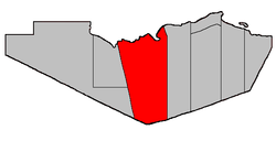 Location within Restigouche County. | |
| Coordinates: 47.75°N 67.075°W | |
| Country | |
| Province | |
| County | Restigouche |
| Established | 1826 |
| Area | |
| • Land | 1,681.46 km2 (649.22 sq mi) |
| Population (2016)[1] | |
| • Total | 657 |
| • Density | 0.4/km2 (1/sq mi) |
| • Change 2011-2016 | |
| • Dwellings | 360 |
| Time zone | UTC-4 (AST) |
| • Summer (DST) | UTC-3 (ADT) |
For governance purposes it is divided between the local service districts of Flatlands, Mann Mountain, St. Jean Baptiste – Menneval, White's Brook, and the parish of Eldon.[3]
Delineation
Eldon Parish is defined in the Territorial Division Act[2] as being bounded:
- Northerly by the Province of Quebec Boundary line, easterly by a line beginning on the southern bank or shore of Restigouche River at the northwest angle of lot number twenty-two, granted to George Firth below Metapedia, thence southerly along the western line of said lot and its prolongation to the northeast angle of lot number one, in Dawsonville, thence continuing southerly along the eastern line of said lot number one and its southern prolongation, to the southeast angle of lot number two (Thomas Gracie) and thence true south to the County limits; southerly by the County line and westerly by a straight line extending from the Province of Quebec Boundary line in the Restigouche River, at the mouth of Upper Thorn Point Brook to Whites Brook railway station on the Canadian National Railways, and thence prolonged southerly to the Victoria County Boundary line.
Communities
All municipalities within Eldon Parish are unincorporated.
Demographics
Population
| Canada census – Eldon Parish, New Brunswick community profile | |||
|---|---|---|---|
| 2016 | 2011 | 2006 | |
| Population: | 657 (-5.9%% from 2011) | 698 (-10.4% from 2006) | 779 (-13.6% from 2001) |
| Land area: | 1,681.46 km2 (649.22 sq mi) | 1,681.54 km2 (649.25 sq mi) | 1,681.51 km2 (649.23 sq mi) |
| Population density: | 0.4/km2 (1.0/sq mi) | 0.4/km2 (1.0/sq mi) | 0.5/km2 (1.3/sq mi) |
| Median age: | 54.2 (M: 54.7, F: 53.6) | 52.0 (M: 51.8, F: 52.1) | 47.5 (M: 47.1, F: 47.7) |
| Total private dwellings: | 360 | 375 | 494 |
| Median household income: | $42,112 | $.N/A | $25,587 |
| Notes: 2011 income data for this area has been suppressed for data quality or confidentiality reasons. – References: 2016[4] 2011[5] 2006[6] earlier[7] | |||
|
|
| |||||||||||||||||||||||||||
| [8][1] | |||||||||||||||||||||||||||||
Language
| Canada Census Mother Tongue - Eldon Parish, New Brunswick[8] | ||||||||||||||||||
|---|---|---|---|---|---|---|---|---|---|---|---|---|---|---|---|---|---|---|
| Census | Total | English |
French |
English & French |
Other | |||||||||||||
| Year | Responses | Count | Trend | Pop % | Count | Trend | Pop % | Count | Trend | Pop % | Count | Trend | Pop % | |||||
2016 |
655 |
330 | 50.38% | 320 | 48.85% | 5 | 0.76% | 0 | 0.0% | |||||||||
2011 |
695 |
360 | 51.80% | 330 | 47.48% | 5 | 0.72% | 0 | 0.00% | |||||||||
2006 |
780 |
355 | 45.51% | 410 | 52.56% | 15 | 1.92% | 0 | 0.00% | |||||||||
2001 |
900 |
460 | 51.11% | 420 | 46.67% | 20 | 2.22% | 0 | 0.00% | |||||||||
1996 |
1,045 |
570 | n/a | 54.55% | 475 | n/a | 45.45% | 0 | n/a | 0.00% | 0 | n/a | 0.00% | |||||
Access Routes
Highways and numbered routes that run through the parish, including external routes that start or finish at the parish limits:[9]
|
|
|
|
|
gollark: I'm glad you agree with me.
gollark: LyricLy should really be banned from participating if they're going to keep accessing this kind of information.
gollark: ALL of which are mine.
gollark: No you don't.
gollark: Yes you are, actually, when I win.
See also
- List of parishes in New Brunswick
- Upsalquitch Northwest River
Notes
- Civil parishes served a variety of government functions until 1966, when the new Municipalities Act stripped them of their responsibilities; they continue to provide convenient boundaries for government uses, especially electoral districts and local service districts. Statistics Canada uses civil parishes as census subdivisions for all parts of the province that are not within municipalities and similar entities.
References
- "Census Profile, 2016 Census: Eldon, Parish [Census subdivision], New Brunswick". Statistics Canada. Retrieved September 28, 2019.
- "Chapter T-3 Territorial Division Act". Government of New Brunswick. Retrieved 22 July 2020.
- "New Brunswick Regulation 84-168 under the Municipalities Act (O.C. 84-582)". Government of New Brunswick. Retrieved 22 July 2020.
- "2016 Community Profiles". 2016 Canadian Census. Statistics Canada. February 21, 2017. Retrieved 2019-09-28.
- "2011 Community Profiles". 2011 Canadian Census. Statistics Canada. July 5, 2013. Retrieved 2014-03-21.
- "2006 Community Profiles". 2006 Canadian Census. Statistics Canada. March 30, 2011. Retrieved 2014-03-21.
- "2001 Community Profiles". 2001 Canadian Census. Statistics Canada. February 17, 2012.
- Statistics Canada: 1996, 2001, 2006, 2011 census
- Atlantic Canada Back Road Atlas ISBN 978-1-55368-618-7 Pages 4-5, 12-13
Places adjacent to Eldon Parish, New Brunswick | ||||||||||
|---|---|---|---|---|---|---|---|---|---|---|
| ||||||||||
| Subdivisions |
|
|---|---|
| Cities | |
| Counties | |
| |
This article is issued from Wikipedia. The text is licensed under Creative Commons - Attribution - Sharealike. Additional terms may apply for the media files.